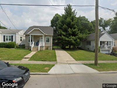
1940 Sundale Ave Cincinnati, OH 45239
Estimated Value: $148,000 - $156,000
3
Beds
1
Bath
1,109
Sq Ft
$136/Sq Ft
Est. Value
About This Home
This home is located at 1940 Sundale Ave, Cincinnati, OH 45239 and is currently estimated at $151,237, approximately $136 per square foot. 1940 Sundale Ave is a home located in Hamilton County with nearby schools including North College Hill Elementary School, North College Hill Middle School, and North College Hill High School.
Ownership History
Date
Name
Owned For
Owner Type
Purchase Details
Closed on
May 21, 2013
Sold by
Habitat For Humanity Of Greater Cincinna
Bought by
Hudson Faith
Current Estimated Value
Home Financials for this Owner
Home Financials are based on the most recent Mortgage that was taken out on this home.
Original Mortgage
$66,056
Outstanding Balance
$47,553
Interest Rate
3.38%
Mortgage Type
Seller Take Back
Estimated Equity
$102,909
Purchase Details
Closed on
Mar 13, 2012
Sold by
Alpha Real Estate Holdings Lp
Bought by
Cincinnati Habitat For Humanity
Purchase Details
Closed on
Aug 5, 2009
Sold by
Jd4 Investments Llc
Bought by
Alpha Real Estate Holdings Lp
Purchase Details
Closed on
Jun 18, 2008
Sold by
Fannie Mae
Bought by
Jd4 Invesmtments Llc
Purchase Details
Closed on
Dec 3, 2007
Sold by
Roseman Monika and Roseman Harold
Bought by
Federal National Mortgage Association
Purchase Details
Closed on
May 21, 2007
Sold by
Roseman Monika
Bought by
Roseman Harold R
Purchase Details
Closed on
May 7, 2003
Sold by
Kreamelmeyer Shane A and Kreamelmeyer Amy D
Bought by
Roseman Monika
Home Financials for this Owner
Home Financials are based on the most recent Mortgage that was taken out on this home.
Original Mortgage
$63,000
Interest Rate
6.02%
Mortgage Type
Unknown
Purchase Details
Closed on
Mar 28, 2000
Sold by
Leugers Thomas J and Leugers Jennifer G
Bought by
Kreamelmeyer Shane A
Home Financials for this Owner
Home Financials are based on the most recent Mortgage that was taken out on this home.
Original Mortgage
$73,450
Interest Rate
8.29%
Mortgage Type
FHA
Purchase Details
Closed on
Apr 29, 1996
Sold by
Obermeyer Paul E and Obermeyer Elizabeth
Bought by
Leugers Thomas J and Rosen Jennifer G
Home Financials for this Owner
Home Financials are based on the most recent Mortgage that was taken out on this home.
Original Mortgage
$56,525
Interest Rate
7.86%
Create a Home Valuation Report for This Property
The Home Valuation Report is an in-depth analysis detailing your home's value as well as a comparison with similar homes in the area
Home Values in the Area
Average Home Value in this Area
Purchase History
| Date | Buyer | Sale Price | Title Company |
|---|---|---|---|
| Hudson Faith | $64,000 | None Available | |
| Cincinnati Habitat For Humanity | $18,000 | Attorney | |
| Alpha Real Estate Holdings Lp | $19,800 | None Available | |
| Jd4 Invesmtments Llc | $16,958 | Accutitle Agency Inc | |
| Federal National Mortgage Association | $48,000 | None Available | |
| Roseman Harold R | -- | Attorney | |
| Roseman Monika | $70,000 | Title Resolutions | |
| Kreamelmeyer Shane A | $73,500 | First Title Agency Inc | |
| Leugers Thomas J | $59,500 | -- |
Source: Public Records
Mortgage History
| Date | Status | Borrower | Loan Amount |
|---|---|---|---|
| Open | Hudson Faith | $66,056 | |
| Previous Owner | Roseman Monika | $63,000 | |
| Previous Owner | Kreamelmeyer Shane A | $73,450 | |
| Previous Owner | Leugers Thomas J | $56,525 |
Source: Public Records
Tax History Compared to Growth
Tax History
| Year | Tax Paid | Tax Assessment Tax Assessment Total Assessment is a certain percentage of the fair market value that is determined by local assessors to be the total taxable value of land and additions on the property. | Land | Improvement |
|---|---|---|---|---|
| 2024 | $1,644 | $32,487 | $7,630 | $24,857 |
| 2023 | $1,658 | $32,487 | $7,630 | $24,857 |
| 2022 | $1,512 | $21,147 | $7,581 | $13,566 |
| 2021 | $1,480 | $21,147 | $7,581 | $13,566 |
| 2020 | $1,299 | $21,147 | $7,581 | $13,566 |
| 2019 | $1,272 | $18,550 | $6,650 | $11,900 |
| 2018 | $1,273 | $18,550 | $6,650 | $11,900 |
| 2017 | $1,203 | $18,550 | $6,650 | $11,900 |
| 2016 | $1,370 | $22,401 | $7,403 | $14,998 |
| 2015 | $1,373 | $22,401 | $7,403 | $14,998 |
| 2014 | $1,371 | $22,401 | $7,403 | $14,998 |
| 2013 | $781 | $12,576 | $7,875 | $4,701 |
Source: Public Records
Map
Nearby Homes
- 1921 Dallas Ave
- 1916 Waltham Ave
- 1926 Emerson Ave
- 1914 de Armand Ave
- 1917 Emerson Ave
- 6503 Simpson Ave
- 1811 Sterling Ave
- 2029 Sundale Ave
- 1931 Cordova Ave
- 1947 Cordova Ave
- 1917 Cordova Ave
- 1948 Catalpa Ave
- 1800 Waltham Ave
- 1811 Emerson Ave
- 1825 Cordova Ave
- 2015 W Galbraith Rd
- 1608 Goodman Ave
- 6429 Aspen Way
- 6546 Meis Ave
- 2125 Mckinley Ave
- 1940 Sundale Ave
- 1942 Sundale Ave
- 1938 Sundale Ave
- 1936 Sundale Ave
- 1950 Sundale Ave
- 1934 Sundale Ave
- 1945 Sundale Ave
- 1941 Sundale Ave
- 1937 Sundale Ave
- 1949 Sundale Ave
- 1933 Sundale Ave
- 1939 Dallas Ave
- 1941 Dallas Ave
- 1937 Dallas Ave
- 1951 Sundale Ave
- 1926 Sundale Ave
- 1947 Dallas Ave
- 1945 Dallas Ave
- 1935 Dallas Ave
- 6700 Simpson Ave