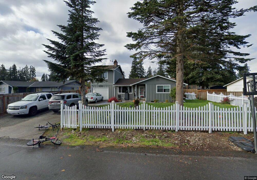
19406 Aurora Dr E Spanaway, WA 98387
Estimated Value: $407,000 - $445,000
4
Beds
1
Bath
1,216
Sq Ft
$343/Sq Ft
Est. Value
About This Home
This home is located at 19406 Aurora Dr E, Spanaway, WA 98387 and is currently estimated at $417,037, approximately $342 per square foot. 19406 Aurora Dr E is a home located in Pierce County with nearby schools including Camas Prairie Elementary School, Cedarcrest Junior High School, and Spanaway Lake High School.
Ownership History
Date
Name
Owned For
Owner Type
Purchase Details
Closed on
Jul 29, 2014
Sold by
Newbury Reo 2013 Llc
Bought by
Baker Russell and Baker Tammy
Current Estimated Value
Home Financials for this Owner
Home Financials are based on the most recent Mortgage that was taken out on this home.
Original Mortgage
$119,790
Outstanding Balance
$90,095
Interest Rate
3.75%
Mortgage Type
FHA
Estimated Equity
$326,942
Purchase Details
Closed on
Apr 24, 2014
Sold by
Shipton Richmond Nd
Bought by
Newbury Reo 2013 Llc
Purchase Details
Closed on
Aug 21, 2003
Sold by
Mcclure Terrace G
Bought by
Shipton Richmond D
Home Financials for this Owner
Home Financials are based on the most recent Mortgage that was taken out on this home.
Original Mortgage
$139,500
Interest Rate
10.25%
Mortgage Type
Purchase Money Mortgage
Create a Home Valuation Report for This Property
The Home Valuation Report is an in-depth analysis detailing your home's value as well as a comparison with similar homes in the area
Home Values in the Area
Average Home Value in this Area
Purchase History
| Date | Buyer | Sale Price | Title Company |
|---|---|---|---|
| Baker Russell | $121,719 | Fidelity National Title Co | |
| Newbury Reo 2013 Llc | $117,000 | None Available | |
| Shipton Richmond D | $139,500 | Rtc |
Source: Public Records
Mortgage History
| Date | Status | Borrower | Loan Amount |
|---|---|---|---|
| Open | Baker Russell | $119,790 | |
| Previous Owner | Shipton Richmond D | $139,500 |
Source: Public Records
Tax History
| Year | Tax Paid | Tax Assessment Tax Assessment Total Assessment is a certain percentage of the fair market value that is determined by local assessors to be the total taxable value of land and additions on the property. | Land | Improvement |
|---|---|---|---|---|
| 2025 | $4,066 | $359,200 | $157,400 | $201,800 |
| 2024 | $4,066 | $358,600 | $152,800 | $205,800 |
| 2023 | $4,066 | $344,700 | $157,400 | $187,300 |
| 2022 | $3,811 | $352,600 | $149,300 | $203,300 |
| 2021 | $3,500 | $245,100 | $94,600 | $150,500 |
| 2019 | $2,399 | $204,100 | $82,500 | $121,600 |
| 2018 | $2,747 | $192,000 | $74,800 | $117,200 |
| 2017 | $2,469 | $172,900 | $66,000 | $106,900 |
| 2016 | $2,294 | $141,800 | $55,900 | $85,900 |
| 2014 | $1,990 | $133,500 | $53,700 | $79,800 |
| 2013 | $1,990 | $120,000 | $46,300 | $73,700 |
Source: Public Records
Map
Nearby Homes
- 923 198th Street Ct E
- 1221 201st Street Ct E
- 1524 199th St E
- 1 8th Ave E
- 1609 200th Street Ct E
- 1803 197th Street Ct E
- 19631 19th Avenue Ct E
- 19519 19th Avenue Ct E
- 1833 193rd Street Ct E
- 20101 17th Avenue Ct E
- 511 190th St E
- 20208 17th Avenue Ct E
- 516 189th Street Ct E
- 20402 15th Avenue Ct E
- 2022 201st St E
- 612 185th Street Ct E Unit 30
- 1104 183rd Street Ct E
- 2 189th Street Ct E
- 608 185th Street Ct E Unit 29
- 1224 183rd Street Ct E
- 19410 Aurora Dr E
- 19402 Aurora Dr E
- 19405 Twinkle Dr E
- 19401 Twinkle Dr E
- 19409 Twinkle Dr E
- 19414 Aurora Dr E
- 19407 Aurora Dr E
- 19322 Aurora Dr E
- 19405 Aurora Dr E
- 19411 Aurora Dr E
- 19401 Aurora Dr E
- 19315 Twinkle Dr E
- 19411 Twinkle Dr E
- 19413 Aurora Dr E
- 19418 Aurora Dr E
- 19318 Aurora Dr E
- 19323 Aurora Dr E
- 19403 Twinkle Dr E
- 19407 Twinkle Dr E
- 19415 Aurora Dr E
Your Personal Tour Guide
Ask me questions while you tour the home.