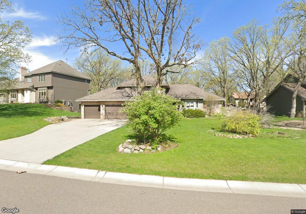
1941 127th Ln NW Coon Rapids, MN 55448
Estimated Value: $425,000 - $461,000
3
Beds
3
Baths
2,126
Sq Ft
$208/Sq Ft
Est. Value
About This Home
This home is located at 1941 127th Ln NW, Coon Rapids, MN 55448 and is currently estimated at $441,614, approximately $207 per square foot. 1941 127th Ln NW is a home located in Anoka County with nearby schools including Lucile Bruner Elementary School, Morris Bye Elementary School, and Laughlin Junior/Senior High School.
Ownership History
Date
Name
Owned For
Owner Type
Purchase Details
Closed on
Jun 15, 2018
Sold by
Aust Jay T and Aust Lynn B
Bought by
Brittain Joel M and Duncan Alyssha
Current Estimated Value
Home Financials for this Owner
Home Financials are based on the most recent Mortgage that was taken out on this home.
Original Mortgage
$311,159
Outstanding Balance
$269,100
Interest Rate
4.5%
Mortgage Type
FHA
Estimated Equity
$172,514
Create a Home Valuation Report for This Property
The Home Valuation Report is an in-depth analysis detailing your home's value as well as a comparison with similar homes in the area
Home Values in the Area
Average Home Value in this Area
Purchase History
| Date | Buyer | Sale Price | Title Company |
|---|---|---|---|
| Brittain Joel M | $316,900 | Burnet Title |
Source: Public Records
Mortgage History
| Date | Status | Borrower | Loan Amount |
|---|---|---|---|
| Open | Brittain Joel M | $311,159 |
Source: Public Records
Tax History Compared to Growth
Tax History
| Year | Tax Paid | Tax Assessment Tax Assessment Total Assessment is a certain percentage of the fair market value that is determined by local assessors to be the total taxable value of land and additions on the property. | Land | Improvement |
|---|---|---|---|---|
| 2025 | $4,270 | $403,200 | $90,000 | $313,200 |
| 2024 | $4,270 | $402,000 | $87,000 | $315,000 |
| 2023 | $3,917 | $389,900 | $72,000 | $317,900 |
| 2022 | $3,602 | $395,900 | $72,000 | $323,900 |
| 2021 | $3,490 | $325,900 | $56,000 | $269,900 |
| 2020 | $3,361 | $309,300 | $56,000 | $253,300 |
| 2019 | $3,197 | $287,000 | $56,000 | $231,000 |
| 2018 | $3,137 | $266,400 | $0 | $0 |
| 2017 | $2,880 | $254,000 | $0 | $0 |
| 2016 | $2,947 | $231,000 | $0 | $0 |
| 2015 | $2,860 | $231,000 | $50,000 | $181,000 |
| 2014 | -- | $192,700 | $35,400 | $157,300 |
Source: Public Records
Map
Nearby Homes
- 12888 Nightingale St NW
- 1930 127th Cir NW
- 12760 Raven St NW
- 12759 Ibis St NW
- 2147 125th Ln NW
- 12554 Grouse St NW
- 2068 124th Ln NW
- 1593 126th Ln NW
- 1687 131st Ln NW
- 12365 Jay St NW
- 1520 129th Ave NW
- 1776 133rd Ave NW
- 1450 126th Ln NW
- 13416 Swallow St NW
- 12463 Drake St NW
- 2675 128th Ave NW
- 1727 121st Ln NW
- 13182 Zion St NW
- 13519 Partridge Cir NW
- 1234 128th Cir NW
- 1945 127th Ln NW
- 1909 127th Ln NW
- 2032 128th Ave NW
- 1955 127th Ln NW
- 2036 128th Ave NW
- 1938 127th Cir NW
- 2024 128th Ave NW
- 1905 127th Ln NW
- 1914 127th Cir NW
- 1965 127th Ln NW
- 1948 127th Ln NW
- 2040 128th Ave NW
- 2016 128th Ave NW
- 1901 127th Ln NW
- 1934 127th Cir NW
- 1958 127th Ln NW
- 1918 127th Cir NW
- 12750 Nightingale St NW
- 2013 127th Ln NW
- 2029 128th Ave NW