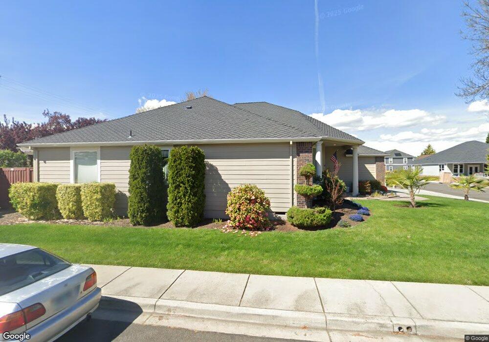
1941 Bluegrass Dr Central Point, OR 97502
Estimated Value: $563,352 - $623,000
3
Beds
2
Baths
2,489
Sq Ft
$241/Sq Ft
Est. Value
About This Home
This home is located at 1941 Bluegrass Dr, Central Point, OR 97502 and is currently estimated at $601,088, approximately $241 per square foot. 1941 Bluegrass Dr is a home located in Jackson County with nearby schools including Jewett Elementary School, Scenic Middle School, and Crater High School.
Ownership History
Date
Name
Owned For
Owner Type
Purchase Details
Closed on
Mar 3, 2021
Sold by
Martin James and Martin Nancy
Bought by
Martin James and Martin Nancy
Current Estimated Value
Purchase Details
Closed on
Dec 10, 2020
Sold by
Miller Kenneth D and Miller Adrianne Y
Bought by
Martin James and Jones Nancy
Purchase Details
Closed on
Jun 6, 2016
Sold by
Lasby Joan A
Bought by
Miller Kenneth D and Miller Adrianne Y
Home Financials for this Owner
Home Financials are based on the most recent Mortgage that was taken out on this home.
Original Mortgage
$386,000
Interest Rate
3.6%
Mortgage Type
VA
Purchase Details
Closed on
Nov 13, 2014
Sold by
Leonard Gary Deasy and Leonard Janet Ruth
Bought by
Lasby Joan A
Purchase Details
Closed on
Aug 17, 2007
Sold by
Leonard Gary D and Leonard Janet R
Bought by
Leonard Gary Deasy and Leonard Janet Ruth
Purchase Details
Closed on
Aug 15, 2007
Sold by
Hamilton Randall K
Bought by
Leonard Gary D and Leonard Janet R
Purchase Details
Closed on
Nov 6, 2006
Sold by
Duncan Development Llc
Bought by
Hamilton Randall K
Create a Home Valuation Report for This Property
The Home Valuation Report is an in-depth analysis detailing your home's value as well as a comparison with similar homes in the area
Purchase History
| Date | Buyer | Sale Price | Title Company |
|---|---|---|---|
| Martin James | -- | None Available | |
| Martin James | -- | None Available | |
| Martin James | $500,000 | Ticor Title | |
| Martin James | $500,000 | Ticor Title | |
| Miller Kenneth D | $386,000 | First American | |
| Miller Kenneth D | $386,000 | First American | |
| Lasby Joan A | $335,000 | First American | |
| Lasby Joan A | $335,000 | First American | |
| Leonard Gary Deasy | -- | Ticor Title | |
| Leonard Gary Deasy | -- | Ticor Title | |
| Leonard Gary D | $400,000 | Ticor Title | |
| Leonard Gary D | $400,000 | Ticor Title | |
| Hamilton Randall K | $99,900 | Amerititle | |
| Hamilton Randall K | $99,900 | Amerititle |
Source: Public Records
Mortgage History
| Date | Status | Borrower | Loan Amount |
|---|---|---|---|
| Previous Owner | Miller Kenneth D | $386,000 |
Source: Public Records
Tax History
| Year | Tax Paid | Tax Assessment Tax Assessment Total Assessment is a certain percentage of the fair market value that is determined by local assessors to be the total taxable value of land and additions on the property. | Land | Improvement |
|---|---|---|---|---|
| 2026 | $6,521 | $381,870 | $128,000 | $253,870 |
| 2025 | $6,361 | $382,570 | $62,780 | $319,790 |
| 2024 | $6,361 | $371,430 | $60,960 | $310,470 |
| 2023 | $6,156 | $360,620 | $59,180 | $301,440 |
| 2022 | $6,012 | $360,620 | $59,180 | $301,440 |
| 2021 | $5,841 | $350,120 | $57,450 | $292,670 |
| 2020 | $5,202 | $339,930 | $55,780 | $284,150 |
| 2019 | $5,074 | $320,420 | $52,590 | $267,830 |
| 2018 | $5,362 | $311,090 | $51,050 | $260,040 |
| 2017 | $5,227 | $311,090 | $51,050 | $260,040 |
| 2016 | $5,074 | $293,240 | $48,120 | $245,120 |
| 2015 | $4,862 | $293,240 | $48,120 | $245,120 |
| 2014 | $4,738 | $276,410 | $45,360 | $231,050 |
Source: Public Records
Map
Nearby Homes
- 1653 Kentucky Ct
- 1617 Tennessee Ln
- 2335 New Haven Dr
- 2311 Lara Ln
- 1153 Annalise St
- 2460 Jeremy St
- 4722 Gebhard Rd
- 1121 Annalise St
- 1113 Annalise St
- 1109 Annalise St
- 549 Wilson Rd
- 875 N Mountain Ave
- 446 Beebe Rd
- 225 Wilson Rd
- 368 Live Oak Loop
- 0 Peninger Rd
- 4595 Table Rock Rd
- 4286 Hamrick Rd
- 1600 E Pine St
- 1840 E Pine St
- 1950 Bluegrass Dr
- 1940 Bluegrass Dr
- 1960 Bluegrass Dr
- 1603 Kentucky Ct
- 5238 Gebhard Rd
- 1919 Walnut Grove Ln
- 1923 Walnut Grove Ln
- 1970 Bluegrass Dr
- 1927 Walnut Grove Ln
- 1961 Bluegrass Dr
- 1613 Kentucky Ct
- 1406 Blue Sky Way
- 1931 Walnut Grove Ln
- 1971 Bluegrass Dr
- 1980 Bluegrass Dr
- 1402 Blue Sky Way
- 1935 Walnut Grove Ln
- 1623 Kentucky Ct
- 1401 Blue Sky Way
- 1624 Kentucky Ct
Your Personal Tour Guide
Ask me questions while you tour the home.