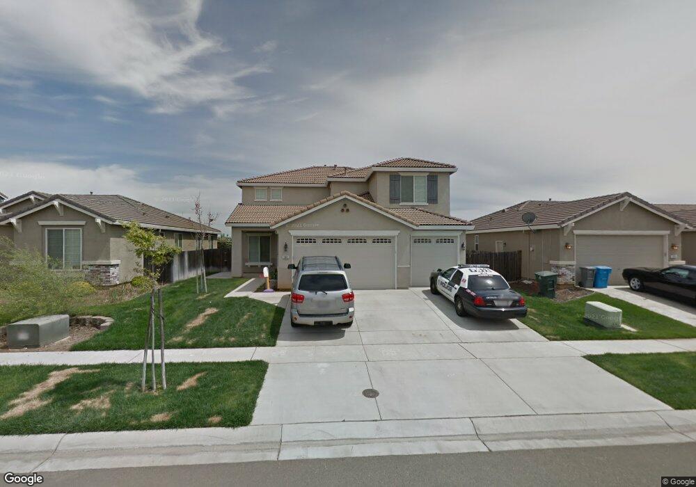
1941 Branding Iron Way Plumas Lake, CA 95961
Estimated Value: $476,000 - $613,000
5
Beds
3
Baths
3,151
Sq Ft
$177/Sq Ft
Est. Value
About This Home
This home is located at 1941 Branding Iron Way, Plumas Lake, CA 95961 and is currently estimated at $557,073, approximately $176 per square foot. 1941 Branding Iron Way is a home located in Yuba County with nearby schools including Rio Del Oro Elementary School, Cobblestone Elementary School, and Riverside Meadows Intermediate School.
Ownership History
Date
Name
Owned For
Owner Type
Purchase Details
Closed on
May 20, 2011
Sold by
Smith Cecil G
Bought by
Johnson Edward L
Current Estimated Value
Home Financials for this Owner
Home Financials are based on the most recent Mortgage that was taken out on this home.
Original Mortgage
$215,434
Outstanding Balance
$149,441
Interest Rate
4.84%
Mortgage Type
VA
Estimated Equity
$407,632
Purchase Details
Closed on
Jan 18, 2006
Sold by
Towne Development Of Plumas Lake Llc
Bought by
Smith Cecil G and Smith Kathleen S
Home Financials for this Owner
Home Financials are based on the most recent Mortgage that was taken out on this home.
Original Mortgage
$118,600
Interest Rate
6.28%
Mortgage Type
New Conventional
Create a Home Valuation Report for This Property
The Home Valuation Report is an in-depth analysis detailing your home's value as well as a comparison with similar homes in the area
Home Values in the Area
Average Home Value in this Area
Purchase History
| Date | Buyer | Sale Price | Title Company |
|---|---|---|---|
| Johnson Edward L | $211,000 | First American Title Company | |
| Smith Cecil G | $466,000 | First American Title Co |
Source: Public Records
Mortgage History
| Date | Status | Borrower | Loan Amount |
|---|---|---|---|
| Open | Johnson Edward L | $215,434 | |
| Previous Owner | Smith Cecil G | $118,600 |
Source: Public Records
Tax History Compared to Growth
Tax History
| Year | Tax Paid | Tax Assessment Tax Assessment Total Assessment is a certain percentage of the fair market value that is determined by local assessors to be the total taxable value of land and additions on the property. | Land | Improvement |
|---|---|---|---|---|
| 2025 | $4,371 | $270,316 | $19,212 | $251,104 |
| 2023 | $4,371 | $259,821 | $18,467 | $241,354 |
| 2022 | $4,245 | $254,727 | $18,105 | $236,622 |
| 2021 | $4,161 | $249,733 | $17,750 | $231,983 |
| 2020 | $4,130 | $247,173 | $17,568 | $229,605 |
| 2019 | $4,060 | $242,327 | $17,224 | $225,103 |
| 2018 | $3,845 | $237,577 | $16,887 | $220,690 |
| 2017 | $4,066 | $232,919 | $16,556 | $216,363 |
| 2016 | $4,023 | $228,353 | $16,232 | $212,121 |
| 2015 | $3,969 | $224,924 | $15,989 | $208,935 |
| 2014 | $3,910 | $220,519 | $15,676 | $204,843 |
Source: Public Records
Map
Nearby Homes
- 1986 Branding Iron Way
- 1911 Broken Bit Dr
- 1962 Knights Ferry Dr
- 1974 Bidwell Bar Dr
- 2040 Maverick Dr
- 2035 Bidwell Bar Dr
- 1406 Sundance Dr
- 1836 Broken Bit Dr
- 1337 Wawona Ct
- 1390 Heartland Dr
- 1352 Bedford Way
- 1758 Durham Ct
- 1351 Leighton Grove Dr
- 1711 Churchill Way
- 1149 Oxbow Ct
- 1649 Notting Hill Way
- 1626 Stepney Way
- 1721 London Way
- 1666 Guildford Way
- 1670 Guildford Way
- 1947 Branding Iron Way
- 1935 Branding Iron Way
- 1929 Branding Iron Way
- 1953 Branding Iron Way
- 1449 Freemans Ct
- 1448 Freemans Ct
- 1959 Branding Iron Way
- 1923 Branding Iron Way
- 1443 Freemans Ct
- 1965 Branding Iron Way
- 1919 Branding Iron Way
- 1956 Branding Iron Way
- 1440 Freemans Ct
- 1962 Branding Iron Way
- 1437 Freemans Ct
- 1969 Branding Iron Way
- 1916 Branding Iron Way
- 1968 Branding Iron Way
- 1436 Freemans Ct
- 1975 Branding Iron Way