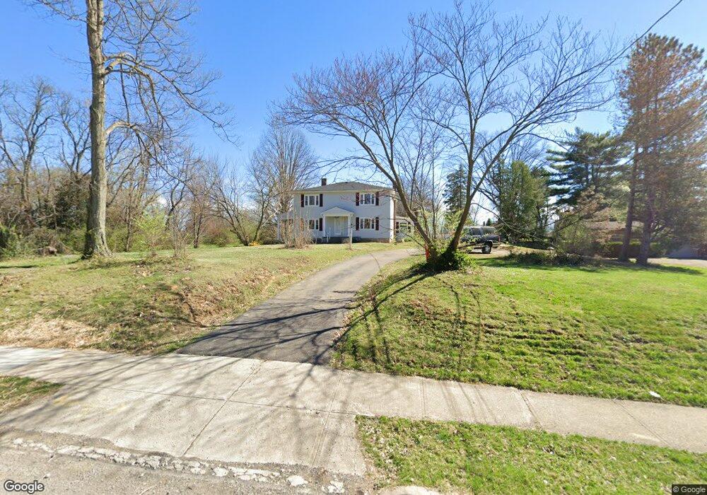
1941 Compton Rd Cincinnati, OH 45231
Estimated Value: $47,000 - $366,000
4
Beds
2
Baths
--
Sq Ft
27,443
Sq Ft Lot
About This Home
This home is located at 1941 Compton Rd, Cincinnati, OH 45231 and is currently estimated at $213,000. 1941 Compton Rd is a home located in Hamilton County with nearby schools including Mt Healthy High School, Central Montessori Academy, and Our Lady of Grace Catholic School.
Ownership History
Date
Name
Owned For
Owner Type
Purchase Details
Closed on
Feb 12, 2026
Sold by
City Properties Enterprises Llc
Bought by
Progressive Acquisitions Llc
Current Estimated Value
Purchase Details
Closed on
May 27, 2014
Sold by
Bloom Donald R
Bought by
City Properties Enterprises Llc
Purchase Details
Closed on
Dec 24, 2005
Sold by
Dahm Deborah and Dunn Denise
Bought by
Bloom Donald R
Purchase Details
Closed on
Dec 22, 2005
Sold by
Estate Of Dorothy M Bloom
Bought by
Bloom Donald R and Bloom Robert T
Create a Home Valuation Report for This Property
The Home Valuation Report is an in-depth analysis detailing your home's value as well as a comparison with similar homes in the area
Home Values in the Area
Average Home Value in this Area
Purchase History
| Date | Buyer | Sale Price | Title Company |
|---|---|---|---|
| Progressive Acquisitions Llc | -- | None Listed On Document | |
| City Properties Enterprises Llc | $6,199 | None Available | |
| Bloom Donald R | -- | None Available | |
| Bloom Donald R | -- | None Available |
Source: Public Records
Tax History
| Year | Tax Paid | Tax Assessment Tax Assessment Total Assessment is a certain percentage of the fair market value that is determined by local assessors to be the total taxable value of land and additions on the property. | Land | Improvement |
|---|---|---|---|---|
| 2025 | $256 | $4,771 | $4,771 | -- |
| 2023 | $259 | $4,771 | $4,771 | $0 |
| 2022 | $355 | $4,694 | $4,694 | $0 |
| 2021 | $353 | $4,694 | $4,694 | $0 |
| 2020 | $354 | $4,694 | $4,694 | $0 |
| 2019 | $300 | $4,155 | $4,155 | $0 |
| 2018 | $302 | $4,155 | $4,155 | $0 |
| 2017 | $289 | $4,155 | $4,155 | $0 |
| 2016 | $275 | $3,850 | $3,850 | $0 |
| 2015 | $272 | $3,850 | $3,850 | $0 |
| 2014 | $270 | $3,850 | $3,850 | $0 |
| 2013 | $304 | $4,375 | $4,375 | $0 |
Source: Public Records
Map
Nearby Homes
- 1967 Compton Rd
- 1980 Stevens Ave
- 1725 Hastings Ave
- 7718 Hamilton Ave
- 9125 Tag Dr
- 7310 Forest Ave
- 1545 Mcmakin Ave
- 1650 Joseph Ct
- 7404 Joseph St
- 1625 Joseph Ct
- 2175 Carlsbory Dr
- 9369 Ranchill Dr
- 7508 Elizabeth St
- 1461 Kinney Ave
- 8724 Neptune Dr
- 7274 Elizabeth St
- 1457 Adams Rd
- 1458 Van Fleet Ave
- 8729 Morningstar Ln
- 1481 Saint Clair Ave
- 1959 Compton Rd
- 7441 Park Ave
- 1956 Compton Rd
- 1925 Compton Rd
- 1940 Compton Rd
- 1952 Compton Rd
- 1958 Compton Rd
- 1936 Compton Rd
- 7428 Park Ave
- 1971 Compton Rd
- 1915 Compton Rd
- 7429 Park Ave
- 1964 Compton Rd
- 7424 Park Ave
- 1922 Compton Rd
- 7441 Roettele Place
- 7441 Roettele Place
- 7425 Park Ave
- 1966 Compton Rd
- 1926 Stevens Ave
Your Personal Tour Guide
Ask me questions while you tour the home.