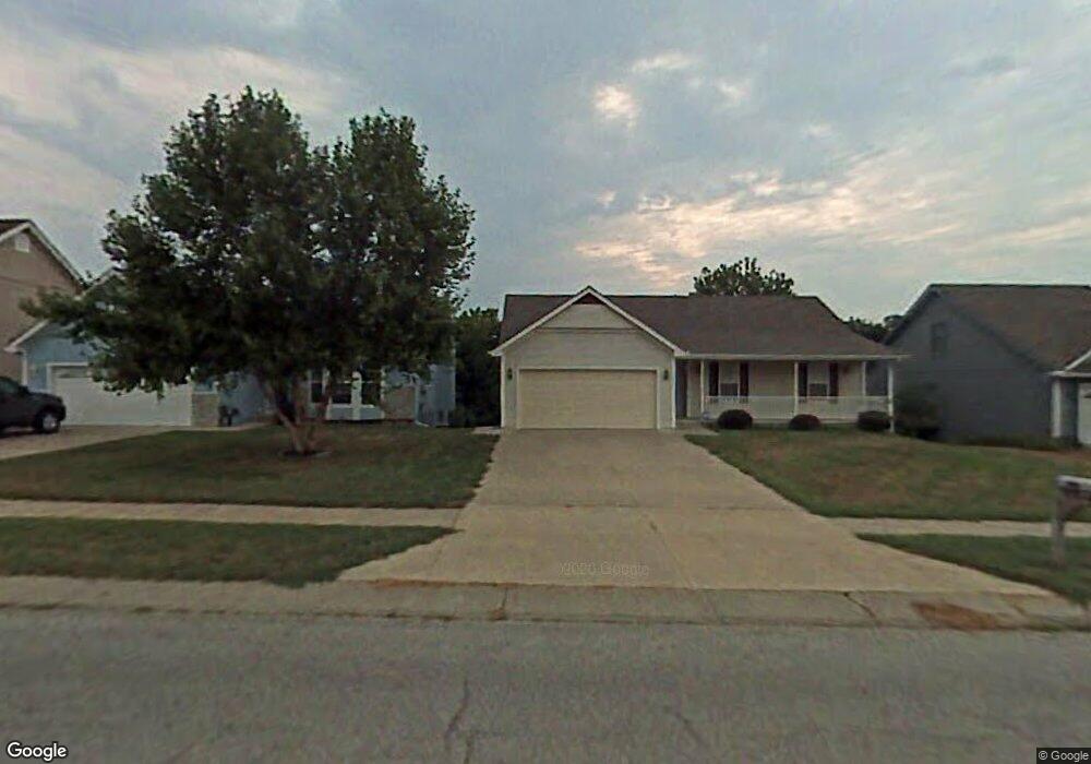
1941 Current St Liberty, MO 64068
Estimated Value: $307,203 - $369,000
3
Beds
3
Baths
1,250
Sq Ft
$266/Sq Ft
Est. Value
About This Home
This home is located at 1941 Current St, Liberty, MO 64068 and is currently estimated at $332,801, approximately $266 per square foot. 1941 Current St is a home located in Clay County with nearby schools including Lillian Schumacher Elementary School, Liberty Middle School, and Liberty High School.
Ownership History
Date
Name
Owned For
Owner Type
Purchase Details
Closed on
Oct 9, 2009
Sold by
Knutter Kathy Mae and Wren Kathy Mae
Bought by
Wren Don E
Current Estimated Value
Home Financials for this Owner
Home Financials are based on the most recent Mortgage that was taken out on this home.
Original Mortgage
$167,093
Outstanding Balance
$108,777
Interest Rate
5.1%
Mortgage Type
FHA
Estimated Equity
$224,024
Purchase Details
Closed on
Aug 17, 2006
Sold by
Hudgins Charlotte E
Bought by
Wren Donald E
Create a Home Valuation Report for This Property
The Home Valuation Report is an in-depth analysis detailing your home's value as well as a comparison with similar homes in the area
Purchase History
| Date | Buyer | Sale Price | Title Company |
|---|---|---|---|
| Wren Don E | -- | None Available | |
| Wren Donald E | -- | Commonwealth Land Title Ins |
Source: Public Records
Mortgage History
| Date | Status | Borrower | Loan Amount |
|---|---|---|---|
| Open | Wren Don E | $167,093 |
Source: Public Records
Tax History
| Year | Tax Paid | Tax Assessment Tax Assessment Total Assessment is a certain percentage of the fair market value that is determined by local assessors to be the total taxable value of land and additions on the property. | Land | Improvement |
|---|---|---|---|---|
| 2025 | $3,428 | $51,220 | -- | -- |
| 2024 | $3,428 | $44,570 | -- | -- |
| 2023 | $3,486 | $44,570 | $0 | $0 |
| 2022 | $3,162 | $39,920 | $0 | $0 |
| 2021 | $3,138 | $39,919 | $6,650 | $33,269 |
| 2020 | $2,848 | $34,030 | $0 | $0 |
| 2019 | $2,848 | $34,029 | $4,940 | $29,089 |
| 2018 | $2,623 | $30,780 | $0 | $0 |
| 2017 | $2,506 | $30,780 | $3,990 | $26,790 |
| 2016 | $2,506 | $29,680 | $3,990 | $25,690 |
| 2015 | $2,507 | $29,680 | $3,990 | $25,690 |
| 2014 | $2,419 | $28,420 | $3,990 | $24,430 |
Source: Public Records
Map
Nearby Homes
- 1877 Chickadee Dr
- 939 Goldfinch Ln
- 1846 Mallard Dr
- 1205 Robin Cir
- 900 Shiloh Ct
- 2218 Liberty Landing Rd
- 2600 Magnolia Ave
- 822 Sherrill Ave
- 1200 Silverleaf Ct
- 1059 Fir Ln
- 1026 Jasmine Dr
- 1022 Jasmine Dr
- 1955 Birmingham Rd
- 1015 Poplar Ln
- 1007 Poplar Ln
- 1027 Fir Ln
- 1012 Poplar Ln
- 988 Poplar Ln
- 1015 Fir Ln
- 409 Lilly Ln
- 1937 Current St
- 1945 Current St
- 1933 Current St
- 1949 Current St
- 1101 Current Ct
- 1934 Current St
- 1929 Current St
- 1925 Current St
- 1930 Current St
- 1104 Current Ct
- 1105 Current Ct
- 1107 Current Place
- 1109 Current Ct
- 1921 Current St
- 1108 Current Ct
- 1112 Pier
- 1917 Current St
- 1111 Current Place
- 1916 Current St
- 1913 Current St
Your Personal Tour Guide
Ask me questions while you tour the home.