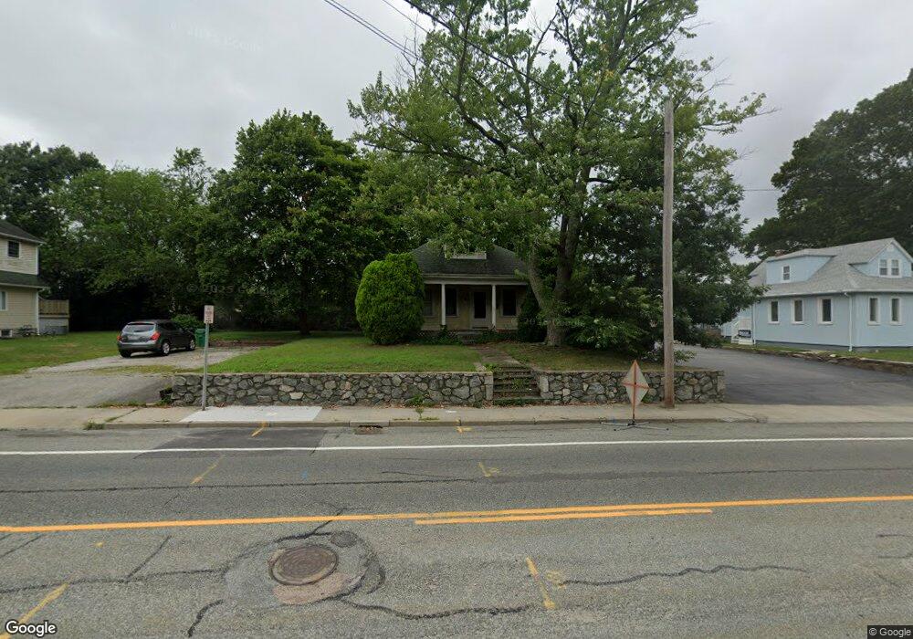
1941 Elmwood Ave Warwick, RI 02888
Norwood NeighborhoodEstimated Value: $334,000 - $395,000
3
Beds
1
Bath
1,456
Sq Ft
$250/Sq Ft
Est. Value
About This Home
This home is located at 1941 Elmwood Ave, Warwick, RI 02888 and is currently estimated at $363,796, approximately $249 per square foot. 1941 Elmwood Ave is a home located in Kent County with nearby schools including St. Peter School.
Ownership History
Date
Name
Owned For
Owner Type
Purchase Details
Closed on
Jan 6, 2000
Sold by
Stockley Robert
Bought by
Caporelli John A
Current Estimated Value
Home Financials for this Owner
Home Financials are based on the most recent Mortgage that was taken out on this home.
Original Mortgage
$68,850
Outstanding Balance
$20,987
Interest Rate
7.73%
Mortgage Type
Purchase Money Mortgage
Estimated Equity
$342,809
Purchase Details
Closed on
Feb 5, 1999
Sold by
Graf John W and Graf Diane K
Bought by
Stockley Robert
Home Financials for this Owner
Home Financials are based on the most recent Mortgage that was taken out on this home.
Original Mortgage
$63,650
Interest Rate
6.74%
Mortgage Type
Purchase Money Mortgage
Create a Home Valuation Report for This Property
The Home Valuation Report is an in-depth analysis detailing your home's value as well as a comparison with similar homes in the area
Home Values in the Area
Average Home Value in this Area
Purchase History
| Date | Buyer | Sale Price | Title Company |
|---|---|---|---|
| Caporelli John A | $76,500 | -- | |
| Stockley Robert | $67,000 | -- |
Source: Public Records
Mortgage History
| Date | Status | Borrower | Loan Amount |
|---|---|---|---|
| Open | Stockley Robert | $68,850 | |
| Previous Owner | Stockley Robert | $63,650 |
Source: Public Records
Tax History Compared to Growth
Tax History
| Year | Tax Paid | Tax Assessment Tax Assessment Total Assessment is a certain percentage of the fair market value that is determined by local assessors to be the total taxable value of land and additions on the property. | Land | Improvement |
|---|---|---|---|---|
| 2025 | $3,853 | $303,400 | $102,900 | $200,500 |
| 2024 | $3,508 | $242,400 | $89,400 | $153,000 |
| 2023 | $3,440 | $242,400 | $89,400 | $153,000 |
| 2022 | $3,222 | $172,000 | $58,700 | $113,300 |
| 2021 | $3,222 | $172,000 | $58,700 | $113,300 |
| 2020 | $3,222 | $172,000 | $58,700 | $113,300 |
| 2019 | $3,222 | $172,000 | $58,700 | $113,300 |
| 2018 | $2,816 | $135,400 | $58,700 | $76,700 |
| 2017 | $2,740 | $135,400 | $58,700 | $76,700 |
| 2016 | $2,740 | $135,400 | $58,700 | $76,700 |
| 2015 | $2,596 | $125,100 | $52,200 | $72,900 |
| 2014 | $2,510 | $125,100 | $52,200 | $72,900 |
| 2013 | $2,476 | $125,100 | $52,200 | $72,900 |
Source: Public Records
Map
Nearby Homes
- 341 Sumner Ave
- 35 Welfare Ave
- 120 Gould Ave
- 27 Frederick St
- 447 Harrington Ave
- 110 Heath Ave
- 1052 Post Rd
- 35 Manson Ave
- 1153 Post Rd
- 158 Underwood Ave
- 63 Massasoit Dr
- 126 Fairfax Dr
- 396 Elm St
- 208 Negansett Ave
- 150 Riverside Ave
- 15 Spruce Ave
- 70 Perkins Ave
- 65 Perkins Ave
- 81 Allen Ave
- 63 Benbridge Ave
- 1935 Elmwood Ave
- 1951 Elmwood Ave
- 242 Harrington Ave
- 250 Harrington Ave
- 260 Harrington Ave
- 0 Harrington Ave
- 232 Harrington Ave
- 1782 Elmwood Ave
- 1967 Elmwood Ave
- 1962 Elmwood Ave
- 247 Harrington Ave
- 257 Harrington Ave
- 241 Harrington Ave
- 1971 Elmwood Ave
- 261 Harrington Ave
- 272 Harrington Ave
- 1970 Elmwood Ave
- 233 Harrington Ave
- 267 Harrington Ave
- 184 Pawtuxet Ave