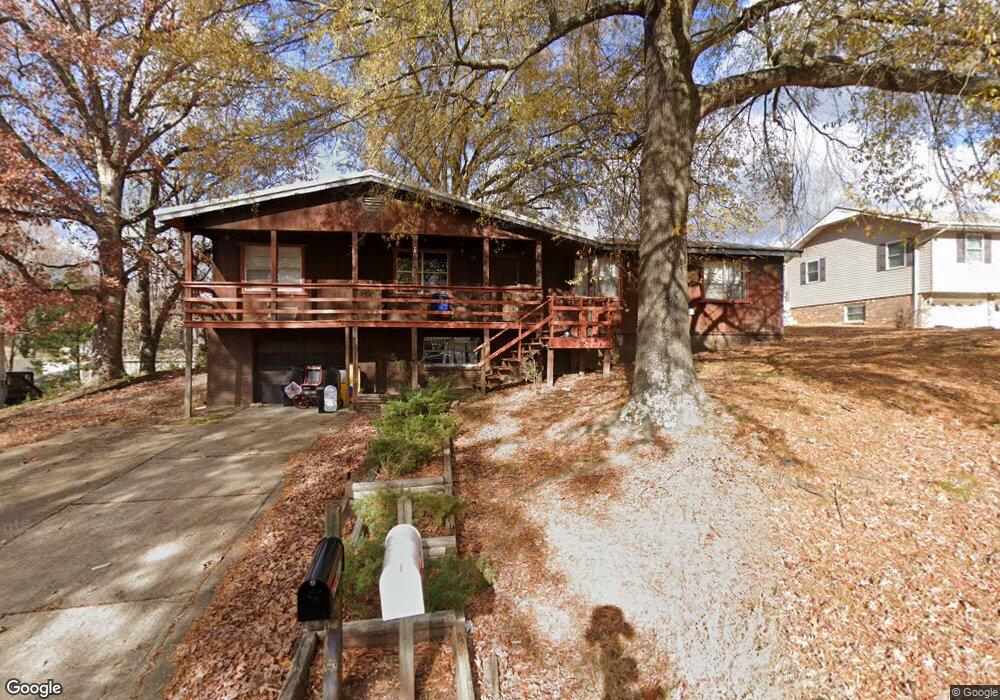
1941 Fernwood Rd Poplar Bluff, MO 63901
Estimated Value: $156,000 - $185,090
3
Beds
--
Bath
1,560
Sq Ft
$111/Sq Ft
Est. Value
About This Home
This home is located at 1941 Fernwood Rd, Poplar Bluff, MO 63901 and is currently estimated at $172,523, approximately $110 per square foot. 1941 Fernwood Rd is a home located in Butler County with nearby schools including Eugene Field Elementary School, Poplar Bluff Fifth & Sixth Grade Center, and Poplar Bluff Junior High School.
Ownership History
Date
Name
Owned For
Owner Type
Purchase Details
Closed on
May 3, 2011
Sold by
Secretary Of H U D Of Washington D C
Bought by
West Gregory
Current Estimated Value
Purchase Details
Closed on
Sep 13, 2010
Sold by
Hicks Jamie and Hicks Misty
Bought by
Bac Home Loans Servicing Lp and Countrywide Home Loans Servicing Lp
Purchase Details
Closed on
Jul 12, 2007
Sold by
Weir Melanie
Bought by
Hicks Jamie and Hicks Misty
Home Financials for this Owner
Home Financials are based on the most recent Mortgage that was taken out on this home.
Original Mortgage
$74,500
Interest Rate
6.41%
Mortgage Type
New Conventional
Purchase Details
Closed on
Mar 21, 2005
Sold by
Garrett Glendol D and Garrett Judith R
Bought by
Weir Melanie
Create a Home Valuation Report for This Property
The Home Valuation Report is an in-depth analysis detailing your home's value as well as a comparison with similar homes in the area
Home Values in the Area
Average Home Value in this Area
Purchase History
| Date | Buyer | Sale Price | Title Company |
|---|---|---|---|
| West Gregory | -- | -- | |
| Bac Home Loans Servicing Lp | -- | -- | |
| Hicks Jamie | -- | -- | |
| Weir Melanie | -- | None Available |
Source: Public Records
Mortgage History
| Date | Status | Borrower | Loan Amount |
|---|---|---|---|
| Previous Owner | Hicks Jamie | $74,500 |
Source: Public Records
Tax History Compared to Growth
Tax History
| Year | Tax Paid | Tax Assessment Tax Assessment Total Assessment is a certain percentage of the fair market value that is determined by local assessors to be the total taxable value of land and additions on the property. | Land | Improvement |
|---|---|---|---|---|
| 2024 | $9 | $18,120 | $0 | $0 |
| 2023 | $875 | $18,120 | $0 | $0 |
| 2022 | $863 | $17,900 | $0 | $0 |
| 2021 | $864 | $17,900 | $0 | $0 |
| 2020 | $811 | $16,580 | $0 | $0 |
| 2019 | $810 | $16,580 | $0 | $0 |
| 2018 | $810 | $16,580 | $0 | $0 |
| 2017 | -- | $16,580 | $0 | $0 |
| 2016 | -- | $16,580 | $0 | $0 |
| 2015 | -- | $16,580 | $0 | $0 |
| 2014 | -- | $15,490 | $0 | $0 |
| 2012 | $660 | $15,490 | $0 | $0 |
Source: Public Records
Map
Nearby Homes
- 2024 Glendale Rd
- 2718 Bedoll Ave
- 2801 Bedoll Ave
- 2925 Wayne Ave
- 1110 Commerce St
- 2121 Pike St
- 1039 Franklin St
- 1025 Delano St
- 1315 S 11th St
- 2335 Cheshire Blvd
- 1000 W Victor St
- 712 Nickey St
- 622 Nickey St
- 163 Fairway Dr
- 0 County Road 301
- 912 Adam St
- 112 Kaylee Cir
- 1905 Kentucky Ave
- 792 County Road 466
- 1708 Kentucky Ave
- 1935 Fernwood Rd
- 1949 Fernwood Rd
- 1929 Fernwood Rd
- 1936 Glendale Rd
- 1942 Fernwood Rd
- 1936 Fernwood Rd
- 1948 Fernwood Rd
- 1930 Glendale Rd
- 1948 Glendale Rd
- 1926 Fernwood Rd
- 1919 Fernwood Rd
- 2007 Fernwood Rd
- 1924 Glendale Rd
- 1920 Fernwood Rd
- 2006 Fernwood Rd
- 1918 Glendale Rd
- 1927 Glendale Rd
- 1935 Glendale Rd
- 2013 Fernwood Rd
- 1911 Fernwood Rd