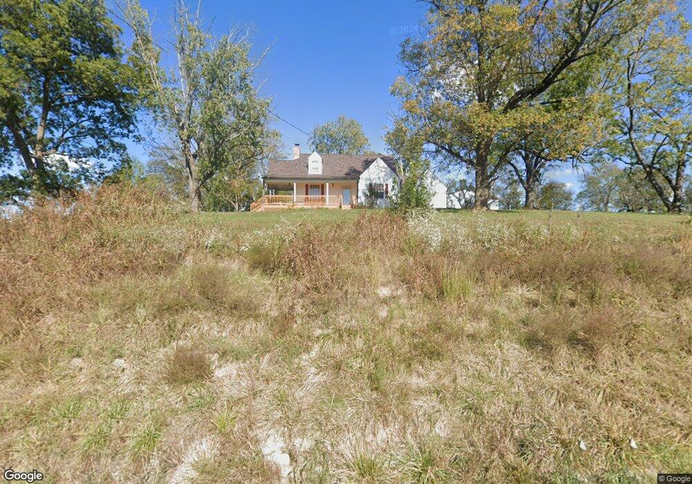
1941 Highway 82 S Shelbyville, TN 37160
Estimated Value: $381,209 - $706,000
--
Bed
2
Baths
2,100
Sq Ft
$231/Sq Ft
Est. Value
About This Home
This home is located at 1941 Highway 82 S, Shelbyville, TN 37160 and is currently estimated at $485,052, approximately $230 per square foot. 1941 Highway 82 S is a home located in Bedford County with nearby schools including Liberty Elementary School.
Ownership History
Date
Name
Owned For
Owner Type
Purchase Details
Closed on
May 1, 2017
Sold by
Hicks Suzanne G
Bought by
Ketner Todd E Rebecca H
Current Estimated Value
Purchase Details
Closed on
Apr 29, 2010
Sold by
Glover Carl
Bought by
Hicks Suzanne G
Purchase Details
Closed on
Jun 12, 2009
Sold by
Mcdaniel Donetta Kay Hix
Bought by
Glover Carl
Purchase Details
Closed on
Jan 19, 1996
Bought by
Baker James and Baker Mary
Purchase Details
Closed on
Jun 9, 1983
Bought by
Bartlett Emily S
Create a Home Valuation Report for This Property
The Home Valuation Report is an in-depth analysis detailing your home's value as well as a comparison with similar homes in the area
Home Values in the Area
Average Home Value in this Area
Purchase History
| Date | Buyer | Sale Price | Title Company |
|---|---|---|---|
| Ketner Todd E Rebecca H | $194,900 | -- | |
| Hicks Suzanne G | $146,000 | -- | |
| Hicks Suzanne G | $4,000 | -- | |
| Glover Carl | $5,000 | -- | |
| Mcdaniel Donnetta Kay Hix | $34,000 | -- | |
| Glover Carl | $80,000 | -- | |
| Baker James | $5,500 | -- | |
| Bartlett Emily S | -- | -- |
Source: Public Records
Tax History Compared to Growth
Tax History
| Year | Tax Paid | Tax Assessment Tax Assessment Total Assessment is a certain percentage of the fair market value that is determined by local assessors to be the total taxable value of land and additions on the property. | Land | Improvement |
|---|---|---|---|---|
| 2025 | $1,193 | $51,300 | $0 | $0 |
| 2024 | $1,193 | $51,300 | $10,225 | $41,075 |
| 2023 | $1,193 | $51,300 | $10,225 | $41,075 |
| 2022 | $1,193 | $51,300 | $10,225 | $41,075 |
| 2021 | $1,008 | $51,300 | $10,225 | $41,075 |
| 2020 | $982 | $51,300 | $10,225 | $41,075 |
| 2019 | $982 | $36,900 | $6,875 | $30,025 |
| 2018 | $847 | $33,100 | $6,875 | $26,225 |
| 2017 | $841 | $32,850 | $6,875 | $25,975 |
| 2016 | $828 | $32,850 | $6,875 | $25,975 |
| 2015 | $828 | $32,850 | $6,875 | $25,975 |
| 2014 | $751 | $33,089 | $0 | $0 |
Source: Public Records
Map
Nearby Homes
- 176 Corder Ln
- 0 New Center Church Rd
- 506 New Center Church Rd
- 248 Old Flat Creek Rd
- 455 Himesville Rd
- 495 Himesville Rd
- 209 Gladys Dr
- 119 Crestland Cir
- 0 Himesville Rd
- 0 Overlook Ln Unit RTC2889952
- 0 Overlook Ln Unit 1513245
- 0 Overlook Ln Unit RTC3015273
- 231 Riverbend Country Club Rd
- 315 Woodland Dr
- 0 Highway 130 E
- 1519 Highway 130 E
- 201 Sulphur Springs Rd
- 128 Riverlake Rd
- 339 Riverbend Country Club Rd
- 485 Naron Rd
- 1941 Tennessee 82
- 1944 Highway 82 S
- 1953 Highway 82 S
- 1931 Highway 82 S
- 1930 Highway 82 S
- 1925 Highway 82 S
- 1198 New Hope Rd
- 1196 New Hope Rd
- 1190 New Hope Rd
- 1130 New Hope Rd
- 0 Cy Thomas Rd
- 0 Cy Thomas Rd Unit RTC1921032
- 0 Cy Thomas Rd Unit 2001897
- 1915 Highway 82 S
- 1131 New Hope Rd
- 2010 Highway 82 S
- 1125 New Hope Rd
- 0 Mill Rd
- 245 Mill Rd
- 1127 New Hope Rd