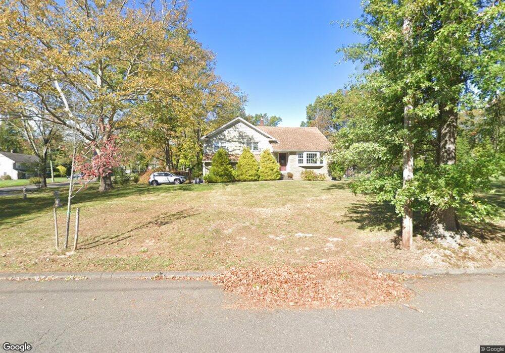
1941 Inverness Dr Scotch Plains, NJ 07076
Estimated Value: $771,853 - $1,534,000
--
Bed
--
Bath
1,676
Sq Ft
$694/Sq Ft
Est. Value
About This Home
This home is located at 1941 Inverness Dr, Scotch Plains, NJ 07076 and is currently estimated at $1,162,713, approximately $693 per square foot. 1941 Inverness Dr is a home located in Union County with nearby schools including William J. McGinn Elementary School, Terrill Middle School, and Scotch Plains-Fanwood High School.
Ownership History
Date
Name
Owned For
Owner Type
Purchase Details
Closed on
Mar 19, 2010
Sold by
Madden Properties Llc
Bought by
Gromek Michael R and Gromek Jessica L
Current Estimated Value
Home Financials for this Owner
Home Financials are based on the most recent Mortgage that was taken out on this home.
Original Mortgage
$569,800
Outstanding Balance
$387,331
Interest Rate
5.5%
Mortgage Type
FHA
Estimated Equity
$775,382
Purchase Details
Closed on
Sep 24, 2009
Sold by
Winburn Walter H and Winburn Janet C
Bought by
Madden Properties Llc
Home Financials for this Owner
Home Financials are based on the most recent Mortgage that was taken out on this home.
Original Mortgage
$250,000
Interest Rate
5.12%
Mortgage Type
Purchase Money Mortgage
Create a Home Valuation Report for This Property
The Home Valuation Report is an in-depth analysis detailing your home's value as well as a comparison with similar homes in the area
Home Values in the Area
Average Home Value in this Area
Purchase History
| Date | Buyer | Sale Price | Title Company |
|---|---|---|---|
| Gromek Michael R | $625,000 | First American Title Ins Co | |
| Madden Properties Llc | $465,000 | Chicago Title Insurance Co |
Source: Public Records
Mortgage History
| Date | Status | Borrower | Loan Amount |
|---|---|---|---|
| Open | Gromek Michael R | $569,800 | |
| Previous Owner | Madden Properties Llc | $250,000 |
Source: Public Records
Tax History Compared to Growth
Tax History
| Year | Tax Paid | Tax Assessment Tax Assessment Total Assessment is a certain percentage of the fair market value that is determined by local assessors to be the total taxable value of land and additions on the property. | Land | Improvement |
|---|---|---|---|---|
| 2025 | $16,252 | $138,100 | $54,100 | $84,000 |
| 2024 | $15,772 | $138,100 | $54,100 | $84,000 |
| 2023 | $15,772 | $138,100 | $54,100 | $84,000 |
| 2022 | $14,896 | $132,000 | $54,100 | $77,900 |
| 2021 | $14,601 | $129,600 | $54,100 | $75,500 |
| 2020 | $14,531 | $129,600 | $54,100 | $75,500 |
| 2019 | $14,423 | $129,600 | $54,100 | $75,500 |
| 2018 | $14,181 | $129,600 | $54,100 | $75,500 |
| 2017 | $13,866 | $129,600 | $54,100 | $75,500 |
| 2016 | $13,599 | $129,600 | $54,100 | $75,500 |
| 2015 | $13,376 | $129,600 | $54,100 | $75,500 |
| 2014 | $12,935 | $129,600 | $54,100 | $75,500 |
Source: Public Records
Map
Nearby Homes
- 2 Brookside Ct
- 2 Dutch Ln
- 57 Rambling Dr
- 1466 Lamberts Mill Rd
- 1933 W Broad St
- 2154 W Broad St
- 314 Highgate Ave
- 119 Lamberts Mill Rd
- 1933 Mary Ellen Ln
- 2 Unami Ln
- 1840 Raritan Rd
- 2116 Newark Ave
- 1701 Raritan Rd
- 1840 Lake Ave
- 1380 Terrill Rd
- 1621 Terrill Rd
- 1148 Tanglewood Ln
- 187 King St
- 525 Edgar Rd
- 524 Edgar Rd
- 1949 Inverness Dr
- 1942 Duncan Dr
- 1907 Duncan Dr
- 1915 Duncan Dr
- 1950 Duncan Dr
- 1940 Inverness Dr
- 1946 Inverness Dr
- 1957 Inverness Dr
- 1934 Inverness Dr
- 1952 Inverness Dr
- 1923 Duncan Dr
- 1958 Duncan Dr
- 1925 Inverness Dr
- 1931 Duncan Dr
- 1 Norwegian Woods
- 1958 Inverness Dr
- 1926 Inverness Dr
- 1939 Duncan Dr
- 1947 Duncan Dr
- 1966 Duncan Dr