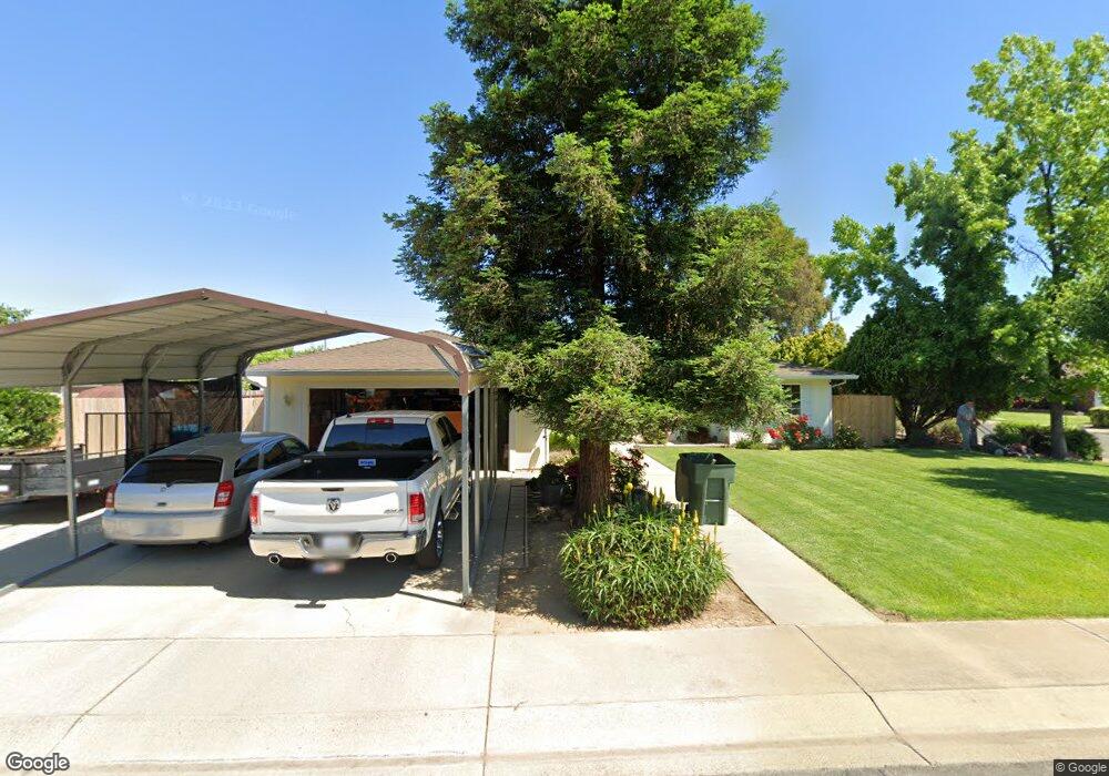
1941 Lambert Ct Yuba City, CA 95993
Estimated Value: $267,000 - $413,000
3
Beds
2
Baths
1,276
Sq Ft
$286/Sq Ft
Est. Value
About This Home
This home is located at 1941 Lambert Ct, Yuba City, CA 95993 and is currently estimated at $364,819, approximately $285 per square foot. 1941 Lambert Ct is a home located in Sutter County with nearby schools including Andros Karperos, River Valley High School, and Adventist Christian School.
Ownership History
Date
Name
Owned For
Owner Type
Purchase Details
Closed on
Nov 19, 2014
Sold by
Schwall Paul M
Bought by
Schwall Sandra L
Current Estimated Value
Home Financials for this Owner
Home Financials are based on the most recent Mortgage that was taken out on this home.
Original Mortgage
$117,500
Interest Rate
3.89%
Mortgage Type
New Conventional
Purchase Details
Closed on
Feb 23, 2005
Sold by
Mitchell Sandra L and Johnson Sandra Lynn
Bought by
Mitchell Sandra L
Home Financials for this Owner
Home Financials are based on the most recent Mortgage that was taken out on this home.
Original Mortgage
$104,000
Interest Rate
5.66%
Mortgage Type
New Conventional
Purchase Details
Closed on
Jan 27, 2000
Sold by
Johnson Lanny L
Bought by
Johnson Sandra Lynn
Create a Home Valuation Report for This Property
The Home Valuation Report is an in-depth analysis detailing your home's value as well as a comparison with similar homes in the area
Home Values in the Area
Average Home Value in this Area
Purchase History
| Date | Buyer | Sale Price | Title Company |
|---|---|---|---|
| Schwall Sandra L | -- | Placer Title Company | |
| Schwall Sandra L | -- | Placer Title Company | |
| Mitchell Sandra L | -- | Orange Coast Title | |
| Johnson Sandra Lynn | -- | -- |
Source: Public Records
Mortgage History
| Date | Status | Borrower | Loan Amount |
|---|---|---|---|
| Closed | Schwall Sandra L | $117,500 | |
| Closed | Mitchell Sandra L | $104,000 |
Source: Public Records
Tax History Compared to Growth
Tax History
| Year | Tax Paid | Tax Assessment Tax Assessment Total Assessment is a certain percentage of the fair market value that is determined by local assessors to be the total taxable value of land and additions on the property. | Land | Improvement |
|---|---|---|---|---|
| 2025 | $2,338 | $205,973 | $56,565 | $149,408 |
| 2024 | $2,338 | $201,935 | $55,456 | $146,479 |
| 2023 | $2,338 | $197,976 | $54,369 | $143,607 |
| 2022 | $2,252 | $194,095 | $53,303 | $140,792 |
| 2021 | $2,228 | $190,332 | $52,280 | $138,052 |
| 2020 | $2,189 | $188,381 | $51,744 | $136,637 |
| 2019 | $2,142 | $184,686 | $50,729 | $133,957 |
| 2018 | $2,111 | $181,066 | $49,735 | $131,331 |
| 2017 | $2,061 | $177,516 | $48,760 | $128,756 |
| 2016 | $2,020 | $174,035 | $47,804 | $126,231 |
| 2015 | $1,988 | $171,420 | $47,085 | $124,335 |
| 2014 | $1,964 | $168,063 | $46,163 | $121,900 |
Source: Public Records
Map
Nearby Homes
- 1955 Jason Ct
- 156 Bristol Way
- 152 College Hill Way
- 238 Anita Way
- 1781 Franklin Rd Unit 36
- 1781 Franklin Rd Unit 59
- 138 Nantucket Way
- 170 Nantucket Way
- 1665 Michelle Dr
- 683 Mark Thomas Dr
- 1571 Holly Tree Dr
- 430 Neil Dr
- 1545 Camino Del Oro
- 955 Carson Dr
- 2624 Azalea Way
- 2690 Red Bud Ln
- 2661 Imperial Way
- 0 Lassen Blvd
- 1344 Kean Ave
- 1330 Kean Ave
- 1949 Lambert Ct
- 1932 Franklin Rd
- 142 Oliver Dr
- 1946 Franklin Rd
- 1940 Lambert Ct
- 120 Oliver Dr
- 160 Oliver Dr
- 1957 Lambert Ct
- 1950 Lambert Ct
- 1958 Franklin Rd
- 1962 Lambert Ct
- 152 Rai Estates Ct
- 176 Oliver Dr
- 1956 Lambert Ct
- 374 N Oliver Dr
- 160 Rai Estates Ct
- 195 Oliver Dr
- 1945 Jason Ct
- 168 Rai Estates Ct
- 1880 Franklin Rd