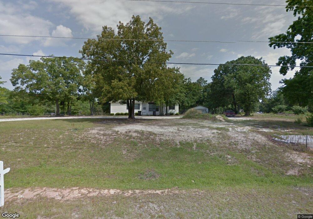
1941 Mcdade Rd Unit B Hephzibah, GA 30815
McDade NeighborhoodEstimated Value: $182,000 - $231,000
3
Beds
2
Baths
1,504
Sq Ft
$139/Sq Ft
Est. Value
About This Home
This home is located at 1941 Mcdade Rd Unit B, Hephzibah, GA 30815 and is currently estimated at $208,798, approximately $138 per square foot. 1941 Mcdade Rd Unit B is a home located in Richmond County with nearby schools including Goshen Elementary School, Pine Hill Middle School, and Johnson Magnet.
Ownership History
Date
Name
Owned For
Owner Type
Purchase Details
Closed on
Jul 1, 1992
Sold by
Barlow & Associates Inc
Bought by
Pyles Donald L Pyles Renee B
Current Estimated Value
Purchase Details
Closed on
May 29, 1992
Sold by
Barlow & Associates
Bought by
Pyles Donald L
Purchase Details
Closed on
Jan 20, 1987
Sold by
Grove John W Grove Heidi
Bought by
Garrett Forrest Garrett Jeanette Y
Purchase Details
Closed on
Jan 1, 1987
Sold by
Grove John W
Bought by
Garrett Forrest
Create a Home Valuation Report for This Property
The Home Valuation Report is an in-depth analysis detailing your home's value as well as a comparison with similar homes in the area
Home Values in the Area
Average Home Value in this Area
Purchase History
| Date | Buyer | Sale Price | Title Company |
|---|---|---|---|
| Pyles Donald L Pyles Renee B | -- | -- | |
| Pyles Donald L | $61,800 | -- | |
| Garrett Forrest Garrett Jeanette Y | $6,000 | -- | |
| Garrett Forrest | $6,000 | -- |
Source: Public Records
Tax History Compared to Growth
Tax History
| Year | Tax Paid | Tax Assessment Tax Assessment Total Assessment is a certain percentage of the fair market value that is determined by local assessors to be the total taxable value of land and additions on the property. | Land | Improvement |
|---|---|---|---|---|
| 2025 | $1,056 | $77,032 | $4,200 | $72,832 |
| 2024 | $1,056 | $66,484 | $4,200 | $62,284 |
| 2023 | $921 | $64,072 | $4,200 | $59,872 |
| 2022 | $1,770 | $54,088 | $4,200 | $49,888 |
| 2021 | $1,303 | $34,526 | $4,200 | $30,326 |
| 2020 | $1,286 | $34,526 | $4,200 | $30,326 |
| 2019 | $1,351 | $34,526 | $4,200 | $30,326 |
| 2018 | $1,359 | $34,526 | $4,200 | $30,326 |
| 2017 | $1,331 | $34,526 | $4,200 | $30,326 |
| 2016 | $1,332 | $34,526 | $4,200 | $30,326 |
| 2015 | $1,340 | $34,526 | $4,200 | $30,326 |
| 2014 | $1,341 | $34,526 | $4,200 | $30,326 |
Source: Public Records
Map
Nearby Homes
- 1894 Mcdade Rd
- 1943 McDade Farm Rd
- 1943 McDade Farm Rd Unit F
- 1898 McDade Farm Rd
- 2031 Mcdade Rd
- 3926 Union Grove Cir
- 3405 Southern Ridge Ct
- 2039 McDade Farm Rd
- 3819 Clanton Rd
- 4149 Markwalter Rd
- 4077 Burning Tree Ln
- 1737 Tamarind Way
- 4053 Burning Tree Ln
- 1725 Tamarind Way
- 2319 Peach Blossom Pass
- 2237 Sunny Day Dr
- 3801 Clanton Rd
- 2316 Peach Blossom Pass
- 2053 Brown Rd
- 4051 Goshen Lake Dr S
- 1941 Mcdade Rd
- 1941 Mcdade Rd Unit A
- 2007 Mcdade Rd
- 1945 Mcdade Rd
- 1980 Mcdade Rd
- 1982 Mcdade Rd
- 1942 Mcdade Rd
- 1940 Mcdade Rd
- 1944 Mcdade Rd
- 1946 Mcdade Rd
- 1930 Mcdade Rd
- 1953 Mcdade Rd
- 1951 Mcdade Rd
- 1902 Mcdade Rd
- 1966 Mcdade Rd
- 1955 McDade Farm Rd
- 1953 McDade Farm Rd
- 1948 Mcdade Rd
- 1849 Mcdade Rd
- 2032 Mcdade Rd