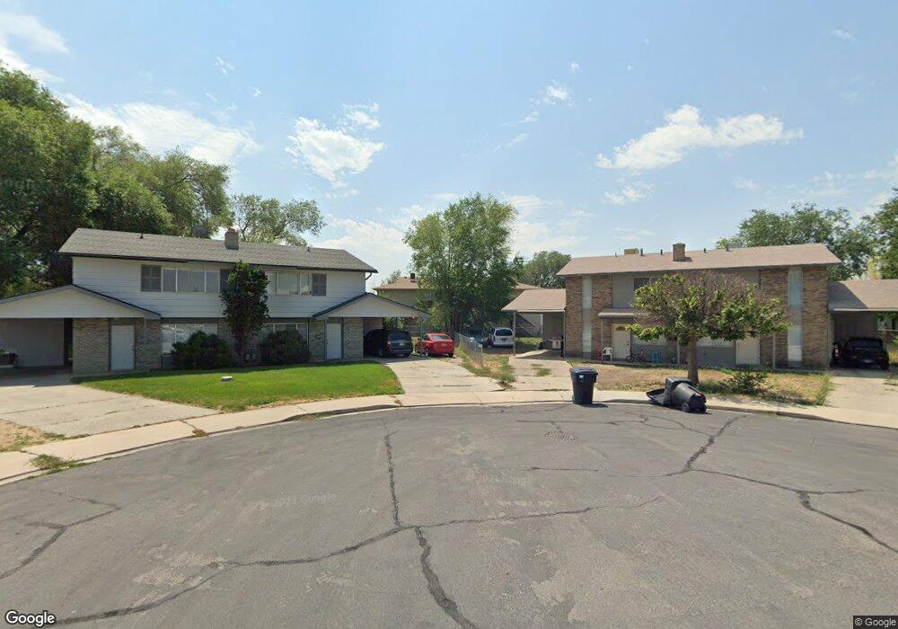
1941 N 360 E Provo, UT 84604
Rock Canyon NeighborhoodEstimated Value: $699,000 - $821,000
5
Beds
3
Baths
3,478
Sq Ft
$220/Sq Ft
Est. Value
About This Home
This home is located at 1941 N 360 E, Provo, UT 84604 and is currently estimated at $764,947, approximately $219 per square foot. 1941 N 360 E is a home located in Utah County with nearby schools including Rock Canyon Elementary School, Centennial Middle School, and Timpview High School.
Ownership History
Date
Name
Owned For
Owner Type
Purchase Details
Closed on
Aug 6, 2012
Sold by
Mills Roger E
Bought by
Crookston Michael and Crookston Judy
Current Estimated Value
Purchase Details
Closed on
Jun 15, 2011
Sold by
Hardy Kenneth L and Hardy Stephanie
Bought by
Mills Roger E
Purchase Details
Closed on
Sep 1, 1999
Sold by
Mangalei Mandy Sue and Mangalei Issaiah K
Bought by
Mills Roger E
Home Financials for this Owner
Home Financials are based on the most recent Mortgage that was taken out on this home.
Original Mortgage
$209,000
Interest Rate
8.75%
Purchase Details
Closed on
Aug 19, 1998
Sold by
Magalei Issiah K and Magalei Mandy Sue
Bought by
Magalei Mandy Sue and Magalei Issiah K
Home Financials for this Owner
Home Financials are based on the most recent Mortgage that was taken out on this home.
Original Mortgage
$177,300
Interest Rate
6.88%
Purchase Details
Closed on
Aug 13, 1998
Sold by
Magalei Issiah K and Magalei Mandy Sue
Bought by
Magalei Issiah K and Magalei Mandy Sue
Home Financials for this Owner
Home Financials are based on the most recent Mortgage that was taken out on this home.
Original Mortgage
$177,300
Interest Rate
6.88%
Purchase Details
Closed on
Sep 11, 1997
Sold by
Monson Susan R
Bought by
Magalei Issiah K and Magalei Mandy Sue
Home Financials for this Owner
Home Financials are based on the most recent Mortgage that was taken out on this home.
Original Mortgage
$162,450
Interest Rate
7.45%
Create a Home Valuation Report for This Property
The Home Valuation Report is an in-depth analysis detailing your home's value as well as a comparison with similar homes in the area
Home Values in the Area
Average Home Value in this Area
Purchase History
| Date | Buyer | Sale Price | Title Company |
|---|---|---|---|
| Crookston Michael | -- | Provo Land Title Company | |
| Mills Roger E | -- | Provo Land Title Company | |
| Mills Roger E | -- | First American Title Ins Co | |
| Magalei Mandy Sue | -- | -- | |
| Magalei Issiah K | -- | -- | |
| Magalei Issiah K | -- | -- |
Source: Public Records
Mortgage History
| Date | Status | Borrower | Loan Amount |
|---|---|---|---|
| Previous Owner | Mills Roger E | $209,000 | |
| Previous Owner | Magalei Mandy Sue | $177,300 | |
| Previous Owner | Magalei Issiah K | $162,450 |
Source: Public Records
Tax History
| Year | Tax Paid | Tax Assessment Tax Assessment Total Assessment is a certain percentage of the fair market value that is determined by local assessors to be the total taxable value of land and additions on the property. | Land | Improvement |
|---|---|---|---|---|
| 2025 | $3,334 | $377,960 | -- | -- |
| 2024 | $3,334 | $328,185 | $0 | $0 |
| 2023 | $3,121 | $302,830 | $0 | $0 |
| 2022 | $3,003 | $293,810 | $0 | $0 |
| 2021 | $2,441 | $416,500 | $207,900 | $208,600 |
| 2020 | $2,318 | $370,800 | $166,300 | $204,500 |
| 2019 | $2,185 | $363,500 | $166,300 | $197,200 |
| 2018 | $2,002 | $337,800 | $166,300 | $171,500 |
| 2017 | $1,841 | $170,665 | $0 | $0 |
| 2016 | $1,613 | $139,370 | $0 | $0 |
| 2015 | $1,412 | $123,310 | $0 | $0 |
| 2014 | $1,217 | $110,825 | $0 | $0 |
Source: Public Records
Map
Nearby Homes
- 1960 N Canyon Rd
- 360 Sumac Ln
- 182 E 2090 N
- 186 E 2100 N
- 240 E 2230 N Unit 7
- 1801 N 650 E
- 223 W 2230 N Unit 14
- 241 W 2230 N Unit 16
- 264 W 1625 N
- 2735 N Country Club Dr
- 1470 N 380 W
- 2774 N 370 E
- 788 E 2680 N
- 990 Cedar Ave
- 1411 N Locust Ln
- 1108 E 2620 N
- 948 N 50 E Unit 301
- 431 W 2310 N
- 3025 N 250 E
- 2939 N Marrcrest Dr W
Your Personal Tour Guide
Ask me questions while you tour the home.