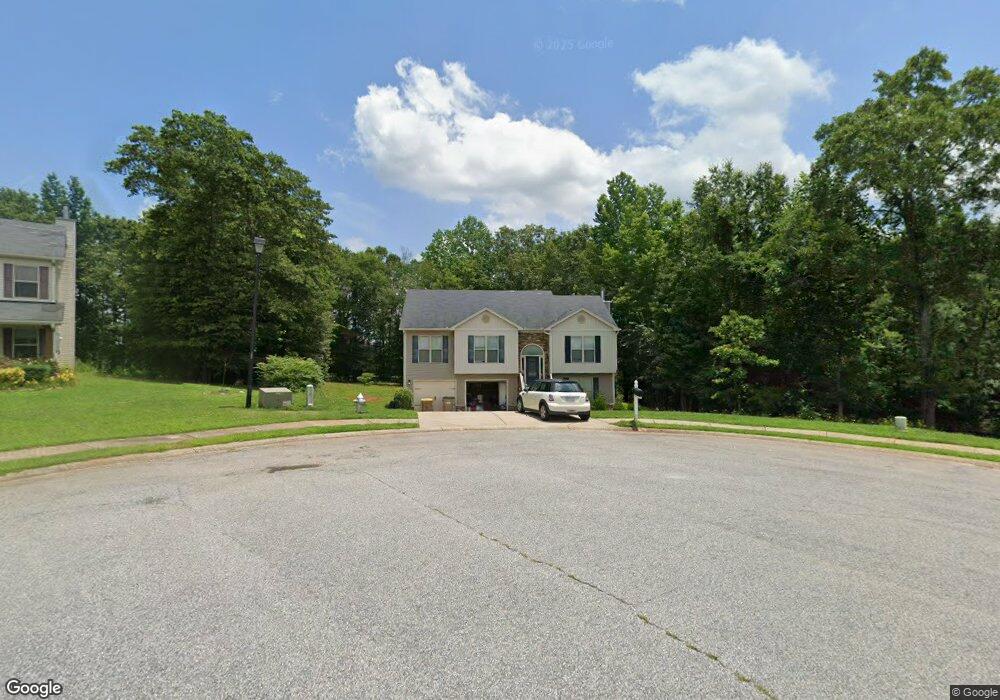
1941 Paynes Point Unit 73 Winder, GA 30680
Estimated Value: $371,098 - $397,000
4
Beds
3
Baths
2,200
Sq Ft
$175/Sq Ft
Est. Value
About This Home
This home is located at 1941 Paynes Point Unit 73, Winder, GA 30680 and is currently estimated at $384,275, approximately $174 per square foot. 1941 Paynes Point Unit 73 is a home located in Barrow County with nearby schools including Statham Elementary School, Bear Creek Middle School, and Winder-Barrow High School.
Ownership History
Date
Name
Owned For
Owner Type
Purchase Details
Closed on
May 13, 2016
Sold by
Southfork Homes Llc
Bought by
Adkins Anthony M
Current Estimated Value
Home Financials for this Owner
Home Financials are based on the most recent Mortgage that was taken out on this home.
Original Mortgage
$169,900
Outstanding Balance
$133,791
Interest Rate
3.58%
Mortgage Type
VA
Estimated Equity
$250,484
Purchase Details
Closed on
Dec 22, 2010
Sold by
State Bank & Trust Co
Bought by
Sugarloaf East Llc
Purchase Details
Closed on
Dec 7, 2009
Sold by
Lcs Llc
Bought by
State Bank & Trust Co
Purchase Details
Closed on
Aug 2, 2006
Sold by
Reece Deborah P
Bought by
Lcs Llc
Create a Home Valuation Report for This Property
The Home Valuation Report is an in-depth analysis detailing your home's value as well as a comparison with similar homes in the area
Home Values in the Area
Average Home Value in this Area
Purchase History
| Date | Buyer | Sale Price | Title Company |
|---|---|---|---|
| Adkins Anthony M | $169,900 | -- | |
| Sugarloaf East Llc | $3,700 | -- | |
| State Bank & Trust Co | -- | -- | |
| Lcs Llc | -- | -- |
Source: Public Records
Mortgage History
| Date | Status | Borrower | Loan Amount |
|---|---|---|---|
| Open | Adkins Anthony M | $169,900 |
Source: Public Records
Tax History
| Year | Tax Paid | Tax Assessment Tax Assessment Total Assessment is a certain percentage of the fair market value that is determined by local assessors to be the total taxable value of land and additions on the property. | Land | Improvement |
|---|---|---|---|---|
| 2025 | $2,927 | $121,458 | $19,200 | $102,258 |
| 2024 | $3,006 | $118,456 | $19,200 | $99,256 |
| 2023 | $3,005 | $118,856 | $19,200 | $99,656 |
| 2022 | $3,071 | $104,867 | $19,200 | $85,667 |
| 2021 | $2,796 | $89,640 | $19,200 | $70,440 |
| 2020 | $2,526 | $80,350 | $16,000 | $64,350 |
| 2019 | $2,571 | $80,350 | $16,000 | $64,350 |
| 2018 | $2,357 | $74,105 | $12,800 | $61,305 |
| 2017 | $2,051 | $70,454 | $16,000 | $54,454 |
| 2016 | $323 | $7,680 | $7,680 | $0 |
| 2015 | $233 | $7,680 | $7,680 | $0 |
| 2014 | $82 | $2,600 | $2,600 | $0 |
| 2013 | -- | $2,600 | $2,600 | $0 |
Source: Public Records
Map
Nearby Homes
- 1295 Double Bridges Rd
- 113 Platte St
- 207 Cedar Grove Church Rd
- 0
- 670 Cedar Grove Church Rd
- 1453 Solomon Dr
- 670 Cedar Grove Church Rd
- 16 Fox Dr
- 1264 Highway 211 NE
- 311 Anchors Way
- 315 Paige Way
- 233 Hunter Rd
- 3845 S Highway 82
- 142 Defilippe Dr
- 416 Corbin Ct
- 614 Anns Way
- 144 Briar Rose Blvd
- 123 Briar Rose Blvd
- 102 Richmond Dr
- 41 Lavender Rd
- 1941 Paynes Point
- 1943 Paynes Point Unit LOT 72
- 1943 Paynes Point
- 1939 Paynes Point
- 1939 Paynes Point Unit 74
- 1945 Paynes Point
- 1945 Paynes Point Unit 71
- 1368 Oak Grove Rd
- 1937 Paynes Point Unit 75
- 1937 Paynes Point
- 1947 Paynes Point Unit 70
- 1947 Paynes Point
- 1944 Paynes Point Unit 38
- 1944 Paynes Point
- 1949 Paynes Point Unit 69
- 1949 Paynes Point
- 1946 Paynes Point Unit 39
- 1946 Paynes Point
- 1935 Paynes Point Unit 76
- 1935 Paynes Point
Your Personal Tour Guide
Ask me questions while you tour the home.