1941 University St Helena, MT 59601
Upper West Side NeighborhoodEstimated Value: $617,458 - $677,000
4
Beds
3
Baths
2,520
Sq Ft
$258/Sq Ft
Est. Value
About This Home
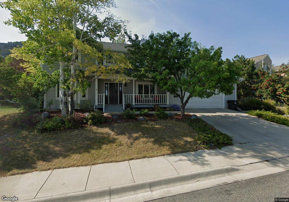
This home is located at 1941 University St, Helena, MT 59601 and is currently estimated at $649,865, approximately $257 per square foot. 1941 University St is a home located in Lewis and Clark County with nearby schools including Kessler Elementary School, C.R. Anderson Middle School, and Helena Christian Academy.
Ownership History
Date
Name
Owned For
Owner Type
Purchase Details
Closed on
Mar 16, 2012
Sold by
Mccrae Kevin W and Mclaughlin Bethany L
Bought by
Mcrae Kevin W and Mclaughlin Bethany L
Current Estimated Value
Home Financials for this Owner
Home Financials are based on the most recent Mortgage that was taken out on this home.
Original Mortgage
$163,400
Interest Rate
3.84%
Mortgage Type
New Conventional
Purchase Details
Closed on
Jan 11, 2011
Sold by
Keech Bonny J
Bought by
Bock Alan and Hampton Greg
Create a Home Valuation Report for This Property
The Home Valuation Report is an in-depth analysis detailing your home's value as well as a comparison with similar homes in the area
Home Values in the Area
Average Home Value in this Area
Purchase History
| Date | Buyer | Sale Price | Title Company |
|---|---|---|---|
| Mcrae Kevin W | -- | First Mt Title Co Of Helena | |
| Bock Alan | $134,744 | None Available |
Source: Public Records
Mortgage History
| Date | Status | Borrower | Loan Amount |
|---|---|---|---|
| Closed | Mcrae Kevin W | $163,400 |
Source: Public Records
Tax History Compared to Growth
Tax History
| Year | Tax Paid | Tax Assessment Tax Assessment Total Assessment is a certain percentage of the fair market value that is determined by local assessors to be the total taxable value of land and additions on the property. | Land | Improvement |
|---|---|---|---|---|
| 2025 | $4,500 | $714,200 | $0 | $0 |
| 2024 | $5,427 | $569,100 | $0 | $0 |
| 2023 | $5,984 | $569,100 | $0 | $0 |
| 2022 | $4,869 | $388,400 | $0 | $0 |
| 2021 | $4,292 | $388,400 | $0 | $0 |
| 2020 | $4,792 | $373,500 | $0 | $0 |
| 2019 | $4,799 | $373,500 | $0 | $0 |
| 2018 | $4,306 | $333,200 | $0 | $0 |
| 2017 | $3,312 | $333,200 | $0 | $0 |
| 2016 | $3,900 | $336,100 | $0 | $0 |
| 2015 | $3,365 | $336,100 | $0 | $0 |
| 2014 | $2,952 | $160,855 | $0 | $0 |
Source: Public Records
Map
Nearby Homes
- 801 Joslyn St
- 2025 Stuart St
- NHN Highview Way
- 860 Hiawatha St
- 2211 Hauser Blvd
- 2213 Hauser Blvd
- 2215 Hauser Blvd
- 2217 Hauser Blvd
- 1922 Knight St
- 1931 Choteau St
- 1450 Mount Helena Dr
- Lots 29 & 30 Knight St
- 1801 Cannon St
- 1601 Choteau St
- 1160 Laurel St
- 1624 Cannon St Unit 35
- 1624 Cannon St Unit 26
- 1624 Cannon St Unit 25
- 1616 Cannon St Unit 17
- 1610 Cannon St Unit 4
- 508 Linden Ct
- 504 Linden Ct
- 1940 University St
- 1944 University St
- 1825 University St
- 509 Linden Ct
- 1948 University St
- 1953 University St
- 536 Linden Ct
- 625 Linden St
- 411 Foothill Ct
- 1952 University St
- 1823 University St
- 405 Foothill Ct
- 1830 Le Grande Cannon Blvd
- 1957 University St
- 401 Foothill Ct
- TBD Foothill Ct
- 413 Foothill Ct
- 1835 Flowerree St