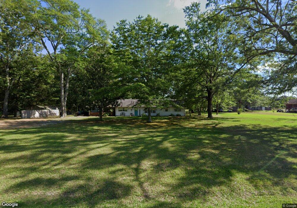
19410 Highway 50 W Cedarbluff, MS 39741
Estimated Value: $123,763 - $302,000
3
Beds
--
Bath
1,796
Sq Ft
$110/Sq Ft
Est. Value
About This Home
This home is located at 19410 Highway 50 W, Cedarbluff, MS 39741 and is currently estimated at $197,921, approximately $110 per square foot. 19410 Highway 50 W is a home with nearby schools including East Side Elementary School, West Clay Elementary School, and Church Hill Elementary School.
Ownership History
Date
Name
Owned For
Owner Type
Purchase Details
Closed on
Dec 17, 2020
Sold by
Davis David Eugene and Davis Betty T
Bought by
Gray Les and Gray Wanda Jean
Current Estimated Value
Home Financials for this Owner
Home Financials are based on the most recent Mortgage that was taken out on this home.
Original Mortgage
$85,500
Outstanding Balance
$76,121
Interest Rate
2.7%
Mortgage Type
Unknown
Estimated Equity
$121,801
Purchase Details
Closed on
Oct 15, 2019
Sold by
Davis Betty T
Bought by
Davis David Eugene and Davis Betty T
Create a Home Valuation Report for This Property
The Home Valuation Report is an in-depth analysis detailing your home's value as well as a comparison with similar homes in the area
Purchase History
| Date | Buyer | Sale Price | Title Company |
|---|---|---|---|
| Gray Les | -- | -- | |
| Gray Les | -- | None Listed On Document | |
| Davis David Eugene | -- | -- | |
| Davis David Eugene | -- | -- |
Source: Public Records
Mortgage History
| Date | Status | Borrower | Loan Amount |
|---|---|---|---|
| Open | Gray Les | $85,500 | |
| Closed | Gray Les | $85,500 |
Source: Public Records
Tax History Compared to Growth
Tax History
| Year | Tax Paid | Tax Assessment Tax Assessment Total Assessment is a certain percentage of the fair market value that is determined by local assessors to be the total taxable value of land and additions on the property. | Land | Improvement |
|---|---|---|---|---|
| 2024 | $481 | $7,885 | $827 | $7,058 |
| 2023 | $481 | $6,565 | $827 | $5,738 |
| 2022 | $231 | $6,565 | $827 | $5,738 |
| 2021 | $229 | $6,565 | $827 | $5,738 |
| 2020 | $533 | $9,642 | $1,035 | $8,607 |
| 2019 | $0 | $6,376 | $690 | $5,686 |
| 2018 | $0 | $6,376 | $690 | $5,686 |
| 2017 | $0 | $6,376 | $690 | $5,686 |
| 2016 | -- | $6,376 | $690 | $5,686 |
| 2015 | -- | $5,931 | $690 | $5,241 |
| 2014 | -- | $5,931 | $690 | $5,241 |
| 2013 | -- | $8,896 | $1,035 | $7,861 |
Source: Public Records
Map
Nearby Homes
- 001 Mississippi 46
- 18832 Mississippi 50
- 20810 Mississippi 50
- Hwy 47 Unit LotWP001
- 145 Pollard Ln
- Highway 50
- Hwy 46
- 67 Lone Oak Cir
- 222 Lone Oak Park
- 593 Lone Oak Park
- 222 Wyman Dr
- 593 Lone Oak Dr
- 165 William Huffman Rd
- 1674 Gin House Rd
- 171 Fagan Blvd
- 201 Quail Ridge Rd
- 399 Lone Oak Dr
- 10007 Speed Bottom Rd
- 1142 Waddell Rd
- 49 Barksdale Dr
- 269 Trulove Loop
- 2087 Obrian Dr
- 19353 Highway 50 W
- 19320 Highway 50 W
- 185 Trulove Loop
- 121 Trulove Loop
- 19627 Highway 50 W
- 19111 Highway 50 W
- 19688 Highway 50 W
- 985 Old Highway 10
- 855 Old Highway 10
- 807 Old Highway 10
- 19033 Highway 50 W
- 19904 Highway 50 W
- 1411 Old Highway 10
- 716 Highway 46
- 407 Old Highway 10
- 1825 Mhoon Valley Rd
- 309 Old Highway 10
- 18642 Highway 50 W