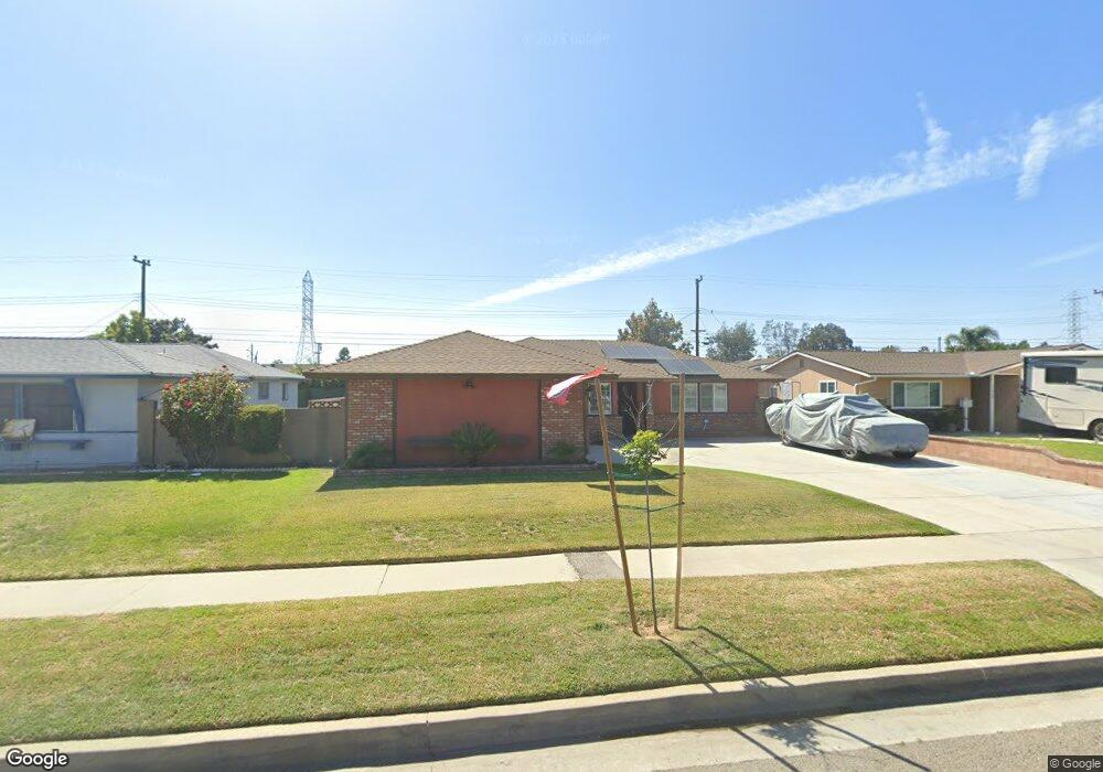
19415 Reinhart Ave Carson, CA 90746
Estimated Value: $785,191 - $860,000
4
Beds
2
Baths
1,400
Sq Ft
$589/Sq Ft
Est. Value
About This Home
This home is located at 19415 Reinhart Ave, Carson, CA 90746 and is currently estimated at $824,298, approximately $588 per square foot. 19415 Reinhart Ave is a home located in Los Angeles County with nearby schools including Leapwood Avenue Elementary School, Glenn Hammond Curtiss Middle School, and Rancho Dominguez Preparatory School.
Ownership History
Date
Name
Owned For
Owner Type
Purchase Details
Closed on
Aug 23, 2014
Sold by
Brown Jeffery E and Brown Omelia A
Bought by
J & O Brown Family Trust
Current Estimated Value
Purchase Details
Closed on
Jan 25, 1995
Sold by
Che Alexander and Cruz Violet Charrington
Bought by
Brown Jeffery E and Brown Omelia A
Home Financials for this Owner
Home Financials are based on the most recent Mortgage that was taken out on this home.
Original Mortgage
$117,000
Interest Rate
9.28%
Create a Home Valuation Report for This Property
The Home Valuation Report is an in-depth analysis detailing your home's value as well as a comparison with similar homes in the area
Home Values in the Area
Average Home Value in this Area
Purchase History
| Date | Buyer | Sale Price | Title Company |
|---|---|---|---|
| J & O Brown Family Trust | -- | None Available | |
| Brown Jeffery E | $130,000 | Fidelity National Title |
Source: Public Records
Mortgage History
| Date | Status | Borrower | Loan Amount |
|---|---|---|---|
| Closed | Brown Jeffery E | $117,000 |
Source: Public Records
Tax History Compared to Growth
Tax History
| Year | Tax Paid | Tax Assessment Tax Assessment Total Assessment is a certain percentage of the fair market value that is determined by local assessors to be the total taxable value of land and additions on the property. | Land | Improvement |
|---|---|---|---|---|
| 2025 | $4,136 | $280,480 | $184,755 | $95,725 |
| 2024 | $4,136 | $274,982 | $181,133 | $93,849 |
| 2023 | $4,051 | $269,591 | $177,582 | $92,009 |
| 2022 | $3,856 | $264,305 | $174,100 | $90,205 |
| 2021 | $3,805 | $259,124 | $170,687 | $88,437 |
| 2019 | $3,661 | $251,440 | $165,625 | $85,815 |
| 2018 | $3,550 | $246,511 | $162,378 | $84,133 |
| 2016 | $3,396 | $236,941 | $156,074 | $80,867 |
| 2015 | $3,323 | $233,383 | $153,730 | $79,653 |
| 2014 | $3,315 | $228,812 | $150,719 | $78,093 |
Source: Public Records
Map
Nearby Homes
- 19327 Galway Ave
- 664 E Elsmere Dr
- 19717 Alonda Dr
- 19202 Campaign Dr
- 19603 Enslow Dr
- 19617 Enslow Dr
- 879 E Turmont St
- 19415 Fariman Dr
- 18813 Crocker Ave
- 19302 Fariman Dr
- 19426 Belshaw Ave
- 956 E Gladwick St
- 962 E Gladwick St
- 18329 Towne Ave
- 20203 Tillman Ave
- 17700 Avalon Blvd Unit 54
- 17700 Avalon Blvd Unit 387
- 17700 Avalon Blvd Unit 40
- 18223 Milmore Ave
- 18106 Coltman Ave
- 19421 Reinhart Ave
- 19409 Reinhart Ave
- 19410 Dunbrooke Ave
- 19418 Dunbrooke Ave
- 19503 Reinhart Ave
- 19402 Dunbrooke Ave
- 19403 Reinhart Ave
- 19424 Dunbrooke Ave
- 19416 Reinhart Ave
- 19410 Reinhart Ave
- 19334 Dunbrooke Ave
- 19422 Reinhart Ave
- 19509 Reinhart Ave
- 19327 Reinhart Ave
- 19404 Reinhart Ave
- 19504 Dunbrooke Ave
- 19502 Reinhart Ave
- 19328 Dunbrooke Ave
- 19328 Reinhart Ave
- 19321 Reinhart Ave