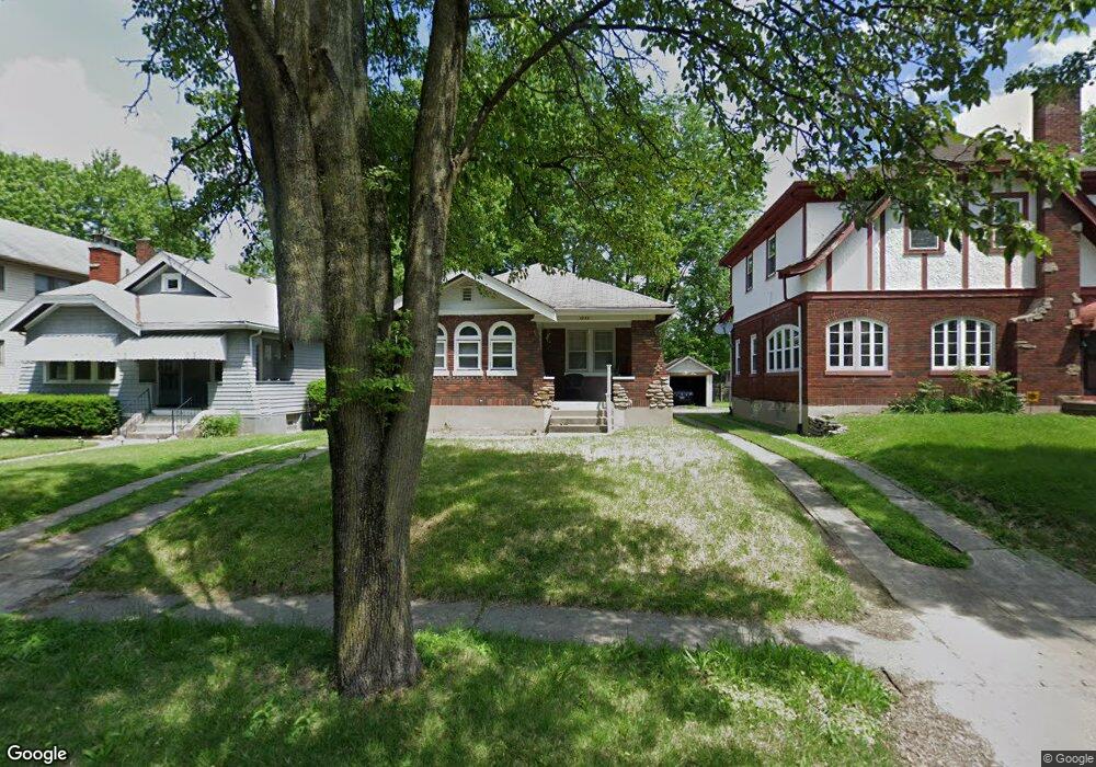
1942 Avonlea Ave Cincinnati, OH 45237
Bond Hill NeighborhoodEstimated Value: $150,083 - $180,000
2
Beds
1
Bath
990
Sq Ft
$168/Sq Ft
Est. Value
About This Home
This home is located at 1942 Avonlea Ave, Cincinnati, OH 45237 and is currently estimated at $166,271, approximately $167 per square foot. 1942 Avonlea Ave is a home located in Hamilton County with nearby schools including Bond Hill Academy Elementary School, Shroder High School, and Clark Montessori High School.
Ownership History
Date
Name
Owned For
Owner Type
Purchase Details
Closed on
Dec 21, 2017
Sold by
Foster Joel
Bought by
Smith Angela D and Smith Kenneth J
Current Estimated Value
Purchase Details
Closed on
Oct 18, 2011
Sold by
Estate Of Dorothy Foster
Bought by
Foster Joel
Create a Home Valuation Report for This Property
The Home Valuation Report is an in-depth analysis detailing your home's value as well as a comparison with similar homes in the area
Home Values in the Area
Average Home Value in this Area
Purchase History
| Date | Buyer | Sale Price | Title Company |
|---|---|---|---|
| Smith Angela D | $8,900 | None Available | |
| Foster Joel | -- | Attorney |
Source: Public Records
Tax History Compared to Growth
Tax History
| Year | Tax Paid | Tax Assessment Tax Assessment Total Assessment is a certain percentage of the fair market value that is determined by local assessors to be the total taxable value of land and additions on the property. | Land | Improvement |
|---|---|---|---|---|
| 2024 | $2,066 | $31,266 | $5,390 | $25,876 |
| 2023 | $2,018 | $31,266 | $5,390 | $25,876 |
| 2022 | $1,088 | $14,921 | $5,275 | $9,646 |
| 2021 | $1,067 | $14,921 | $5,275 | $9,646 |
| 2020 | $1,067 | $14,921 | $5,275 | $9,646 |
| 2019 | $1,095 | $13,944 | $4,928 | $9,016 |
| 2018 | $1,096 | $13,944 | $4,928 | $9,016 |
| 2017 | $1,054 | $13,944 | $4,928 | $9,016 |
| 2016 | $1,146 | $14,819 | $5,481 | $9,338 |
| 2015 | $1,027 | $14,819 | $5,481 | $9,338 |
| 2014 | $1,030 | $14,819 | $5,481 | $9,338 |
| 2013 | $1,173 | $16,653 | $6,160 | $10,493 |
Source: Public Records
Map
Nearby Homes
- 1943 Northcut Ave
- 1946 Berkley Ave
- 5314 Section Ave
- 1843 Northcutt Ave
- 1906 Andina Ave
- 5334 Warren Ave
- 5252 Warren Ave
- 1832 Catalina Ave
- 1810 Berkley Ave
- 5328 Rolston Ave
- 1801 Northcut Ave
- 5209 Rhode Island Ave
- 1940 Dalewood Place
- 1855 Dalewood Place
- 5343 Hunter Ave
- 5508 Warren Ave
- 1870 Dalewood Place
- 1751 Andina Ave
- 5601 Warren Ave
- 5209 Warren Ave
- 1946 Avonlea Ave
- 1938 Avonlea Ave
- 1950 Avonlea Ave
- 1934 Avonlea Ave
- 1954 Avonlea Ave
- 1930 Avonlea Ave
- 1947 Northcut Ave
- 1939 Northcut Ave
- 1958 Avonlea Ave
- 1926 Avonlea Ave
- 1951 Northcut Ave
- 1933 Northcut Ave
- 1955 Northcut Ave
- 1931 Northcut Ave
- 1943 Avonlea Ave
- 1947 Avonlea Ave
- 1939 Avonlea Ave
- 1962 Avonlea Ave
- 1922 Avonlea Ave
- 1951 Avonlea Ave