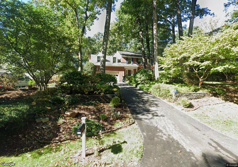
1942 Barton Hill Rd Reston, VA 20191
Estimated Value: $979,000 - $1,098,248
5
Beds
4
Baths
2,528
Sq Ft
$412/Sq Ft
Est. Value
About This Home
This home is located at 1942 Barton Hill Rd, Reston, VA 20191 and is currently estimated at $1,042,062, approximately $412 per square foot. 1942 Barton Hill Rd is a home located in Fairfax County with nearby schools including Sunrise Valley Elementary, Langston Hughes Middle School, and South Lakes High School.
Ownership History
Date
Name
Owned For
Owner Type
Purchase Details
Closed on
Apr 28, 1994
Sold by
Planty Donald J
Bought by
Orr Edward A
Current Estimated Value
Home Financials for this Owner
Home Financials are based on the most recent Mortgage that was taken out on this home.
Original Mortgage
$185,000
Interest Rate
7.7%
Create a Home Valuation Report for This Property
The Home Valuation Report is an in-depth analysis detailing your home's value as well as a comparison with similar homes in the area
Home Values in the Area
Average Home Value in this Area
Purchase History
| Date | Buyer | Sale Price | Title Company |
|---|---|---|---|
| Orr Edward A | $305,000 | -- |
Source: Public Records
Mortgage History
| Date | Status | Borrower | Loan Amount |
|---|---|---|---|
| Closed | Orr Edward A | $185,000 |
Source: Public Records
Tax History
| Year | Tax Paid | Tax Assessment Tax Assessment Total Assessment is a certain percentage of the fair market value that is determined by local assessors to be the total taxable value of land and additions on the property. | Land | Improvement |
|---|---|---|---|---|
| 2025 | $11,437 | $1,025,030 | $365,000 | $660,030 |
| 2024 | $11,437 | $948,770 | $340,000 | $608,770 |
| 2023 | $10,040 | $854,110 | $320,000 | $534,110 |
| 2022 | $9,800 | $823,190 | $320,000 | $503,190 |
| 2021 | $9,803 | $803,190 | $300,000 | $503,190 |
| 2020 | $9,453 | $768,190 | $265,000 | $503,190 |
| 2019 | $9,587 | $779,090 | $265,000 | $514,090 |
| 2018 | $8,395 | $729,990 | $245,000 | $484,990 |
| 2017 | $8,418 | $696,860 | $226,000 | $470,860 |
| 2016 | $9,140 | $758,180 | $235,000 | $523,180 |
Source: Public Records
Map
Nearby Homes
- 10921 Harpers Square Ct
- 1951 Sagewood Ln Unit 619
- 11117 Little Compton Dr
- 11144 Beaver Trail Ct Unit 11144
- 11116 Beaver Trail Ct Unit 11116
- 11262 Harbor Ct Unit 11262
- 1953 Lakeport Way
- 1933 Lakeport Way
- 10929 Howland Dr
- 1840 Post Oak Trail
- 10900 Hunter Station Rd
- 2148 Whisperwood Glen Ln
- 2114 Whisperwood Glen Ln
- 2201 Nobehar Dr
- 2006 Headlands Cir
- 10900 Sunset Hills Rd
- 1870 Easterly Rd
- 11236 Faraday Park Dr
- 11308 Geddys Ct
- 1738 Dressage Dr
- 1944 Barton Hill Rd
- 1940 Barton Hill Rd
- 1938 Barton Hill Rd
- 1946 Barton Hill Rd
- 11978 Sentinel Point Ct
- 11976 Sentinel Point Ct
- 11974 Sentinel Point Ct
- 11972 Sentinel Point Ct
- 11035 Solaridge Dr
- 11970 Sentinel Point Ct
- 11968 Sentinel Point Ct
- 11037 Solaridge Dr
- 11966 Sentinel Point Ct
- 1941 Barton Hill Rd
- 1943 Barton Hill Rd
- 11964 Sentinel Point Ct
- 1936 Barton Hill Rd
- 1939 Barton Hill Rd
- 11033 Solaridge Dr
- 11962 Sentinel Point Ct
Your Personal Tour Guide
Ask me questions while you tour the home.