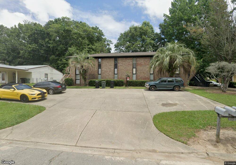
1942 Darryl Dr Unit D Tallahassee, FL 32301
Old Saint Augustine NeighborhoodEstimated Value: $112,000 - $149,000
2
Beds
2
Baths
1,225
Sq Ft
$103/Sq Ft
Est. Value
About This Home
This home is located at 1942 Darryl Dr Unit D, Tallahassee, FL 32301 and is currently estimated at $125,580, approximately $102 per square foot. 1942 Darryl Dr Unit D is a home located in Leon County with nearby schools including Apalachee Elementary School, Fairview Middle School, and James Rickards High School.
Ownership History
Date
Name
Owned For
Owner Type
Purchase Details
Closed on
Jun 6, 2023
Sold by
Lozano Penny Ann
Bought by
Pal Tallahassee Real Estate Llc
Current Estimated Value
Purchase Details
Closed on
Aug 31, 2007
Sold by
Etheridge Jay and Etheridge Stacey
Bought by
Falgas Penny
Home Financials for this Owner
Home Financials are based on the most recent Mortgage that was taken out on this home.
Original Mortgage
$83,250
Interest Rate
6.5%
Mortgage Type
Purchase Money Mortgage
Create a Home Valuation Report for This Property
The Home Valuation Report is an in-depth analysis detailing your home's value as well as a comparison with similar homes in the area
Home Values in the Area
Average Home Value in this Area
Purchase History
| Date | Buyer | Sale Price | Title Company |
|---|---|---|---|
| Pal Tallahassee Real Estate Llc | $100 | None Listed On Document | |
| Pal Tallahassee Real Estate Llc | $100 | None Listed On Document | |
| Falgas Penny | $92,500 | Mercury Title Company |
Source: Public Records
Mortgage History
| Date | Status | Borrower | Loan Amount |
|---|---|---|---|
| Previous Owner | Falgas Penny | $83,250 |
Source: Public Records
Tax History Compared to Growth
Tax History
| Year | Tax Paid | Tax Assessment Tax Assessment Total Assessment is a certain percentage of the fair market value that is determined by local assessors to be the total taxable value of land and additions on the property. | Land | Improvement |
|---|---|---|---|---|
| 2024 | $1,308 | $68,000 | -- | $68,000 |
| 2023 | $1,161 | $60,000 | $0 | $60,000 |
| 2022 | $1,052 | $56,000 | $0 | $56,000 |
| 2021 | $1,037 | $54,000 | $0 | $54,000 |
| 2020 | $993 | $52,500 | $0 | $52,500 |
| 2019 | $984 | $51,500 | $0 | $51,500 |
| 2018 | $955 | $49,500 | $0 | $49,500 |
| 2017 | $937 | $48,000 | $0 | $0 |
| 2016 | $950 | $48,000 | $0 | $0 |
| 2015 | $957 | $48,000 | $0 | $0 |
| 2014 | $957 | $48,000 | $0 | $0 |
Source: Public Records
Map
Nearby Homes
- 1924 Darryl Dr Unit A
- 1861 Larette Dr Unit B
- 1515 Jacks Dr
- 1575 Paul Russell Rd Unit 2704
- 1575 Paul Russell Rd Unit 1401
- 1529 Live Oak Dr Unit A
- 1515 Paul Russell Rd Unit 64
- 1515 Paul Russell Rd Unit 12
- 1640 Willow Bend Way
- 2897 Blairstone Ct Unit 7
- 3036 Blair Stone Ct
- 3104 Oak Hammock Ln Unit U
- 3146 Oak Hammock Ln
- 1362 Castelnau Ct Unit 3-C
- 2014 Midyette Rd Unit 108
- 1616 Kay Ave
- 1363 Castelnau Ct Unit A
- 1558 Three Lantern Ln
- 1427 Stevenson Dr
- 1315 N Paul Russell Rd Unit E4
- 1942 Darryl Dr Unit C
- 1942 Darryl Dr
- 1942 Darryl Dr Unit B
- 1942 Darryl Dr Unit A
- 1924 Darryl Dr Unit A&B
- 1924 Darryl Dr Unit 2
- 1924 Darryl Dr Unit B
- 1924 Darryl Dr Unit B
- 2/2 Darryl Dr 850sf
- 2/2 Darryl Dr 1300sf
- 1578 Jacks Dr Unit B
- 1578 Jacks Dr Unit D
- 1578 Jacks Dr
- 1578 Jacks Dr
- 1578 Jacks Dr Unit A
- 1578 Jacks Dr
- 1583 Jacks Dr Unit B
- 1583 Jacks Dr Unit A
- 1583 Jacks Dr
- 1583 Jacks Dr