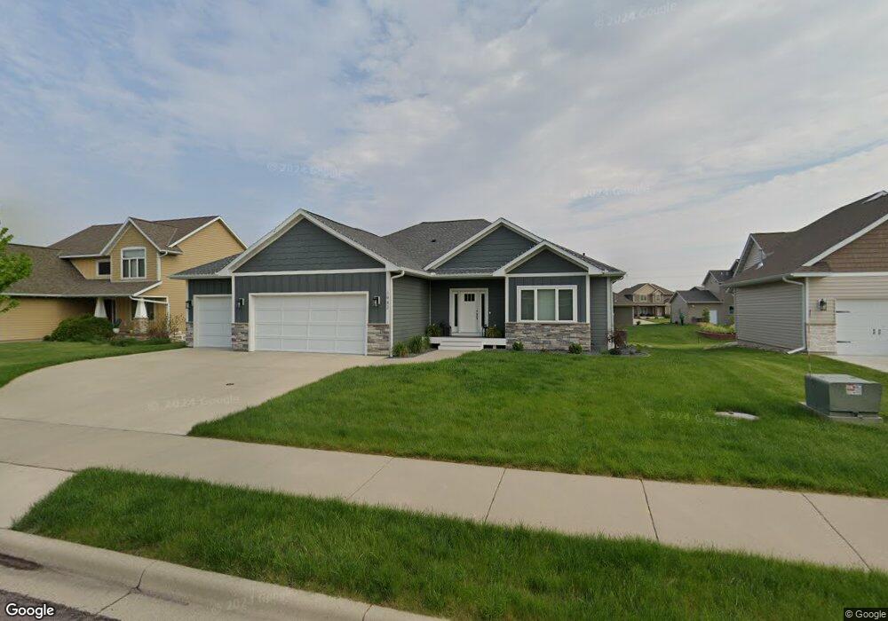
1942 Sheridan Ct North Mankato, MN 56003
Estimated Value: $521,006 - $595,000
5
Beds
3
Baths
1,688
Sq Ft
$332/Sq Ft
Est. Value
About This Home
This home is located at 1942 Sheridan Ct, North Mankato, MN 56003 and is currently estimated at $560,002, approximately $331 per square foot. 1942 Sheridan Ct is a home with nearby schools including Monroe Elementary School, Dakota Meadows Middle School, and Mankato West Senior High School.
Ownership History
Date
Name
Owned For
Owner Type
Purchase Details
Closed on
Dec 14, 2017
Bought by
Torkelson Jared Jared and Torkelson Jennie Jennie
Current Estimated Value
Home Financials for this Owner
Home Financials are based on the most recent Mortgage that was taken out on this home.
Original Mortgage
$350,775
Outstanding Balance
$295,016
Interest Rate
3.9%
Mortgage Type
New Conventional
Estimated Equity
$264,986
Purchase Details
Closed on
May 19, 2017
Home Financials for this Owner
Home Financials are based on the most recent Mortgage that was taken out on this home.
Original Mortgage
$305,932
Interest Rate
4.1%
Mortgage Type
Construction
Purchase Details
Closed on
Jul 30, 2009
Sold by
Hiniker Steven J and Hiniker Julie A
Bought by
Kws Llc
Create a Home Valuation Report for This Property
The Home Valuation Report is an in-depth analysis detailing your home's value as well as a comparison with similar homes in the area
Home Values in the Area
Average Home Value in this Area
Purchase History
| Date | Buyer | Sale Price | Title Company |
|---|---|---|---|
| Torkelson Jared Jared | $371,100 | -- | |
| Torkelson Jared L | $371,091 | Tradmark Title | |
| -- | $50,900 | -- | |
| Snyder Brothers Rentals Llc | $50,900 | Trademark Title | |
| Kws Llc | $441,200 | -- |
Source: Public Records
Mortgage History
| Date | Status | Borrower | Loan Amount |
|---|---|---|---|
| Open | Torkelson Jared L | $350,775 | |
| Closed | Torkelson Jared Jared | $341,492 | |
| Previous Owner | Snyder Brothers Rentals Llc | $305,932 |
Source: Public Records
Tax History Compared to Growth
Tax History
| Year | Tax Paid | Tax Assessment Tax Assessment Total Assessment is a certain percentage of the fair market value that is determined by local assessors to be the total taxable value of land and additions on the property. | Land | Improvement |
|---|---|---|---|---|
| 2025 | $6,380 | $502,300 | $65,800 | $436,500 |
| 2024 | $6,142 | $502,300 | $65,800 | $436,500 |
| 2023 | $6,122 | $475,800 | $65,800 | $410,000 |
| 2022 | $5,834 | $473,200 | $65,800 | $407,400 |
| 2021 | $5,802 | $404,800 | $52,600 | $352,200 |
| 2020 | $5,484 | $390,100 | $52,600 | $337,500 |
| 2019 | $4,558 | $376,500 | $52,600 | $323,900 |
| 2018 | $820 | $315,500 | $52,600 | $262,900 |
| 2017 | -- | $44,700 | $0 | $0 |
| 2016 | $4,634 | $0 | $0 | $0 |
| 2015 | -- | $0 | $0 | $0 |
| 2011 | -- | $0 | $0 | $0 |
Source: Public Records
Map
Nearby Homes
- 1977 Lexington Ln
- 1973 Lexington Ln
- 1965 Lexington Ln
- 1961 Lexington Ln
- 19 Prairie Ct
- 51671 Lor Ray Dr
- 22 Sunset Ct
- 1993 Lexington Ln
- 2262 Fairbanks Dr
- 2224 Fairbanks Dr
- 2257 Fairbanks Dr
- 2210 Anchorage Dr
- 2206 Anchorage Dr
- 2200 Anchorage Dr
- 2203 Rolling Green Ln
- 38388 512th St
- 87 Benson Trail
- 26 Legacy Ct
- 14 Legacy Ct
- 2155 Rolling Green Ln
- 1938 Sheridan Ct
- 1938 Sheridan Ct Unit 1938 Sheridan Court
- 1946 Sheridan Ct
- 1937 1937 Lexington Ln
- 1937 Lexington Ln
- 1934 Sheridan Ct
- 1941 Lexington Ln
- 1939 Sheridan Ct
- 1929 1929 Lexington Ln
- 1935 Sheridan Ct
- 1929 Lexington Ln
- 1943 Sheridan Ct
- 1931 Sheridan Ct
- 1931 Sheridan Ct Unit 1931 Sheridan Court
- 1930 Sheridan Ct
- 11 Danbury Ct
- 1925 Lexington Ln
- 1940 Lexington Ln
- 1936 Lexington Ln
- 1927 Sheridan Ct