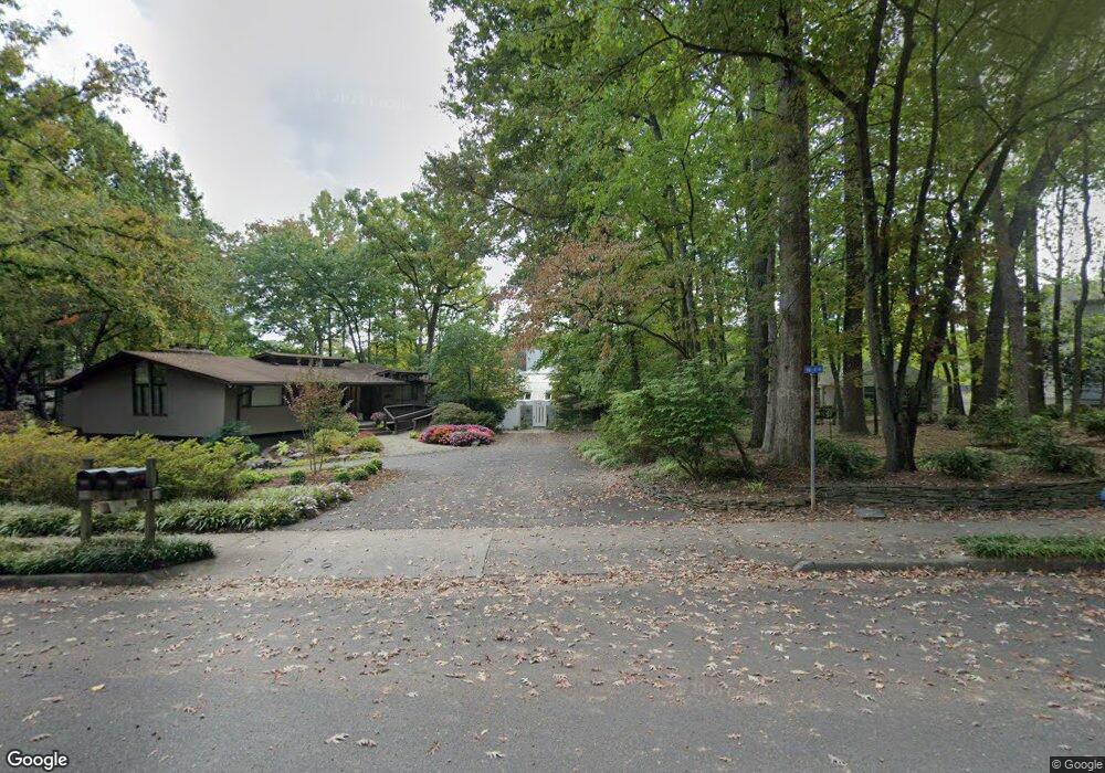
1942 Upper Lake Dr Reston, VA 20191
Estimated Value: $1,896,000 - $2,273,000
4
Beds
3
Baths
3,326
Sq Ft
$604/Sq Ft
Est. Value
About This Home
This home is located at 1942 Upper Lake Dr, Reston, VA 20191 and is currently estimated at $2,007,746, approximately $603 per square foot. 1942 Upper Lake Dr is a home located in Fairfax County with nearby schools including Sunrise Valley Elementary, Langston Hughes Middle School, and South Lakes High School.
Ownership History
Date
Name
Owned For
Owner Type
Purchase Details
Closed on
Aug 1, 2012
Sold by
Hering Joseph F
Bought by
Mccarty Bruce
Current Estimated Value
Home Financials for this Owner
Home Financials are based on the most recent Mortgage that was taken out on this home.
Original Mortgage
$625,000
Outstanding Balance
$433,581
Interest Rate
3.7%
Mortgage Type
New Conventional
Estimated Equity
$1,574,165
Purchase Details
Closed on
Jul 13, 2000
Sold by
Katz Warren
Bought by
Hering Joseph F
Home Financials for this Owner
Home Financials are based on the most recent Mortgage that was taken out on this home.
Original Mortgage
$525,000
Interest Rate
8.5%
Purchase Details
Closed on
Sep 23, 1999
Sold by
Wrenn Associates Ltd
Bought by
Katz Warren
Create a Home Valuation Report for This Property
The Home Valuation Report is an in-depth analysis detailing your home's value as well as a comparison with similar homes in the area
Home Values in the Area
Average Home Value in this Area
Purchase History
| Date | Buyer | Sale Price | Title Company |
|---|---|---|---|
| Mccarty Bruce | $1,375,000 | -- | |
| Hering Joseph F | $850,000 | -- | |
| Katz Warren | $118,880 | -- |
Source: Public Records
Mortgage History
| Date | Status | Borrower | Loan Amount |
|---|---|---|---|
| Open | Mccarty Bruce | $625,000 | |
| Previous Owner | Hering Joseph F | $525,000 |
Source: Public Records
Tax History
| Year | Tax Paid | Tax Assessment Tax Assessment Total Assessment is a certain percentage of the fair market value that is determined by local assessors to be the total taxable value of land and additions on the property. | Land | Improvement |
|---|---|---|---|---|
| 2025 | $18,404 | $1,834,280 | $942,000 | $892,280 |
| 2024 | $18,404 | $1,526,630 | $764,000 | $762,630 |
| 2023 | $17,006 | $1,446,680 | $764,000 | $682,680 |
| 2022 | $16,543 | $1,446,680 | $764,000 | $682,680 |
| 2021 | $14,317 | $1,173,030 | $695,000 | $478,030 |
| 2020 | $13,696 | $1,113,030 | $635,000 | $478,030 |
| 2019 | $13,854 | $1,125,880 | $635,000 | $490,880 |
| 2018 | $12,112 | $1,053,250 | $572,000 | $481,250 |
| 2017 | $12,723 | $1,053,250 | $572,000 | $481,250 |
| 2016 | $13,527 | $1,122,130 | $626,000 | $496,130 |
Source: Public Records
Map
Nearby Homes
- 2009 Headlands Cir
- 2006 Headlands Cir
- 11240 Harbor Ct Unit 11240
- 1953 Lakeport Way
- 1926 Lakeport Way
- 11123 Lakespray Way
- 11117 Little Compton Dr
- 1951 Sagewood Ln Unit 619
- 11236 Faraday Park Dr
- 2118 Owls Cove Ln
- 11168 Beaver Trail Ct
- 1878 Easterly Rd
- 11142 Beaver Trail Ct
- 11144 Beaver Trail Ct Unit 11144
- 11116 Beaver Trail Ct Unit 11116
- 11566 Rolling Green Ct Unit 12/200A
- 11564 Rolling Green Ct Unit 12/301B
- 11226 Beaker St
- 11200 Reston Station Blvd Unit 208
- 2000 Homer Terrace
- 1940 Upper Lake Dr
- 1944 Upper Lake Dr
- 1938 Upper Lake Dr
- 1946 Upper Lake Dr
- 2002 Halyard Ln
- 2004 Halyard Ln
- 1936 Upper Lake Dr
- 2000 Halyard Ln
- 1945 Upper Lake Dr
- 1947 Upper Lake Dr
- 1935 Upper Lake Dr
- 2006 Halyard Ln
- 1934 Upper Lake Dr
- 1939 Upper Lake Dr
- 1949 Upper Lake Dr
- 1937 Upper Lake Dr
- 1933 Upper Lake Dr
- 2001 Upper Lake Dr
- 2009 Halyard Ln
- 2001 Halyard Ln
Your Personal Tour Guide
Ask me questions while you tour the home.