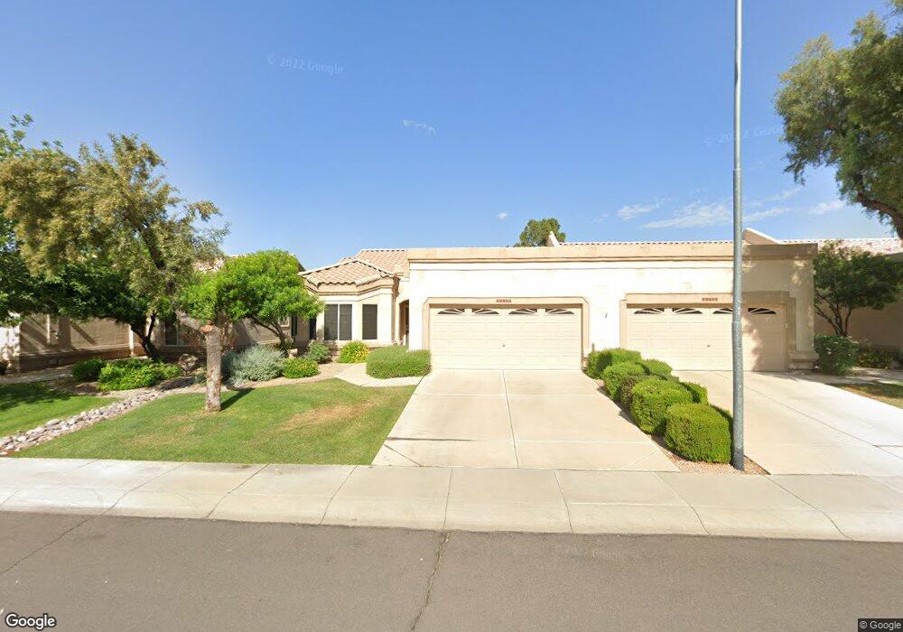
19422 N 85th Dr Peoria, AZ 85382
Estimated Value: $411,008 - $449,000
2
Beds
2
Baths
1,464
Sq Ft
$293/Sq Ft
Est. Value
About This Home
This home is located at 19422 N 85th Dr, Peoria, AZ 85382 and is currently estimated at $428,252, approximately $292 per square foot. 19422 N 85th Dr is a home located in Maricopa County with nearby schools including Apache Elementary School, Sunrise Mountain High School, and Guidepost Montessori at Peoria.
Ownership History
Date
Name
Owned For
Owner Type
Purchase Details
Closed on
Nov 21, 2002
Sold by
Renaud Doreen
Bought by
Clifford Edward A and Clifford Patricia A
Current Estimated Value
Home Financials for this Owner
Home Financials are based on the most recent Mortgage that was taken out on this home.
Original Mortgage
$121,000
Outstanding Balance
$46,381
Interest Rate
4.87%
Mortgage Type
Purchase Money Mortgage
Estimated Equity
$381,871
Purchase Details
Closed on
May 1, 2000
Sold by
Renaud Doreen
Bought by
Renaud Doreen
Purchase Details
Closed on
Jul 10, 1998
Sold by
First American Title Insurance Company
Bought by
Renaud Doreen
Home Financials for this Owner
Home Financials are based on the most recent Mortgage that was taken out on this home.
Original Mortgage
$125,600
Interest Rate
7%
Mortgage Type
New Conventional
Create a Home Valuation Report for This Property
The Home Valuation Report is an in-depth analysis detailing your home's value as well as a comparison with similar homes in the area
Home Values in the Area
Average Home Value in this Area
Purchase History
| Date | Buyer | Sale Price | Title Company |
|---|---|---|---|
| Clifford Edward A | $174,000 | Chicago Title Insurance Co | |
| Renaud Doreen | -- | -- | |
| Renaud Doreen | $157,040 | First American Title |
Source: Public Records
Mortgage History
| Date | Status | Borrower | Loan Amount |
|---|---|---|---|
| Open | Clifford Edward A | $121,000 | |
| Previous Owner | Renaud Doreen | $125,600 |
Source: Public Records
Tax History Compared to Growth
Tax History
| Year | Tax Paid | Tax Assessment Tax Assessment Total Assessment is a certain percentage of the fair market value that is determined by local assessors to be the total taxable value of land and additions on the property. | Land | Improvement |
|---|---|---|---|---|
| 2025 | $2,370 | $29,141 | -- | -- |
| 2024 | $2,698 | $27,753 | -- | -- |
| 2023 | $2,698 | $32,550 | $6,510 | $26,040 |
| 2022 | $2,645 | $26,020 | $5,200 | $20,820 |
| 2021 | $2,768 | $24,600 | $4,920 | $19,680 |
| 2020 | $2,786 | $22,910 | $4,580 | $18,330 |
| 2019 | $2,703 | $22,400 | $4,480 | $17,920 |
| 2018 | $2,612 | $20,710 | $4,140 | $16,570 |
| 2017 | $2,706 | $20,480 | $4,090 | $16,390 |
| 2016 | $2,686 | $19,980 | $3,990 | $15,990 |
| 2015 | $2,529 | $20,310 | $4,060 | $16,250 |
Source: Public Records
Map
Nearby Homes
- 8390 W Oraibi Dr
- 19791 N 86th Dr
- 8444 W Behrend Dr
- 19405 N 83rd Dr
- 19720 N 83rd Dr
- 8701 W Behrend Dr
- 8502 W Kimberly Way
- 8623 W Escuda Dr
- 8546 W Wescott Dr
- 19830 N 84th Ave
- 8333 W Wescott Dr
- 8402 W Rosemonte Dr
- 19491 N 88th Ave
- 19070 N 88th Ave
- 8314 W Escuda Dr
- 8306 W Escuda Dr
- 8823 W Rimrock Dr
- 18830 N 83rd Ln
- 8839 W Rimrock Dr
- 18729 N 84th Dr
- 19424 N 85th Dr
- 19420 N 85th Dr
- 19426 N 85th Dr
- 19428 N 85th Dr
- 19416 N 85th Dr
- 8512 W Oraibi Dr
- 19430 N 85th Dr
- 19425 N 85th Dr
- 19414 N 85th Dr
- 8510 W Oraibi Dr
- 19427 N 85th Dr
- 19432 N 85th Dr
- 8508 W Oraibi Dr
- 19412 N 85th Dr
- 19429 N 85th Dr
- 19410 N 85th Dr
- 8506 W Oraibi Dr
- 19434 N 85th Dr
- 8513 W Oraibi Dr
- 8511 W Oraibi Dr