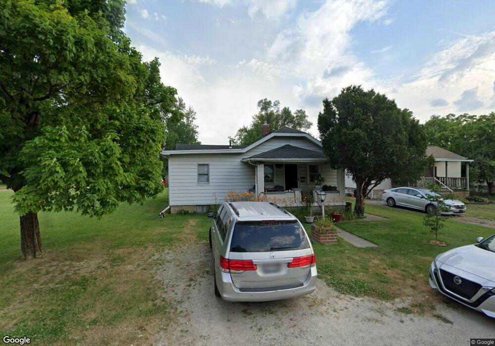
1943 Dunbar Dr Unit O Columbus, OH 43224
North Linden NeighborhoodEstimated Value: $172,000 - $205,383
3
Beds
2
Baths
1,020
Sq Ft
$186/Sq Ft
Est. Value
About This Home
This home is located at 1943 Dunbar Dr Unit O, Columbus, OH 43224 and is currently estimated at $189,846, approximately $186 per square foot. 1943 Dunbar Dr Unit O is a home located in Franklin County with nearby schools including Huy Elementary School, Medina Middle School, and Mifflin High School.
Ownership History
Date
Name
Owned For
Owner Type
Purchase Details
Closed on
Feb 29, 2000
Sold by
Lindish David V and Lindish Mildred M
Bought by
Halves Griffin D
Current Estimated Value
Home Financials for this Owner
Home Financials are based on the most recent Mortgage that was taken out on this home.
Original Mortgage
$65,951
Outstanding Balance
$22,319
Interest Rate
8.27%
Mortgage Type
FHA
Estimated Equity
$167,527
Purchase Details
Closed on
Nov 16, 1981
Bought by
Lindish David
Create a Home Valuation Report for This Property
The Home Valuation Report is an in-depth analysis detailing your home's value as well as a comparison with similar homes in the area
Home Values in the Area
Average Home Value in this Area
Purchase History
| Date | Buyer | Sale Price | Title Company |
|---|---|---|---|
| Halves Griffin D | $71,000 | -- | |
| Lindish David | $43,000 | -- |
Source: Public Records
Mortgage History
| Date | Status | Borrower | Loan Amount |
|---|---|---|---|
| Open | Halves Griffin D | $65,951 |
Source: Public Records
Tax History Compared to Growth
Tax History
| Year | Tax Paid | Tax Assessment Tax Assessment Total Assessment is a certain percentage of the fair market value that is determined by local assessors to be the total taxable value of land and additions on the property. | Land | Improvement |
|---|---|---|---|---|
| 2024 | $2,907 | $50,330 | $15,120 | $35,210 |
| 2023 | $2,876 | $50,330 | $15,120 | $35,210 |
| 2022 | $2,065 | $28,350 | $12,250 | $16,100 |
| 2021 | $2,068 | $28,350 | $12,250 | $16,100 |
| 2020 | $2,070 | $28,350 | $12,250 | $16,100 |
| 2019 | $1,743 | $22,090 | $9,800 | $12,290 |
| 2018 | $1,694 | $22,090 | $9,800 | $12,290 |
| 2017 | $1,814 | $22,090 | $9,800 | $12,290 |
| 2016 | $1,887 | $21,640 | $5,220 | $16,420 |
| 2015 | $1,647 | $21,640 | $5,220 | $16,420 |
| 2014 | $1,649 | $21,640 | $5,220 | $16,420 |
| 2013 | $899 | $24,010 | $5,775 | $18,235 |
Source: Public Records
Map
Nearby Homes
- 1980 Oakland Park Ave
- 1888 E North Broadway St
- 1944 E North Broadway St
- 1841 E North Broadway St
- 3049 Cleveland Ave
- 1940 Eddystone Ave
- 1812 Audrey Rd
- 3137 Westerville Rd Unit 44
- 3137 Westerville Rd Unit 91
- 1794 Audrey Rd
- 1711 Piedmont Rd
- 1729 Huy Rd
- 2076 Agler Rd
- 3005 Kenlawn St
- 1671 E Brighton Rd
- 3086 Bremen St
- 1853 E Lakeview Ave
- 2771 Fern Ave
- 2765 Joyce Ave
- 3058 Dresden St
- 1943 Dunbar Dr
- 1939 Dunbar Dr
- 1967 Dunbar Dr
- 1929 Dunbar Dr
- 0 Oakland Park Ave
- 0 Oakland Park Ave
- 1969 Dunbar Dr
- 0 Oakland Park Ave
- 1885 Dunbar Dr
- 1932 Dunbar Dr
- 1971 Dunbar Dr
- 1938 Oakland Park Ave
- 1930 Dunbar Dr
- 1966 Dunbar Dr
- 1879 Dunbar Dr
- 1880 Dunbar Dr
- 1975 Dunbar Dr
- 1975 Dunbar Dr Unit 1982
- 1975 Dunbar Dr Unit C
- 1975 Dunbar Dr Unit E