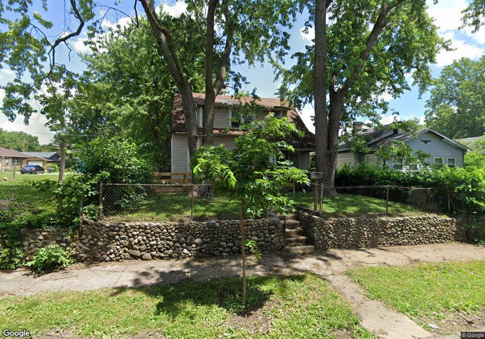
1943 N Lasalle St Indianapolis, IN 46218
Near Eastside NeighborhoodEstimated Value: $95,000 - $129,000
2
Beds
--
Bath
1,520
Sq Ft
$73/Sq Ft
Est. Value
About This Home
This home is located at 1943 N Lasalle St, Indianapolis, IN 46218 and is currently estimated at $110,656, approximately $72 per square foot. 1943 N Lasalle St is a home located in Marion County with nearby schools including Thomas D. Gregg School No. 15, Washington Irving School 14, and Brookside School 54.
Ownership History
Date
Name
Owned For
Owner Type
Purchase Details
Closed on
Jun 22, 2021
Sold by
Claspell Harold
Bought by
Dodson Donald and Dodson Debra
Current Estimated Value
Purchase Details
Closed on
Jun 16, 2021
Sold by
Claspell Harold
Bought by
Dodson Donald and Dodson Debra
Purchase Details
Closed on
Sep 13, 2014
Sold by
Claspell Tonya
Bought by
Claspell Harold
Purchase Details
Closed on
Sep 14, 2007
Sold by
Claspell Harold D and Claspell Bonnie S
Bought by
Claspell Tonya
Create a Home Valuation Report for This Property
The Home Valuation Report is an in-depth analysis detailing your home's value as well as a comparison with similar homes in the area
Home Values in the Area
Average Home Value in this Area
Purchase History
| Date | Buyer | Sale Price | Title Company |
|---|---|---|---|
| Dodson Donald | -- | None Available | |
| Dodson Donald | -- | None Listed On Document | |
| Claspell Harold | -- | None Available | |
| Claspell Tonya | -- | None Available |
Source: Public Records
Tax History Compared to Growth
Tax History
| Year | Tax Paid | Tax Assessment Tax Assessment Total Assessment is a certain percentage of the fair market value that is determined by local assessors to be the total taxable value of land and additions on the property. | Land | Improvement |
|---|---|---|---|---|
| 2024 | $206 | $79,200 | $6,500 | $72,700 |
| 2023 | $206 | $72,900 | $6,500 | $66,400 |
| 2022 | $232 | $71,100 | $6,500 | $64,600 |
| 2021 | $114 | $54,200 | $6,500 | $47,700 |
| 2020 | $1,031 | $41,700 | $2,600 | $39,100 |
| 2019 | $1,013 | $40,200 | $2,600 | $37,600 |
| 2018 | $854 | $33,200 | $2,600 | $30,600 |
| 2017 | $750 | $32,400 | $2,600 | $29,800 |
| 2016 | $753 | $33,300 | $2,600 | $30,700 |
| 2014 | $694 | $32,100 | $2,600 | $29,500 |
| 2013 | $667 | $32,100 | $2,600 | $29,500 |
Source: Public Records
Map
Nearby Homes
- 2030 Houston St
- 3208 Brookside Parkway Dr N
- 1938 N Dearborn St
- 2049 Houston St
- 2921 E Brookside Ave
- 2934 E Brookside Ave
- 2924 E 18th St
- 2822 E 19th St
- 1835 N Rural St
- 1534 N Lasalle St
- 2729 Massachusetts Ave
- 1505 N Dearborn St
- 2646 E 18th St
- 3601 Brookside Parkway Dr S
- 2309 N Dearborn St
- 2626 E Brookside Ave
- 2820 E 16th St
- 2624 E 18th St
- 2612 Brookway St
- 2621 Brookway St
- 1945 N Lasalle St
- 1947 N Lasalle St
- 1929 N Lasalle St
- 1949 N Lasalle St
- 1942 Houston St
- 1938 Houston St
- 1999 N Lasalle St
- 1946 Houston St
- 1925 N Lasalle St
- 1934 Houston St
- 1950 Houston St
- 3315 E 20th St
- 1942 N Lasalle St
- 1940 N Lasalle St
- 1946 N Lasalle St
- 1928 Houston St
- 1930 N Lasalle St
- 1921 N Lasalle St
- 1934 N Lasalle St
- 1952 N Lasalle St