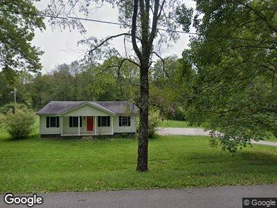
1943 Paint Creek Rd Stanton, KY 40380
Estimated Value: $173,000 - $208,748
3
Beds
2
Baths
1,100
Sq Ft
$171/Sq Ft
Est. Value
About This Home
This home is located at 1943 Paint Creek Rd, Stanton, KY 40380 and is currently estimated at $188,187, approximately $171 per square foot. 1943 Paint Creek Rd is a home located in Powell County with nearby schools including Powell County High School.
Ownership History
Date
Name
Owned For
Owner Type
Purchase Details
Closed on
Jun 26, 2023
Sold by
Blythe Sarah J
Bought by
Chomicki Colt and Chomicki Jessica
Current Estimated Value
Purchase Details
Closed on
Dec 21, 2022
Sold by
Gillispie Jason and Gillispie Lisa
Bought by
Blythe Sarah J
Home Financials for this Owner
Home Financials are based on the most recent Mortgage that was taken out on this home.
Original Mortgage
$155,628
Interest Rate
6.33%
Mortgage Type
FHA
Purchase Details
Closed on
Dec 15, 2013
Sold by
Secretary Of Veterans Affairs
Bought by
Gillispie Jason
Purchase Details
Closed on
Nov 7, 2012
Sold by
Faulkner Justin D
Bought by
Secreatary Of Veterans Affairs
Create a Home Valuation Report for This Property
The Home Valuation Report is an in-depth analysis detailing your home's value as well as a comparison with similar homes in the area
Home Values in the Area
Average Home Value in this Area
Purchase History
| Date | Buyer | Sale Price | Title Company |
|---|---|---|---|
| Chomicki Colt | $176,000 | Bluegrass Land Title | |
| Blythe Sarah J | $158,500 | -- | |
| Gillispie Jason | $49,300 | Metro Title Llc | |
| Secreatary Of Veterans Affairs | $40,000 | None Available |
Source: Public Records
Mortgage History
| Date | Status | Borrower | Loan Amount |
|---|---|---|---|
| Previous Owner | Blythe Sarah J | $155,628 | |
| Previous Owner | Gillispie Jason | $36,936 | |
| Previous Owner | Gillispie Jason | $40,000 | |
| Previous Owner | Gillispie Jason R | $30,000 | |
| Previous Owner | Faulkner Justin D | $84,784 |
Source: Public Records
Tax History Compared to Growth
Tax History
| Year | Tax Paid | Tax Assessment Tax Assessment Total Assessment is a certain percentage of the fair market value that is determined by local assessors to be the total taxable value of land and additions on the property. | Land | Improvement |
|---|---|---|---|---|
| 2024 | $1,593 | $176,000 | $0 | $0 |
| 2023 | $1,449 | $158,500 | $0 | $0 |
| 2022 | $745 | $83,000 | $0 | $0 |
| 2021 | $736 | $83,000 | $0 | $0 |
| 2020 | $742 | $83,000 | $0 | $0 |
| 2019 | $681 | $83,000 | $0 | $0 |
| 2018 | $673 | $83,000 | $0 | $0 |
| 2017 | $647 | $83,000 | $0 | $0 |
| 2016 | -- | $83,000 | $0 | $0 |
| 2015 | -- | $83,000 | $0 | $0 |
| 2013 | -- | $83,000 | $0 | $0 |
| 2012 | -- | $83,000 | $0 | $0 |
Source: Public Records
Map
Nearby Homes
- 44 Hummingbird Ln
- 11 Courtney Ln
- 94 Pearl St
- 175 N Bend Rd
- 11 and 13 Miller Dr
- 843 Breckenridge St
- 10 W Church St
- 740 N Main St
- 527 N Main St
- 229 Strange St
- 167 Strange St
- 80 Westview Dr
- 1680 Lower Hatcher Creek Rd
- 977 Lower Hatcher Creek Rd
- 95 2nd Ave
- 248 3rd Ave
- 39 Meadow Dr
- 95 Wild Turkey
- 69 College Ct
- 90 Teasley Rd