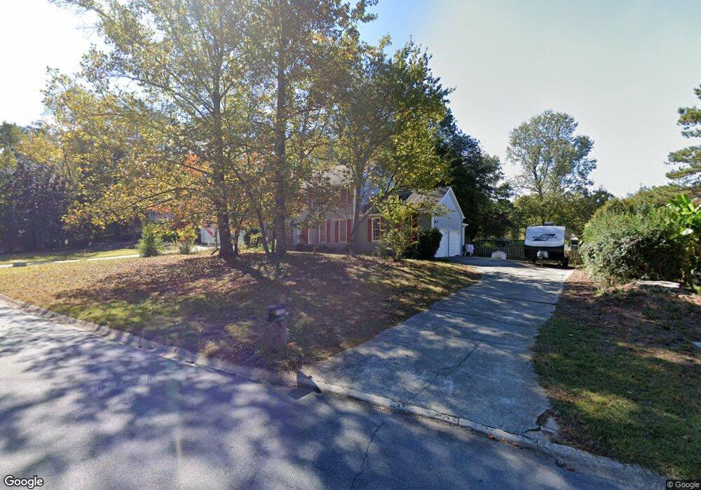
1943 Windcrest Dr SW Unit 4 Lilburn, GA 30047
Estimated Value: $402,000 - $438,000
4
Beds
3
Baths
2,536
Sq Ft
$164/Sq Ft
Est. Value
About This Home
This home is located at 1943 Windcrest Dr SW Unit 4, Lilburn, GA 30047 and is currently estimated at $417,095, approximately $164 per square foot. 1943 Windcrest Dr SW Unit 4 is a home located in Gwinnett County with nearby schools including Head Elementary School, Five Forks Middle School, and Brookwood High School.
Ownership History
Date
Name
Owned For
Owner Type
Purchase Details
Closed on
Sep 5, 2003
Sold by
Sacco Paul E and Sacco Miriam W
Bought by
Armstrong Ursula and Armstrong Mark
Current Estimated Value
Home Financials for this Owner
Home Financials are based on the most recent Mortgage that was taken out on this home.
Original Mortgage
$151,200
Outstanding Balance
$69,439
Interest Rate
6.33%
Mortgage Type
Stand Alone Second
Estimated Equity
$347,656
Purchase Details
Closed on
Jul 27, 1995
Sold by
Syen Stuart Dorie B
Bought by
Cacco Paul E
Create a Home Valuation Report for This Property
The Home Valuation Report is an in-depth analysis detailing your home's value as well as a comparison with similar homes in the area
Home Values in the Area
Average Home Value in this Area
Purchase History
| Date | Buyer | Sale Price | Title Company |
|---|---|---|---|
| Armstrong Ursula | $168,000 | -- | |
| Cacco Paul E | $135,000 | -- |
Source: Public Records
Mortgage History
| Date | Status | Borrower | Loan Amount |
|---|---|---|---|
| Open | Armstrong Ursula | $151,200 | |
| Closed | Cacco Paul E | $0 |
Source: Public Records
Tax History Compared to Growth
Tax History
| Year | Tax Paid | Tax Assessment Tax Assessment Total Assessment is a certain percentage of the fair market value that is determined by local assessors to be the total taxable value of land and additions on the property. | Land | Improvement |
|---|---|---|---|---|
| 2025 | $4,325 | $160,480 | $30,000 | $130,480 |
| 2024 | $4,231 | $149,400 | $30,000 | $119,400 |
| 2023 | $4,231 | $147,720 | $26,400 | $121,320 |
| 2022 | $3,975 | $135,320 | $26,400 | $108,920 |
| 2021 | $3,166 | $93,880 | $16,800 | $77,080 |
| 2020 | $2,779 | $75,000 | $14,800 | $60,200 |
| 2019 | $2,689 | $75,000 | $14,800 | $60,200 |
| 2018 | $2,689 | $75,000 | $14,800 | $60,200 |
| 2016 | $2,357 | $64,120 | $14,800 | $49,320 |
| 2015 | $2,042 | $54,502 | $9,520 | $44,982 |
| 2014 | -- | $64,120 | $11,200 | $52,920 |
Source: Public Records
Map
Nearby Homes
- 3868 Buckland Dr SW
- 3725 Hunting Ridge Dr SW
- 1725 Spindle Top Ct SW
- 1905 Embassy Walk Ln
- 1776 Bear Cave SW
- 4000 Embassy Way
- 1640 Killian Hill Rd SW
- 1732 Beauregard Dr SW
- 4353 Pond Edge Rd
- 4107 Signal Ridge SW
- 3728 Kelin Ct SW
- 1535 Pathfinder Way SW Unit 1
- 3663 Stonelake Ct SW Unit 1
- 4268 Rocky Ledge Way
- 2047 Cliffton Terrace
- 4166 Signal Ridge SW
- 5380 Glade Park Dr
- 5370 Glade Park Dr
- 5340 Glade Park Dr
- 5330 Glade Park Dr
- 5350 Glade Park Dr
- 5360 Glade Park Dr
- 5320 Glade Park Dr
- 5220 Glade Park Dr
- 5210 Glade Park Dr
- 1873 Windcrest Dr SW
- 1903 Windcrest Dr SW
- 1944 Windcrest Dr SW
- 1944 Windcrest Dr SW
- 1863 Windcrest Dr SW
- 1934 Windcrest Dr SW
- 1954 Windcrest Dr SW
- 1924 Windcrest Dr SW
- 1853 Windcrest Dr SW
- 1963 Windcrest Dr SW
- 1884 Windcrest Dr SW Unit 4