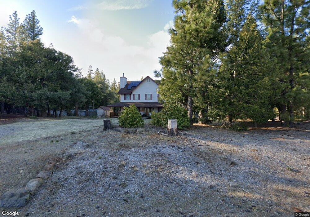
19435 Deerwood Dr Volcano, CA 95689
Estimated Value: $529,881 - $618,000
4
Beds
2
Baths
3,200
Sq Ft
$175/Sq Ft
Est. Value
About This Home
This home is located at 19435 Deerwood Dr, Volcano, CA 95689 and is currently estimated at $559,960, approximately $174 per square foot. 19435 Deerwood Dr is a home located in Amador County with nearby schools including Sutter Creek Elementary School, Ione Junior High School, and Amador High School.
Ownership History
Date
Name
Owned For
Owner Type
Purchase Details
Closed on
Apr 26, 2022
Sold by
Perez Frederick V and Perez Cynthia M
Bought by
Perez Living Trust
Current Estimated Value
Purchase Details
Closed on
Nov 8, 2012
Sold by
Department Of Veterans Affairs
Bought by
Perez Frederick V and Perez Cynthia M
Home Financials for this Owner
Home Financials are based on the most recent Mortgage that was taken out on this home.
Original Mortgage
$120,000
Interest Rate
3.35%
Mortgage Type
New Conventional
Create a Home Valuation Report for This Property
The Home Valuation Report is an in-depth analysis detailing your home's value as well as a comparison with similar homes in the area
Purchase History
| Date | Buyer | Sale Price | Title Company |
|---|---|---|---|
| Perez Living Trust | -- | Temmerman Cilley & Kohlmann Ll | |
| Perez Frederick V | -- | Pasion Title Services |
Source: Public Records
Mortgage History
| Date | Status | Borrower | Loan Amount |
|---|---|---|---|
| Previous Owner | Perez Frederick V | $120,000 |
Source: Public Records
Tax History
| Year | Tax Paid | Tax Assessment Tax Assessment Total Assessment is a certain percentage of the fair market value that is determined by local assessors to be the total taxable value of land and additions on the property. | Land | Improvement |
|---|---|---|---|---|
| 2025 | $4,735 | $477,326 | $96,326 | $381,000 |
| 2024 | $4,735 | $467,968 | $94,438 | $373,530 |
| 2023 | $4,642 | $458,793 | $92,587 | $366,206 |
| 2022 | $4,556 | $449,798 | $90,772 | $359,026 |
| 2021 | $4,468 | $440,980 | $88,993 | $351,987 |
| 2020 | $4,425 | $436,459 | $88,081 | $348,378 |
| 2019 | $4,338 | $427,902 | $86,354 | $341,548 |
| 2018 | $4,255 | $419,512 | $84,661 | $334,851 |
| 2017 | $3,803 | $374,816 | $83,001 | $291,815 |
| 2016 | $3,729 | $367,468 | $81,374 | $286,094 |
| 2015 | $3,676 | $361,949 | $80,152 | $281,797 |
| 2014 | $3,603 | $354,859 | $78,582 | $276,277 |
Source: Public Records
Map
Nearby Homes
- 24200 Golden Ridge Dr
- 19740 Ponderosa Dr
- 23781 Golden Ridge Dr
- 25150 Overland Dr
- 25251 Canterbury Rd
- 0 Canterbury Unit 226003993
- 19015 Pine Dr E
- 19396 Ponderosa Dr
- 25624 Sherwood Dr
- 0 Gold Creek Trail Unit 226022005
- 25661 Blaze Ct
- 18748 Lancelot Ln
- 26340 Cedar Ave
- 25215 Sugar Pine Dr
- 17900 Mira Vista Ct
- 25783 Sugar Pine Dr
- 26476 Spring Rd
- 22400 Clute Canyon Rd
- 26005 Sugar Pine Dr
- 25492 E Meadow Dr
- 19414 Deerwood Dr
- 19485 Deerwood Dr
- 19405 Deerwood Dr
- 19464 Deerwood Dr
- 19464 Cherokee Ln
- 19474 Deerwood Dr
- 19501 Deerwood Dr
- 19434 Cherokee Ln
- 19500 Deerwood Dr
- 19531 Deerwood Dr
- 19374 Cherokee Ln
- 19500 Cherokee Ln
- 19484 Deerwood Dr
- 19530 Cherokee Ln
- 19538 Deerwood Dr
- 19541 Deerwood Dr
- 19889 Ponderosa Dr
- 19821 Ponderosa Dr
- 19405 Cherokee Ln
- 19901 Ponderosa Dr
Your Personal Tour Guide
Ask me questions while you tour the home.