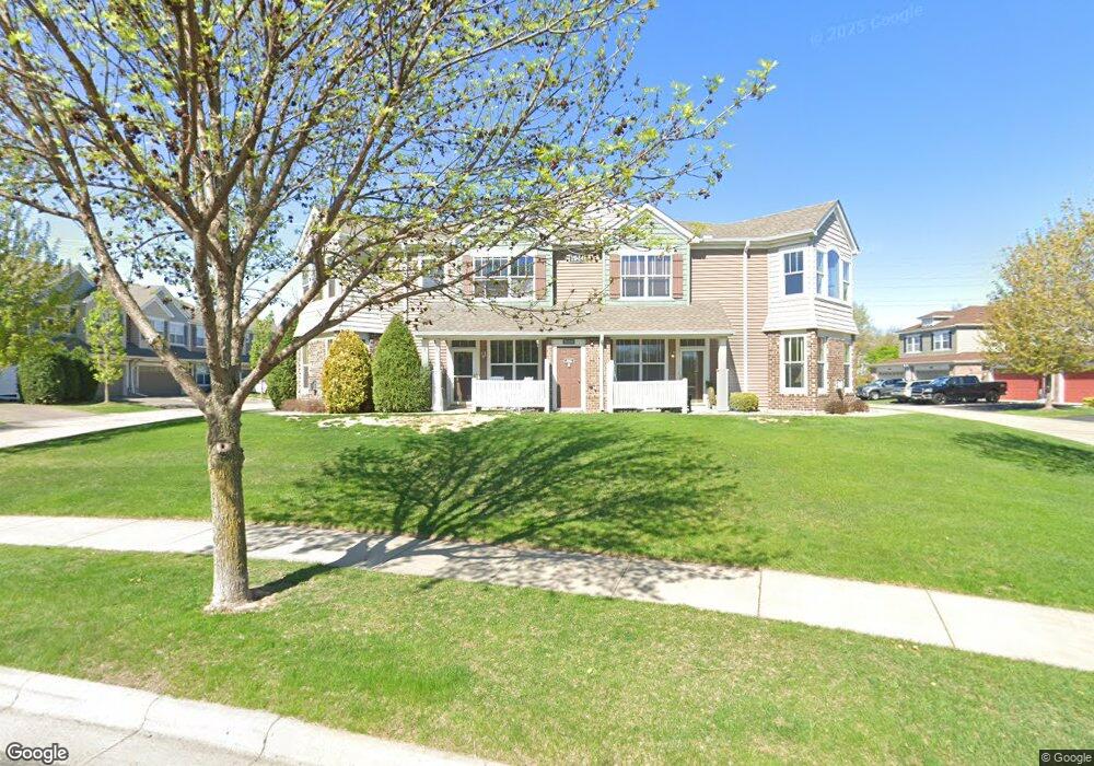
1944 Commonwealth Blvd Chanhassen, MN 55317
Estimated Value: $347,000 - $365,000
3
Beds
3
Baths
1,828
Sq Ft
$194/Sq Ft
Est. Value
About This Home
This home is located at 1944 Commonwealth Blvd, Chanhassen, MN 55317 and is currently estimated at $354,820, approximately $194 per square foot. 1944 Commonwealth Blvd is a home located in Carver County with nearby schools including Bluff Creek Elementary, Chaska Middle School West, and Chanhassen High School.
Ownership History
Date
Name
Owned For
Owner Type
Purchase Details
Closed on
Apr 16, 2020
Sold by
Neuroth Michael Michael
Bought by
Kumar Sarma Pankaj Pankaj
Current Estimated Value
Home Financials for this Owner
Home Financials are based on the most recent Mortgage that was taken out on this home.
Interest Rate
3.31%
Purchase Details
Closed on
Aug 16, 2011
Sold by
Federal National Mortgage Association
Bought by
Neuroth Michael J
Purchase Details
Closed on
Dec 27, 2007
Sold by
K Hovnanian Homes
Bought by
Kerber Tama M
Create a Home Valuation Report for This Property
The Home Valuation Report is an in-depth analysis detailing your home's value as well as a comparison with similar homes in the area
Home Values in the Area
Average Home Value in this Area
Purchase History
| Date | Buyer | Sale Price | Title Company |
|---|---|---|---|
| Kumar Sarma Pankaj Pankaj | $276,200 | -- | |
| Neuroth Michael J | $157,500 | -- | |
| Kerber Tama M | $248,630 | -- |
Source: Public Records
Mortgage History
| Date | Status | Borrower | Loan Amount |
|---|---|---|---|
| Closed | Kumar Sarma Pankaj Pankaj | -- |
Source: Public Records
Tax History Compared to Growth
Tax History
| Year | Tax Paid | Tax Assessment Tax Assessment Total Assessment is a certain percentage of the fair market value that is determined by local assessors to be the total taxable value of land and additions on the property. | Land | Improvement |
|---|---|---|---|---|
| 2025 | $3,498 | $347,700 | $86,300 | $261,400 |
| 2024 | $3,360 | $336,200 | $74,800 | $261,400 |
| 2023 | $3,294 | $325,400 | $74,800 | $250,600 |
| 2022 | $3,278 | $321,900 | $69,600 | $252,300 |
| 2021 | $2,892 | $264,200 | $58,000 | $206,200 |
| 2020 | $3,014 | $268,100 | $58,000 | $210,100 |
| 2019 | $2,914 | $249,500 | $55,300 | $194,200 |
| 2018 | $2,704 | $249,500 | $55,300 | $194,200 |
| 2017 | $2,640 | $227,800 | $52,600 | $175,200 |
| 2016 | $2,554 | $182,500 | $0 | $0 |
| 2015 | $2,312 | $182,500 | $0 | $0 |
| 2014 | $2,312 | $153,600 | $0 | $0 |
Source: Public Records
Map
Nearby Homes
- 1944 Commonwealth Blvd Unit 3
- 1952 Commonwealth Blvd Unit 8
- 1949 Commonwealth Blvd Unit 2
- 1953 Commonwealth Blvd Unit 3
- 9450 Washington Cir
- 3003 Ironwood Blvd
- 2997 Ironwood Blvd
- Sinclair Plan at Reserve at Autumn Woods - Landmark Collection
- Washburn Plan at Reserve at Autumn Woods - Landmark Collection
- Lewis Plan at Reserve at Autumn Woods - Landmark Collection
- Clearwater Plan at Reserve at Autumn Woods - Landmark Collection
- Itasca Plan at Reserve at Autumn Woods - Landmark Collection
- Snelling Plan at Reserve at Autumn Woods - Landmark Collection
- 9523 Declaration Dr
- 9580 Madison Dr Unit 4
- 9534 Roosevelt Dr
- 3015 Sugar Maple Dr
- 9525 Roosevelt Dr
- 3019 Sugar Maple Dr
- 2906 Butternut Dr
- 1944 Commonwealth Blvd
- 1944 Commonwealth Blvd
- 1944 Commonwealth Blvd
- 1944 Commonwealth Blvd Unit 4
- 1944 Commonwealth Blvd Unit 2
- 1944 Commonwealth Blvd Unit 5
- 1944 Commonwealth Blvd Unit 1
- 1956 Lincoln Ln
- 1952 Lincoln Ln
- 1960 Lincoln Ln
- 1964 Lincoln Ln
- 1948 Lincoln Ln
- 1968 Lincoln Ln
- 1940 Lincoln Ln
- 1936 Lincoln Ln
- 1948 Commonwealth Blvd Unit 5
- 1948 Commonwealth Blvd
- 1948 Commonwealth Blvd
- 1948 Commonwealth Blvd
- 1948 Commonwealth Blvd