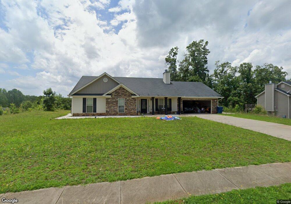
1944 Paynes Point Unit 38 Winder, GA 30680
Estimated Value: $371,072 - $392,000
3
Beds
3
Baths
2,150
Sq Ft
$177/Sq Ft
Est. Value
About This Home
This home is located at 1944 Paynes Point Unit 38, Winder, GA 30680 and is currently estimated at $380,518, approximately $176 per square foot. 1944 Paynes Point Unit 38 is a home located in Barrow County with nearby schools including Statham Elementary School, Bear Creek Middle School, and Winder-Barrow High School.
Ownership History
Date
Name
Owned For
Owner Type
Purchase Details
Closed on
Apr 27, 2015
Sold by
Southfork Homes Llc
Bought by
Soto Mariateresa and Soto Maria
Current Estimated Value
Home Financials for this Owner
Home Financials are based on the most recent Mortgage that was taken out on this home.
Original Mortgage
$142,857
Outstanding Balance
$109,377
Interest Rate
3.75%
Mortgage Type
FHA
Estimated Equity
$271,141
Purchase Details
Closed on
Nov 20, 2014
Sold by
Sugarloaf East Llc
Bought by
Southfork Homes Llc
Purchase Details
Closed on
Dec 22, 2010
Sold by
State Bank And Trust Co
Bought by
Sugarloaf East Llc
Purchase Details
Closed on
Dec 7, 2009
Sold by
Lcs Llc
Bought by
State Bank And Trust Co
Purchase Details
Closed on
Aug 2, 2006
Sold by
Reece Deborah P
Bought by
Lcs Llc
Create a Home Valuation Report for This Property
The Home Valuation Report is an in-depth analysis detailing your home's value as well as a comparison with similar homes in the area
Home Values in the Area
Average Home Value in this Area
Purchase History
| Date | Buyer | Sale Price | Title Company |
|---|---|---|---|
| Soto Mariateresa | $158,400 | -- | |
| Southfork Homes Llc | $108,000 | -- | |
| Sugarloaf East Llc | $3,700 | -- | |
| State Bank And Trust Co | -- | -- | |
| Lcs Llc | -- | -- |
Source: Public Records
Mortgage History
| Date | Status | Borrower | Loan Amount |
|---|---|---|---|
| Open | Soto Mariateresa | $142,857 |
Source: Public Records
Tax History
| Year | Tax Paid | Tax Assessment Tax Assessment Total Assessment is a certain percentage of the fair market value that is determined by local assessors to be the total taxable value of land and additions on the property. | Land | Improvement |
|---|---|---|---|---|
| 2025 | $1,759 | $129,030 | $19,200 | $109,830 |
| 2024 | $1,832 | $125,758 | $19,200 | $106,558 |
| 2023 | $1,435 | $126,158 | $19,200 | $106,958 |
| 2022 | $1,479 | $104,035 | $19,200 | $84,835 |
| 2021 | $1,135 | $88,958 | $19,200 | $69,758 |
| 2020 | $858 | $79,726 | $16,000 | $63,726 |
| 2019 | $895 | $79,726 | $16,000 | $63,726 |
| 2018 | $789 | $73,511 | $12,800 | $60,711 |
| 2017 | $2,025 | $69,539 | $16,000 | $53,539 |
| 2016 | $651 | $62,613 | $16,000 | $46,613 |
| 2015 | $233 | $7,680 | $7,680 | $0 |
| 2014 | $82 | $2,600 | $2,600 | $0 |
| 2013 | -- | $2,600 | $2,600 | $0 |
Source: Public Records
Map
Nearby Homes
- 1295 Double Bridges Rd
- 207 Cedar Grove Church Rd
- 113 Platte St
- 0
- 670 Cedar Grove Church Rd
- 1453 Solomon Dr
- 670 Cedar Grove Church Rd
- 16 Fox Dr
- 1264 Highway 211 NE
- 311 Anchors Way
- 315 Paige Way
- 233 Hunter Rd
- 3845 S Highway 82
- 142 Defilippe Dr
- 416 Corbin Ct
- 614 Anns Way
- 144 Briar Rose Blvd
- 123 Briar Rose Blvd
- 1553 Shoal Creek Dr
- 41 Lavender Rd
- 1944 Paynes Point
- 1946 Paynes Point Unit 39
- 1946 Paynes Point
- 1934 Paynes Point
- 1934 Paynes Point Unit 37
- 1934 Paynes Point
- 1937 Paynes Point Unit 75
- 1937 Paynes Point
- 1948 Paynes Point Unit 40
- 1948 Paynes Point
- 1932 Paynes Point Unit 36
- 1932 Paynes Point
- 1939 Paynes Point
- 1939 Paynes Point Unit 74
- 1935 Paynes Point Unit 76
- 1935 Paynes Point
- 1945 Paynes Point
- 1945 Paynes Point Unit 71
- 1943 Paynes Point Unit LOT 72
- 1943 Paynes Point
Your Personal Tour Guide
Ask me questions while you tour the home.