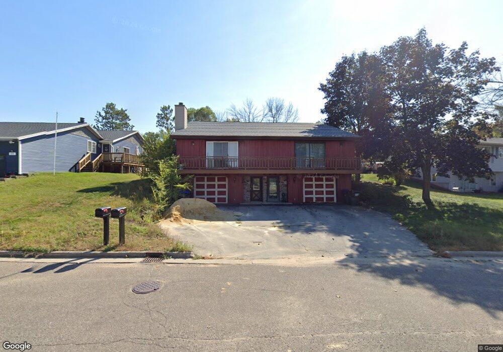
1944 Southland Ln Unit 1946 New London, WI 54961
Estimated Value: $248,493 - $295,000
--
Bed
--
Bath
--
Sq Ft
0.29
Acres
About This Home
This home is located at 1944 Southland Ln Unit 1946, New London, WI 54961 and is currently estimated at $273,123. 1944 Southland Ln Unit 1946 is a home located in Waupaca County with nearby schools including Parkview Elementary School, New London Middle School, and New London High School.
Ownership History
Date
Name
Owned For
Owner Type
Purchase Details
Closed on
Aug 6, 2020
Sold by
Ricker Jacob M
Bought by
Carelli Brian J
Current Estimated Value
Home Financials for this Owner
Home Financials are based on the most recent Mortgage that was taken out on this home.
Original Mortgage
$142,500
Outstanding Balance
$126,641
Interest Rate
3.1%
Mortgage Type
New Conventional
Estimated Equity
$146,482
Purchase Details
Closed on
May 8, 2020
Sold by
Lenzner Scott A
Bought by
Ricker Jacob M
Create a Home Valuation Report for This Property
The Home Valuation Report is an in-depth analysis detailing your home's value as well as a comparison with similar homes in the area
Home Values in the Area
Average Home Value in this Area
Purchase History
| Date | Buyer | Sale Price | Title Company |
|---|---|---|---|
| Carelli Brian J | $150,000 | None Available | |
| Ricker Jacob M | $110,000 | None Available |
Source: Public Records
Mortgage History
| Date | Status | Borrower | Loan Amount |
|---|---|---|---|
| Open | Carelli Brian J | $142,500 |
Source: Public Records
Tax History Compared to Growth
Tax History
| Year | Tax Paid | Tax Assessment Tax Assessment Total Assessment is a certain percentage of the fair market value that is determined by local assessors to be the total taxable value of land and additions on the property. | Land | Improvement |
|---|---|---|---|---|
| 2024 | $5,012 | $142,300 | $24,000 | $118,300 |
| 2023 | $5,012 | $142,300 | $24,000 | $118,300 |
| 2022 | $3,271 | $142,300 | $24,000 | $118,300 |
| 2021 | $3,341 | $142,300 | $24,000 | $118,300 |
| 2020 | $3,351 | $142,300 | $24,000 | $118,300 |
| 2019 | $3,315 | $142,300 | $24,000 | $118,300 |
| 2018 | $3,152 | $142,300 | $24,000 | $118,300 |
| 2017 | $5,401 | $142,300 | $24,000 | $118,300 |
| 2016 | $5,401 | $150,900 | $24,000 | $126,900 |
| 2015 | $3,560 | $150,900 | $24,000 | $126,900 |
| 2014 | $3,497 | $150,900 | $24,000 | $126,900 |
| 2013 | $3,583 | $150,900 | $24,000 | $126,900 |
Source: Public Records
Map
Nearby Homes
- 1931 Southland Ln
- 1930 Southland Ln
- 1835 Southland Ln
- 1801 Southland Ln
- 1605 Cedarhurst Dr
- 1802 Nassau St
- 610 W Pine St
- 102 E Cameron St
- 1975 Penny Ln
- 1010 Smith St
- 1420 Division St
- 903 Smith St
- 907 W Beacon Ave
- 1109 Algoma St
- 200 W Beacon Ave
- 408 Wallace St
- 514 E Pine St
- 0 Shawano St Unit 50295803
- 0 Shawano St Unit 50257475
- 803 W North Water St
- 204 Zacharey Ct
- 205 Zacharey Ct
- 2000 Southland Ln
- 1938 Southland Ln
- 2006 Southland Ln
- 2003 Southland Ln
- 1939 Southland Ln
- 2012 Southland Ln
- 2007 Southland Ln
- 2018 Southland Ln
- 1835 Walmer Ln
- 2011 Southland Ln Unit 2013
- 1829 Walmer Ln
- 2019 Southland Ln
- 2024 Southland Ln
- 1942 Pershing Rd
- 1095 W Beckert Rd Unit 100
- 1095 W Beckert Rd
- 1201 W Beckert Rd
- 2025 Southland Ln