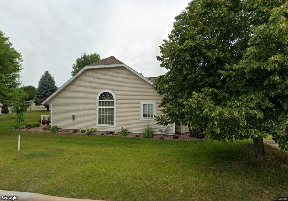
1944 Topaz Pointe Ln SW Rochester, MN 55902
Estimated Value: $337,000 - $383,000
2
Beds
2
Baths
1,749
Sq Ft
$207/Sq Ft
Est. Value
About This Home
This home is located at 1944 Topaz Pointe Ln SW, Rochester, MN 55902 and is currently estimated at $361,350, approximately $206 per square foot. 1944 Topaz Pointe Ln SW is a home located in Olmsted County with nearby schools including Bamber Valley Elementary School, John Adams Middle School, and Mayo Senior High School.
Ownership History
Date
Name
Owned For
Owner Type
Purchase Details
Closed on
Dec 11, 2020
Sold by
Bartlett Judith
Bought by
Bartlett Judith L and Judith L Bartlett Living Trust
Current Estimated Value
Purchase Details
Closed on
Sep 28, 2020
Sold by
Papenfuss Inger Lise and Papenfuss Lyle R
Bought by
Bartlett Judith
Purchase Details
Closed on
Jun 27, 2008
Sold by
Papenfuss Lyle and Papenfuss Lise
Bought by
Papenfuss Inger Lise and Papenfuss Lyle R
Create a Home Valuation Report for This Property
The Home Valuation Report is an in-depth analysis detailing your home's value as well as a comparison with similar homes in the area
Home Values in the Area
Average Home Value in this Area
Purchase History
| Date | Buyer | Sale Price | Title Company |
|---|---|---|---|
| Bartlett Judith L | -- | Results Title | |
| Bartlett Judith | $330,000 | None Available | |
| Papenfuss Inger Lise | -- | None Available | |
| Papenfuss Lyle | $229,000 | Rochester Title & Escrow Co | |
| -- | $330,000 | -- |
Source: Public Records
Mortgage History
| Date | Status | Borrower | Loan Amount |
|---|---|---|---|
| Closed | -- | $330,000 |
Source: Public Records
Tax History Compared to Growth
Tax History
| Year | Tax Paid | Tax Assessment Tax Assessment Total Assessment is a certain percentage of the fair market value that is determined by local assessors to be the total taxable value of land and additions on the property. | Land | Improvement |
|---|---|---|---|---|
| 2024 | $4,784 | $351,900 | $50,000 | $301,900 |
| 2023 | $4,336 | $349,300 | $50,000 | $299,300 |
| 2022 | $4,138 | $333,000 | $50,000 | $283,000 |
| 2021 | $4,026 | $308,900 | $50,000 | $258,900 |
| 2020 | $3,920 | $292,300 | $40,000 | $252,300 |
| 2019 | $3,830 | $273,000 | $40,000 | $233,000 |
| 2018 | $3,304 | $268,000 | $40,000 | $228,000 |
| 2017 | $3,304 | $246,600 | $26,800 | $219,800 |
| 2016 | $3,250 | $226,600 | $26,800 | $199,800 |
| 2015 | $3,088 | $217,900 | $26,800 | $191,100 |
| 2014 | $3,042 | $219,900 | $26,800 | $193,100 |
| 2012 | -- | $222,500 | $26,800 | $195,700 |
Source: Public Records
Map
Nearby Homes
- 1941 Waterford Place SW
- 1814 Mayowood Rd SW
- 1810 Mayowood Rd SW
- 3177 Glenwood Rd SW
- 3125 Glenwood Rd SW
- 2961 Glenwood Rd SW
- 1568 Salem Ct SW
- 1911 Greenfield Ln SW Unit E
- 2449 Salem Heights Ln SW
- 1747 Mayowood Rd SW
- 2229 Ponderosa Dr SW
- 2114 Ponderosa Dr SW
- 2236 Ponderosa Dr SW
- 1704 Lakeview Dr SW
- 3018 Mayowood Common Cir SW
- 1726 Mayowood Rd SW
- 1710 Mayowood Ct SW
- 1750 Mayowood Rd SW
- 1758 Mayowood Rd SW
- 1702 Mayowood Ct SW
- 1944 Topaz Point Ln SW
- 1940 Topaz Point Ln SW
- 1950 Topaz Pointe Ln SW
- 1950 Topaz Point Ln SW
- 1920 Topaz Pointe Ln SW
- 1920 Topaz Point Ln SW
- 1954 Topaz Point Ln SW
- 1926 Topaz Pointe Ln SW
- 1926 Topaz Point Ln SW
- 1918 Topaz Point Ln SW
- 1949 Topaz Pointe Ln SW
- 1949 Topaz Point Ln SW
- 1928 Topaz Pointe Ln SW
- 1960 Topaz Point Ln SW
- 1928 Topaz Point Ln SW
- 1974 Topaz Point Ln SW
- 1970 Topaz Point Ln SW
- 1943 Topaz Pointe Ln SW
- 1971 Topaz Point Ln SW
- 1943 Topaz Point Ln SW