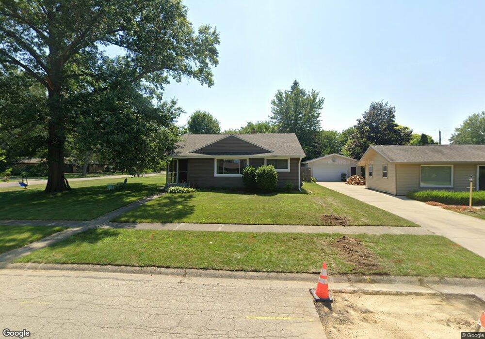
1944 Wisteria Rd Rockford, IL 61107
Estimated Value: $169,000 - $185,000
3
Beds
1
Bath
1,254
Sq Ft
$141/Sq Ft
Est. Value
About This Home
This home is located at 1944 Wisteria Rd, Rockford, IL 61107 and is currently estimated at $177,261, approximately $141 per square foot. 1944 Wisteria Rd is a home located in Winnebago County with nearby schools including Brookview Elementary School, Eisenhower Middle School, and Guilford High School.
Ownership History
Date
Name
Owned For
Owner Type
Purchase Details
Closed on
Aug 28, 2017
Sold by
Austin Reisetter and Austin Lori
Bought by
Versendaal Rita
Current Estimated Value
Home Financials for this Owner
Home Financials are based on the most recent Mortgage that was taken out on this home.
Original Mortgage
$58,500
Outstanding Balance
$31,517
Interest Rate
3.87%
Mortgage Type
New Conventional
Estimated Equity
$145,744
Purchase Details
Closed on
Dec 10, 2007
Bought by
Reisetter Austin C and Reisetter Lori
Create a Home Valuation Report for This Property
The Home Valuation Report is an in-depth analysis detailing your home's value as well as a comparison with similar homes in the area
Home Values in the Area
Average Home Value in this Area
Purchase History
| Date | Buyer | Sale Price | Title Company |
|---|---|---|---|
| Versendaal Rita | $75,800 | Title Underwriters Agency | |
| Reisetter Austin C | $115,900 | -- |
Source: Public Records
Mortgage History
| Date | Status | Borrower | Loan Amount |
|---|---|---|---|
| Open | Versendaal Rita | $58,500 |
Source: Public Records
Tax History Compared to Growth
Tax History
| Year | Tax Paid | Tax Assessment Tax Assessment Total Assessment is a certain percentage of the fair market value that is determined by local assessors to be the total taxable value of land and additions on the property. | Land | Improvement |
|---|---|---|---|---|
| 2024 | $3,043 | $43,821 | $6,858 | $36,963 |
| 2023 | $2,848 | $38,639 | $6,047 | $32,592 |
| 2022 | $2,722 | $34,536 | $5,405 | $29,131 |
| 2021 | $2,618 | $31,667 | $4,956 | $26,711 |
| 2020 | $2,551 | $29,936 | $4,685 | $25,251 |
| 2019 | $2,478 | $28,532 | $4,465 | $24,067 |
| 2018 | $2,440 | $26,890 | $4,208 | $22,682 |
| 2017 | $3,114 | $25,734 | $4,027 | $21,707 |
| 2016 | $3,102 | $25,252 | $3,952 | $21,300 |
| 2015 | $1,568 | $25,252 | $3,952 | $21,300 |
| 2014 | $3,409 | $27,126 | $4,946 | $22,180 |
Source: Public Records
Map
Nearby Homes
- 1954 Wisteria Rd
- 1718 Larkspur Dr
- 1461 Williamsburg Rd
- 1940 Hawthorne Dr
- 4012 Highcrest Rd
- 2180 Stornway Dr
- 4520 Guilford Rd
- 3505 Brookview Rd
- 2020 Valley Rd
- 5075 Welsh Rd
- 4000 Crestview Dr
- 2014 Glenview Rd
- 2020 Glenview Rd
- 1825 Edgebrook Dr
- 3606 Pinecrest Rd
- 5382 Guilford Rd
- 3820 Brendenwood Rd
- 2356 Silverthorn Dr
- 2699 Hickory Ave
- 1948 Wisteria Rd
- 2002 Delcy Dr
- 2005 Spring Brook Ave
- 2005 Delcy Dr
- 1950 Wisteria Rd
- 2104 Delcy Dr
- 1945 Wisteria Rd
- 2001 Delcy Dr
- 2009 Spring Brook Ave
- 1936 Wisteria Rd
- 2103 Delcy Dr
- 1949 Wisteria Rd
- 1931 Spring Brook Ave
- 2013 Spring Brook Ave
- 2106 Delcy Dr
- 1935 Wisteria Rd
- 1932 Delcy Dr
- 1932 Wisteria Rd
- 1960 Wisteria Rd
- 2017 Spring Brook Ave