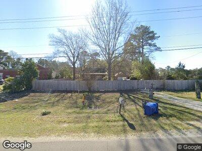
19444 Us Highway 17 Hampstead, NC 28443
Estimated Value: $343,000 - $395,763
4
Beds
2
Baths
1,662
Sq Ft
$225/Sq Ft
Est. Value
About This Home
This home is located at 19444 Us Highway 17, Hampstead, NC 28443 and is currently estimated at $374,441, approximately $225 per square foot. 19444 Us Highway 17 is a home located in Pender County with nearby schools including Topsail Elementary School, Topsail Middle School, and Topsail High School.
Ownership History
Date
Name
Owned For
Owner Type
Purchase Details
Closed on
Jan 20, 2022
Sold by
Grier Thomas A
Bought by
Investisniff Llc
Current Estimated Value
Purchase Details
Closed on
Nov 30, 2015
Sold by
Niegocki Joseph and Niegocki Judith
Bought by
Grier Thomas A
Home Financials for this Owner
Home Financials are based on the most recent Mortgage that was taken out on this home.
Original Mortgage
$154,660
Interest Rate
3.65%
Mortgage Type
FHA
Purchase Details
Closed on
Apr 27, 1989
Bought by
Niegocki Joseph
Create a Home Valuation Report for This Property
The Home Valuation Report is an in-depth analysis detailing your home's value as well as a comparison with similar homes in the area
Home Values in the Area
Average Home Value in this Area
Purchase History
| Date | Buyer | Sale Price | Title Company |
|---|---|---|---|
| Investisniff Llc | $240,000 | Rizzo & Blackburn Pllc | |
| Grier Thomas A | $160,000 | None Available | |
| Niegocki Joseph | $41,500 | -- |
Source: Public Records
Mortgage History
| Date | Status | Borrower | Loan Amount |
|---|---|---|---|
| Previous Owner | Grier Thomas A | $154,660 |
Source: Public Records
Tax History Compared to Growth
Tax History
| Year | Tax Paid | Tax Assessment Tax Assessment Total Assessment is a certain percentage of the fair market value that is determined by local assessors to be the total taxable value of land and additions on the property. | Land | Improvement |
|---|---|---|---|---|
| 2024 | $2,185 | $214,630 | $67,500 | $147,130 |
| 2023 | $2,185 | $214,630 | $67,500 | $147,130 |
| 2022 | $1,897 | $214,630 | $67,500 | $147,130 |
| 2021 | $1,897 | $214,630 | $67,500 | $147,130 |
| 2020 | $1,897 | $214,630 | $67,500 | $147,130 |
| 2019 | $1,897 | $214,630 | $67,500 | $147,130 |
| 2018 | $2,018 | $218,714 | $108,900 | $109,814 |
| 2017 | $2,018 | $218,714 | $108,900 | $109,814 |
| 2016 | $2,106 | $218,714 | $108,900 | $109,814 |
| 2015 | $2,071 | $218,714 | $108,900 | $109,814 |
| 2014 | $1,729 | $232,366 | $108,900 | $123,466 |
| 2013 | -- | $232,366 | $108,900 | $123,466 |
| 2012 | -- | $232,366 | $108,900 | $123,466 |
Source: Public Records
Map
Nearby Homes
- 417 Quartermaster Ct
- 363 Pinnacle Pkwy
- 361 Scrub Oaks Dr
- 614 Galley Ct
- 71 Peoples Ct
- 497 Pinnacle Pkwy
- 803 Jetty Ct
- 810 Topsail Greens Dr
- 551 Aurora Place
- 344 Bluebird Ln
- 356 Bluebird Ln
- 358 Bluebird Ln
- 121 E Singing Ave
- 125 E Singing Ave
- 124 E Singing Ave
- 104 Phoebee Ct
- 124 Azalea Dr
- 24 W Weatherbee Way
- 22 Perch Place
- 106 Painted Bunting Ct
- 19444 Us Highway 17
- 19444 Us Highway 17
- 19444 N Us Hwy Unit 17
- 19444 Highway Unit 17
- 19444 U S 17
- 41 Pinnacle Pkwy
- 104 Champion Dr
- 3 Sloop Point Loop Rd
- 106 Champion Dr
- 42 Pinnacle Pkwy
- 112 Champion Dr
- 112 Champion Dr
- 101 Tugboat Ct
- 216 Spar Ct
- 114 Champion Dr
- 218 Spar Ct
- 22 Pinnacle Pkwy
- 10 Pinnacle Pkwy
- 8 Pinnacle Pkwy
- 18 Pinnacle Pkwy