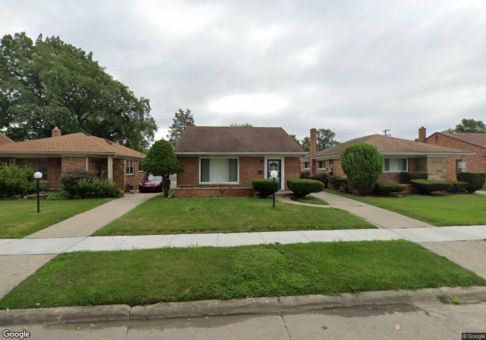
19446 Westmoreland Rd Detroit, MI 48219
O'Hair Park NeighborhoodEstimated Value: $88,000 - $154,000
3
Beds
1
Bath
1,064
Sq Ft
$108/Sq Ft
Est. Value
About This Home
This home is located at 19446 Westmoreland Rd, Detroit, MI 48219 and is currently estimated at $114,670, approximately $107 per square foot. 19446 Westmoreland Rd is a home located in Wayne County with nearby schools including Ralph W. Emerson Elementary-Middle School, Charles L. Spain Elementary-Middle School, and Edward 'Duke' Ellington Conservatory of Music and Art.
Ownership History
Date
Name
Owned For
Owner Type
Purchase Details
Closed on
Apr 16, 2009
Sold by
Secretary Of Housing & Urban Development
Bought by
Causey Scot A
Current Estimated Value
Purchase Details
Closed on
Jul 25, 2007
Sold by
M & T Bank
Bought by
Hud
Purchase Details
Closed on
Sep 27, 2006
Sold by
Watts India
Bought by
M & T Mortgage Corp
Purchase Details
Closed on
Jan 2, 2004
Sold by
Banks Jo Ann
Bought by
Watts India
Create a Home Valuation Report for This Property
The Home Valuation Report is an in-depth analysis detailing your home's value as well as a comparison with similar homes in the area
Home Values in the Area
Average Home Value in this Area
Purchase History
| Date | Buyer | Sale Price | Title Company |
|---|---|---|---|
| Causey Scot A | $15,000 | None Available | |
| Hud | -- | None Available | |
| M & T Mortgage Corp | $131,709 | None Available | |
| Watts India | $134,000 | First American Title |
Source: Public Records
Tax History Compared to Growth
Tax History
| Year | Tax Paid | Tax Assessment Tax Assessment Total Assessment is a certain percentage of the fair market value that is determined by local assessors to be the total taxable value of land and additions on the property. | Land | Improvement |
|---|---|---|---|---|
| 2025 | $1,231 | $54,900 | $0 | $0 |
| 2024 | $1,231 | $47,200 | $0 | $0 |
| 2023 | $1,195 | $37,700 | $0 | $0 |
| 2022 | $1,273 | $29,000 | $0 | $0 |
| 2021 | $1,239 | $23,200 | $0 | $0 |
| 2020 | $1,291 | $22,000 | $0 | $0 |
| 2019 | $1,272 | $17,500 | $0 | $0 |
| 2018 | $1,073 | $15,200 | $0 | $0 |
| 2017 | $201 | $15,400 | $0 | $0 |
| 2016 | $1,174 | $12,400 | $0 | $0 |
| 2015 | $1,240 | $12,400 | $0 | $0 |
| 2013 | $1,740 | $17,397 | $0 | $0 |
| 2010 | -- | $41,964 | $1,149 | $40,815 |
Source: Public Records
Map
Nearby Homes
- 19401 Annchester Rd
- 19356 Westmoreland Rd
- 19468 Evergreen Rd
- 19480 Edinborough Rd
- 19363 Plainview Ave
- 19720 Evergreen Rd
- 19315 Annchester Rd
- 19811 Plainview Ave
- 19356 Huntington Rd
- 19315 Huntington Rd
- 19336 Huntington Rd
- 19719 Vaughan St
- 19470 Grandville Ave
- 19325 Grandville Ave
- 19308 Grandville Ave
- 19830 W 7 Mile Rd
- 19411 Kentfield St
- 19736 Stout St
- 19019 Annchester Rd
- 19347 Sunderland Rd
- 19438 Westmoreland Rd
- 19454 Westmoreland Rd
- 19464 Westmoreland Rd
- 19428 Westmoreland Rd
- 19449 Annchester Rd
- 19441 Annchester Rd
- 19423 Annchester Rd
- 19470 Westmoreland Rd
- 19420 Westmoreland Rd
- 19459 Annchester Rd
- 19431 Annchester Rd
- 19467 Annchester Rd
- 19480 Westmoreland Rd
- 19451 Westmoreland Rd
- 19475 Annchester Rd
- 19400 Westmoreland Rd
- 19413 Annchester Rd
- 19488 Westmoreland Rd
- 19483 Annchester Rd
- 19493 Annchester Rd