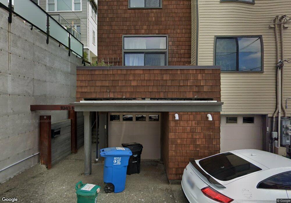
1945 7th Ave W Unit B Seattle, WA 98119
West Queen Anne NeighborhoodEstimated Value: $1,311,000 - $1,598,000
3
Beds
3
Baths
2,190
Sq Ft
$650/Sq Ft
Est. Value
About This Home
This home is located at 1945 7th Ave W Unit B, Seattle, WA 98119 and is currently estimated at $1,424,541, approximately $650 per square foot. 1945 7th Ave W Unit B is a home located in King County with nearby schools including Coe Elementary School, Mcclure Middle School, and Lincoln High School.
Ownership History
Date
Name
Owned For
Owner Type
Purchase Details
Closed on
May 18, 2010
Sold by
Jrj 7Th Avenue West Llc
Bought by
Owsiany David R and Seven Everett M
Current Estimated Value
Home Financials for this Owner
Home Financials are based on the most recent Mortgage that was taken out on this home.
Original Mortgage
$567,500
Outstanding Balance
$383,341
Interest Rate
5.21%
Mortgage Type
New Conventional
Estimated Equity
$1,041,200
Create a Home Valuation Report for This Property
The Home Valuation Report is an in-depth analysis detailing your home's value as well as a comparison with similar homes in the area
Home Values in the Area
Average Home Value in this Area
Purchase History
| Date | Buyer | Sale Price | Title Company |
|---|---|---|---|
| Owsiany David R | $715,000 | Old Republic T |
Source: Public Records
Mortgage History
| Date | Status | Borrower | Loan Amount |
|---|---|---|---|
| Open | Owsiany David R | $567,500 |
Source: Public Records
Tax History Compared to Growth
Tax History
| Year | Tax Paid | Tax Assessment Tax Assessment Total Assessment is a certain percentage of the fair market value that is determined by local assessors to be the total taxable value of land and additions on the property. | Land | Improvement |
|---|---|---|---|---|
| 2024 | $11,306 | $1,202,000 | $330,000 | $872,000 |
| 2023 | $10,124 | $1,125,000 | $330,000 | $795,000 |
| 2022 | $9,925 | $1,218,000 | $350,000 | $868,000 |
| 2021 | $9,720 | $1,099,000 | $265,000 | $834,000 |
| 2020 | $10,740 | $1,021,000 | $244,000 | $777,000 |
| 2018 | $8,711 | $1,119,000 | $262,000 | $857,000 |
| 2017 | $7,792 | $893,000 | $227,000 | $666,000 |
| 2016 | $8,323 | $826,000 | $211,000 | $615,000 |
| 2015 | $6,889 | $863,000 | $228,000 | $635,000 |
| 2014 | -- | $720,000 | $183,000 | $537,000 |
| 2013 | -- | $676,000 | $173,000 | $503,000 |
Source: Public Records
Map
Nearby Homes
- 1945 7th Ave W Unit A
- 1942 7th Ave W
- 1910 8th Ave W Unit B
- 1904 9th Ave W
- 2137 7th Ave W
- 1915 9th Ave W
- 2111 9th Ave W Unit 23
- 1928B 10th Ave W
- 2130 10th Ave W Unit 28
- 914 W Howe St
- 1930 5th Ave W
- 816 W Blaine St
- 901 W Mcgraw St Unit 6
- 1939 10th Ave W Unit B
- 1909 10th Ave W Unit 301
- 1909 10th Ave W Unit 203
- 957 W Mcgraw St Unit 1
- 2430 8th Ave W
- 1811 4th Ave W
- 2146 4th Ave W
- 1945 7th Ave W
- 1935 7th Ave W Unit A
- 1943 7th Ave W Unit A
- 1943 7th Ave W
- 1943 7th Ave W Unit B
- 1937 7th Ave W
- 1947 7th Ave W Unit 1
- 1947 7th Ave W Unit 2
- 1947 7th Ave W
- 1933 7th Ave W
- 1936 8th Ave W
- 1936 8th Ave W Unit B
- 1949 7th Ave W
- 1938 8th Ave W
- 1944 8th Ave W
- 1927 7th Ave W
- 1934 8th Ave W
- 1953 7th Ave W
- 1946 8th Ave W
- 1930 8th Ave W