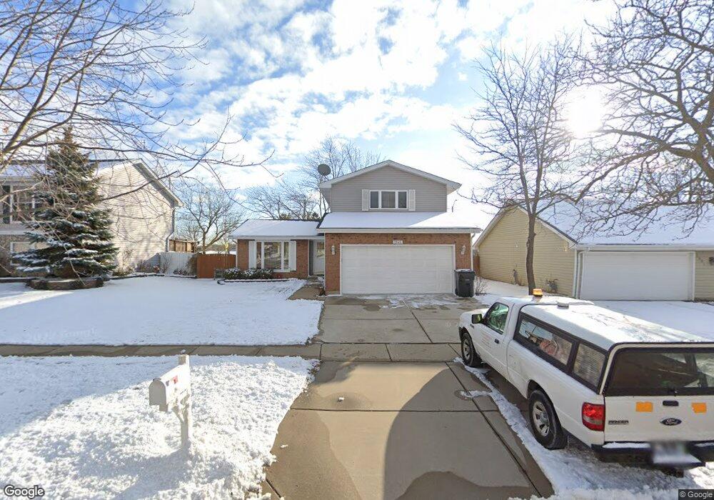
1945 Crescent Ln Hoffman Estates, IL 60169
South Hoffman Estates NeighborhoodEstimated Value: $371,887 - $423,000
3
Beds
2
Baths
1,532
Sq Ft
$261/Sq Ft
Est. Value
About This Home
This home is located at 1945 Crescent Ln, Hoffman Estates, IL 60169 and is currently estimated at $399,972, approximately $261 per square foot. 1945 Crescent Ln is a home located in Cook County with nearby schools including Neil Armstrong Elementary School, Dwight D Eisenhower Junior High School, and Hoffman Estates High School.
Ownership History
Date
Name
Owned For
Owner Type
Purchase Details
Closed on
Oct 1, 2011
Sold by
Patel Ramanlal M and Patel Krishna R
Bought by
Patel Ramanlal M and Patel Krishna R
Current Estimated Value
Home Financials for this Owner
Home Financials are based on the most recent Mortgage that was taken out on this home.
Original Mortgage
$117,500
Outstanding Balance
$7,801
Interest Rate
4.22%
Mortgage Type
New Conventional
Estimated Equity
$392,171
Purchase Details
Closed on
Mar 27, 2002
Sold by
Lambert David W and Lambert Susan J
Bought by
Patel Ramanial M and Patel Krishna R
Home Financials for this Owner
Home Financials are based on the most recent Mortgage that was taken out on this home.
Original Mortgage
$158,000
Interest Rate
6.93%
Create a Home Valuation Report for This Property
The Home Valuation Report is an in-depth analysis detailing your home's value as well as a comparison with similar homes in the area
Home Values in the Area
Average Home Value in this Area
Purchase History
| Date | Buyer | Sale Price | Title Company |
|---|---|---|---|
| Patel Ramanlal M | -- | None Available | |
| Patel Ramanial M | $218,000 | -- |
Source: Public Records
Mortgage History
| Date | Status | Borrower | Loan Amount |
|---|---|---|---|
| Open | Patel Ramanlal M | $117,500 | |
| Closed | Patel Ramanial M | $158,000 |
Source: Public Records
Tax History
| Year | Tax Paid | Tax Assessment Tax Assessment Total Assessment is a certain percentage of the fair market value that is determined by local assessors to be the total taxable value of land and additions on the property. | Land | Improvement |
|---|---|---|---|---|
| 2025 | $7,374 | $36,000 | $5,591 | $30,409 |
| 2024 | $7,374 | $25,704 | $5,083 | $20,621 |
| 2023 | $7,168 | $27,557 | $5,083 | $22,474 |
| 2022 | $7,168 | $27,557 | $5,083 | $22,474 |
| 2021 | $5,986 | $21,196 | $8,005 | $13,191 |
| 2020 | $5,920 | $21,196 | $8,005 | $13,191 |
| 2019 | $6,219 | $24,673 | $8,005 | $16,668 |
| 2018 | $5,730 | $21,007 | $6,989 | $14,018 |
| 2017 | $6,314 | $23,090 | $6,989 | $16,101 |
| 2016 | $6,135 | $23,090 | $6,989 | $16,101 |
| 2015 | $5,545 | $19,887 | $6,099 | $13,788 |
| 2014 | $5,464 | $19,887 | $6,099 | $13,788 |
| 2013 | $5,306 | $19,887 | $6,099 | $13,788 |
Source: Public Records
Map
Nearby Homes
- 1475 Rebecca Dr Unit 213
- 1800 Monterey Ct
- 1880 Bonnie Ln Unit 116
- 1880 Bonnie Ln Unit 112
- 1500 Robin Cir Unit 314
- 2222 Seaver Ln
- 1975 Windsong Dr Unit 333E1
- 1776 Bristol Walk Unit 1776
- 2239 Seaver Ln Unit 2
- 1797 Queensbury Cir Unit 5764
- 1729 Pebble Beach Ct
- 1722 Fayette Walk Unit E
- 1792 Williamsburg Dr
- 1576 Poplar Creek Dr
- 1840 Huntington Blvd Unit BW511
- 1840 Huntington Blvd Unit 203
- 1809 Lancashire Ct
- 1450 Meyer Rd
- 1103 Southbridge Ln
- 1987 Leiter Way Unit 11003
- 1951 Crescent Ln
- 1941 Crescent Ln
- 1955 Crescent Ln
- 1935 Crescent Ln
- 1948 Crescent Ct
- 1961 Crescent Ln
- 1950 Crescent Ln
- 1925 Crescent Ln
- 1930 Crescent Ct
- 1946 Crescent Ct
- 1965 Crescent Ln
- 1915 Crescent Ln
- 1920 Crescent Ln
- 1932 Crescent Ct
- 1954 Crescent Ln
- 1944 Crescent Ct
- 1975 Crescent Ln
- 1910 Crescent Ln
- 1905 Crescent Ln
- 1934 Crescent Ct
Your Personal Tour Guide
Ask me questions while you tour the home.