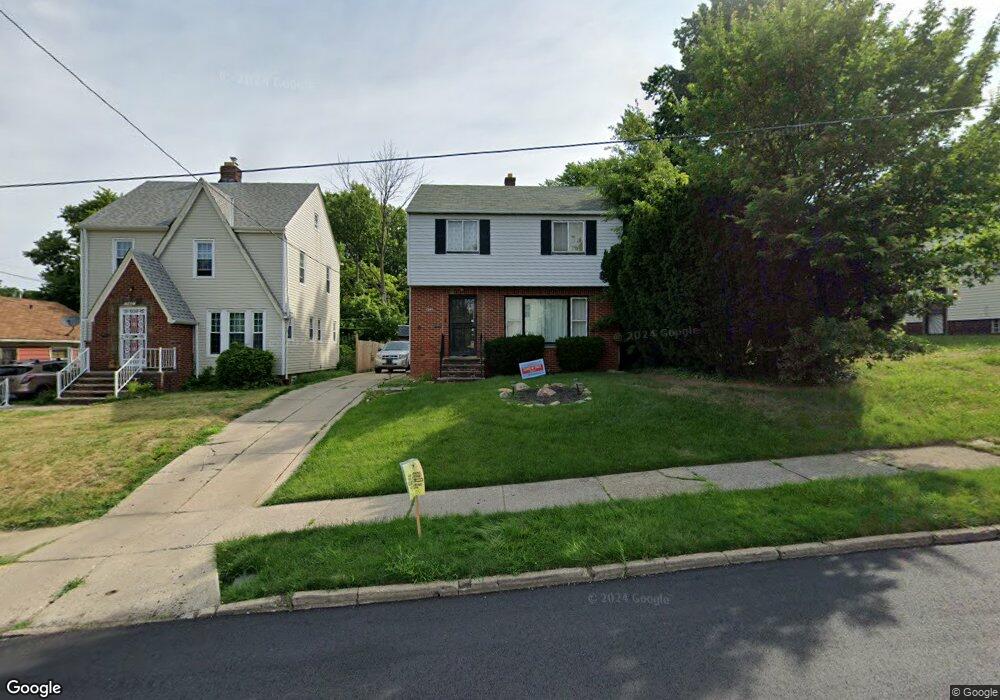
1945 Haverhill Rd Cleveland, OH 44112
Euclid-Green NeighborhoodEstimated Value: $76,116 - $148,000
3
Beds
1
Bath
1,250
Sq Ft
$77/Sq Ft
Est. Value
About This Home
This home is located at 1945 Haverhill Rd, Cleveland, OH 44112 and is currently estimated at $96,279, approximately $77 per square foot. 1945 Haverhill Rd is a home located in Cuyahoga County with nearby schools including Bolton, Anton Grdina School, and Andrew J. Rickoff School.
Ownership History
Date
Name
Owned For
Owner Type
Purchase Details
Closed on
Jun 29, 2005
Sold by
Fears Timothy L and Mack Fears Anita L
Bought by
Kirkpatrick Kelly C
Current Estimated Value
Home Financials for this Owner
Home Financials are based on the most recent Mortgage that was taken out on this home.
Original Mortgage
$80,750
Outstanding Balance
$42,696
Interest Rate
5.86%
Mortgage Type
Fannie Mae Freddie Mac
Estimated Equity
$53,583
Purchase Details
Closed on
Jan 31, 1995
Sold by
Est Charles A Fruscella
Bought by
Fears Timothy L and Mack-Fears Anita L
Purchase Details
Closed on
Aug 9, 1984
Sold by
Fruscella Chas A and Fruscella Phillis A
Bought by
Fruscella Charles A
Purchase Details
Closed on
Jan 1, 1975
Bought by
Fruscella Chas A and Fruscella Phillis A
Create a Home Valuation Report for This Property
The Home Valuation Report is an in-depth analysis detailing your home's value as well as a comparison with similar homes in the area
Home Values in the Area
Average Home Value in this Area
Purchase History
| Date | Buyer | Sale Price | Title Company |
|---|---|---|---|
| Kirkpatrick Kelly C | $95,000 | Titles Etc | |
| Fears Timothy L | $61,000 | -- | |
| Fruscella Charles A | -- | -- | |
| Fruscella Chas A | -- | -- |
Source: Public Records
Mortgage History
| Date | Status | Borrower | Loan Amount |
|---|---|---|---|
| Open | Kirkpatrick Kelly C | $80,750 | |
| Closed | Fears Timothy L | -- | |
| Closed | Kirkpatrick Kelly C | $9,500 |
Source: Public Records
Tax History Compared to Growth
Tax History
| Year | Tax Paid | Tax Assessment Tax Assessment Total Assessment is a certain percentage of the fair market value that is determined by local assessors to be the total taxable value of land and additions on the property. | Land | Improvement |
|---|---|---|---|---|
| 2024 | $1,356 | $20,685 | $3,955 | $16,730 |
| 2023 | $922 | $12,150 | $1,860 | $10,290 |
| 2022 | $916 | $12,145 | $1,855 | $10,290 |
| 2021 | $907 | $12,150 | $1,860 | $10,290 |
| 2020 | $874 | $10,120 | $1,540 | $8,580 |
| 2019 | $808 | $28,900 | $4,400 | $24,500 |
| 2018 | $403 | $10,120 | $1,540 | $8,580 |
| 2017 | $1,074 | $13,020 | $420 | $12,600 |
| 2016 | $1,065 | $13,020 | $420 | $12,600 |
| 2015 | $2,356 | $13,020 | $420 | $12,600 |
| 2014 | $2,356 | $13,440 | $420 | $13,020 |
Source: Public Records
Map
Nearby Homes
- 2116 Reyburn Rd
- 2121 Alton Rd
- 1875 Lampson Rd
- 2133 Reyburn Rd
- 1816 Lampson Rd
- 1767 Algonac Rd Unit 2
- 1758 Algonac Rd
- 1897 Torbenson Dr
- 3595 Runnymede Blvd
- 1762 Alcoy Rd
- 3609 Langton Rd
- 3511 Randolph Rd
- 1738 Burgess Rd
- 565 Quilliams Rd
- 16208 Greyton Rd
- 3655 Langton Rd
- 3547 Randolph Rd
- 3598 Atherstone Rd
- 1738 Cliffview Rd
- 1677 Hillview Rd
- 1941 Haverhill Rd
- 1953 Haverhill Rd
- 1937 Haverhill Rd
- 17120 Hillsboro Rd
- 1962 Hilton Rd
- 1966 Hilton Rd
- 1957 Haverhill Rd
- 1958 Hilton Rd
- 17200 Hillsboro Rd
- 1961 Haverhill Rd
- 1952 Hilton Rd
- 1946 Haverhill Rd
- 1942 Haverhill Rd
- 1967 Haverhill Rd
- 1938 Haverhill Rd
- 1950 Haverhill Rd
- 17204 Hillsboro Rd
- 1954 Haverhill Rd
- 17212 Hillsboro Rd
- 1958 Haverhill Rd