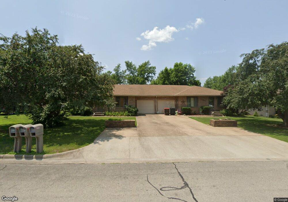
1945 King James Rd Lebanon, MO 65536
Estimated Value: $216,000 - $305,000
4
Beds
1
Bath
3,009
Sq Ft
$91/Sq Ft
Est. Value
About This Home
This home is located at 1945 King James Rd, Lebanon, MO 65536 and is currently estimated at $273,260, approximately $90 per square foot. 1945 King James Rd is a home located in Laclede County with nearby schools including Joe D. Esther Elementary School, Maplecrest Elementary School, and Boswell Elementary School.
Ownership History
Date
Name
Owned For
Owner Type
Purchase Details
Closed on
Dec 14, 2007
Sold by
Sharp Audra
Bought by
Darnell Charles T and Segebarth Lindsay J
Current Estimated Value
Home Financials for this Owner
Home Financials are based on the most recent Mortgage that was taken out on this home.
Original Mortgage
$119,200
Outstanding Balance
$73,754
Interest Rate
5.87%
Mortgage Type
New Conventional
Estimated Equity
$199,506
Create a Home Valuation Report for This Property
The Home Valuation Report is an in-depth analysis detailing your home's value as well as a comparison with similar homes in the area
Home Values in the Area
Average Home Value in this Area
Purchase History
| Date | Buyer | Sale Price | Title Company |
|---|---|---|---|
| Darnell Charles T | -- | None Available |
Source: Public Records
Mortgage History
| Date | Status | Borrower | Loan Amount |
|---|---|---|---|
| Open | Darnell Charles T | $119,200 |
Source: Public Records
Tax History Compared to Growth
Tax History
| Year | Tax Paid | Tax Assessment Tax Assessment Total Assessment is a certain percentage of the fair market value that is determined by local assessors to be the total taxable value of land and additions on the property. | Land | Improvement |
|---|---|---|---|---|
| 2025 | $1,471 | $29,360 | $0 | $0 |
| 2024 | $1,471 | $25,800 | $0 | $0 |
| 2023 | $1,516 | $25,800 | $0 | $0 |
| 2022 | $1,412 | $25,800 | $0 | $0 |
| 2021 | $1,456 | $127,100 | $10,000 | $117,100 |
| 2020 | $1,463 | $127,100 | $10,000 | $117,100 |
| 2019 | $1,402 | $24,150 | $1,900 | $22,250 |
| 2018 | $1,315 | $24,150 | $1,900 | $22,250 |
| 2017 | $1,247 | $24,150 | $0 | $0 |
| 2016 | $1,247 | $24,150 | $0 | $0 |
| 2015 | $1,247 | $24,150 | $0 | $0 |
| 2014 | $1,247 | $24,150 | $0 | $0 |
| 2013 | -- | $24,150 | $0 | $0 |
Source: Public Records
Map
Nearby Homes
- 1953 King James Rd
- 1933 King James Rd
- 1940 Jean Dr
- 1950 Jean Dr
- 1930 Jean Dr
- 1940 King James Rd
- 1923 King James Rd
- 1930 King James Rd
- 273 Farmers Ln
- 1920 Jean Dr
- 301 Farmers Ln
- 255 Farmers Ln
- 1953 Donna Cir
- 1943 Jean Dr
- 1910 Jean Dr
- 1933 Jean Dr
- 319 Farmers Ln
- 237 Farmers Ln
- 1933 Donna Cir
- 1933 Donna Cir