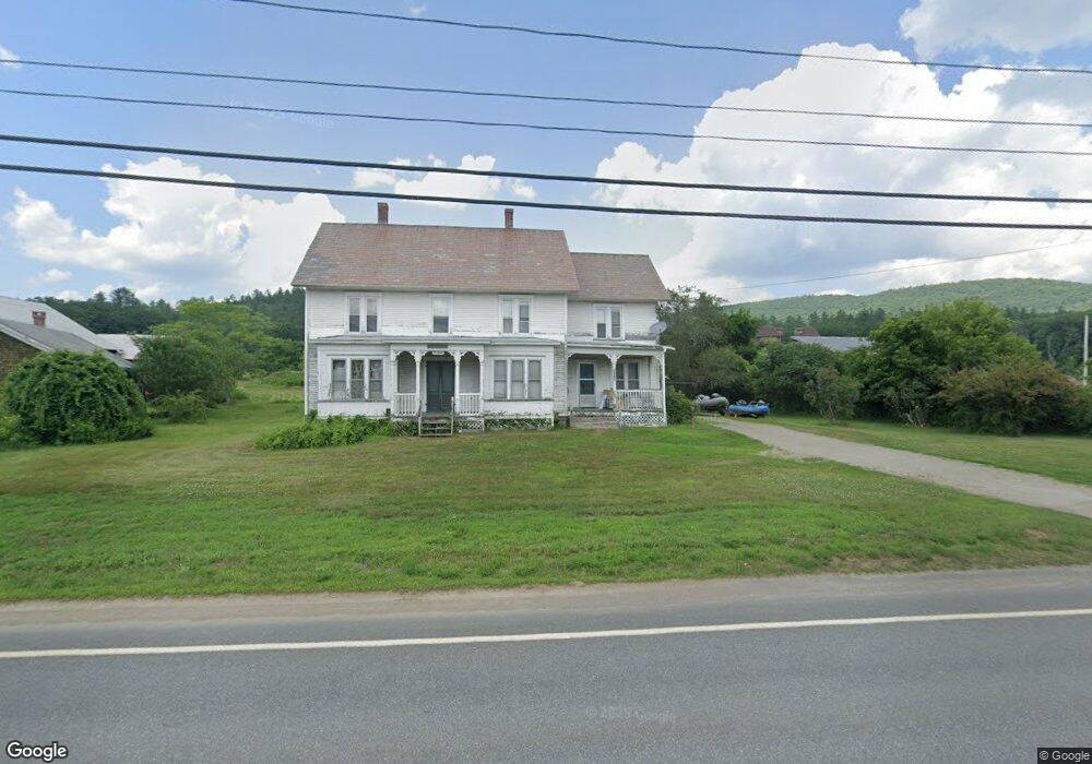
1945 Route 2 Shelburne Falls, MA 01370
Estimated Value: $373,000 - $698,000
--
Bed
2
Baths
2,944
Sq Ft
$155/Sq Ft
Est. Value
About This Home
This home is located at 1945 Route 2, Shelburne Falls, MA 01370 and is currently estimated at $456,601, approximately $155 per square foot. 1945 Route 2 is a home with nearby schools including Mohawk Trail Regional High School and The Academy At Charlemont.
Ownership History
Date
Name
Owned For
Owner Type
Purchase Details
Closed on
Feb 22, 2024
Sold by
Kendrick Int and Kendrick K
Bought by
Paul J Kendrick T J and Paul Kendrick
Current Estimated Value
Purchase Details
Closed on
Oct 13, 2020
Sold by
Paul J Kendrick Lt and Kendrick
Bought by
Kendrick Paul J
Purchase Details
Closed on
Oct 4, 2010
Sold by
Kendrick Paul J
Bought by
Paul J Kendrick Lt and Kendrick
Create a Home Valuation Report for This Property
The Home Valuation Report is an in-depth analysis detailing your home's value as well as a comparison with similar homes in the area
Home Values in the Area
Average Home Value in this Area
Purchase History
| Date | Buyer | Sale Price | Title Company |
|---|---|---|---|
| Paul J Kendrick T J | -- | None Available | |
| Paul J Kendrick T J | -- | None Available | |
| Kendrick Paul J | -- | None Available | |
| Kendrick Paul J | -- | None Available | |
| Paul J Kendrick Lt | -- | -- | |
| Paul J Kendrick Lt | -- | -- |
Source: Public Records
Tax History Compared to Growth
Tax History
| Year | Tax Paid | Tax Assessment Tax Assessment Total Assessment is a certain percentage of the fair market value that is determined by local assessors to be the total taxable value of land and additions on the property. | Land | Improvement |
|---|---|---|---|---|
| 2025 | $5,140 | $280,900 | $32,900 | $248,000 |
| 2024 | $5,428 | $262,200 | $29,900 | $232,300 |
| 2023 | $4,664 | $226,100 | $28,700 | $197,400 |
| 2022 | $4,654 | $224,500 | $28,700 | $195,800 |
| 2021 | $4,520 | $220,700 | $27,500 | $193,200 |
| 2020 | $4,039 | $207,000 | $27,600 | $179,400 |
| 2019 | $4,084 | $207,000 | $27,600 | $179,400 |
| 2018 | $4,227 | $207,000 | $27,600 | $179,400 |
| 2017 | $4,165 | $206,200 | $27,600 | $178,600 |
| 2016 | $3,797 | $193,700 | $27,600 | $166,100 |
| 2015 | $3,463 | $193,700 | $27,600 | $166,100 |
Source: Public Records
Map
Nearby Homes
- 31 W Oxbow Rd
- 24 W Oxbow Rd
- 2155 Massachusetts 2
- 2151 Route 2
- 0 W Oxbow Rd Unit 73453651
- 156 Ashfield Rd
- 33 Williams St
- 7 Hog Hollow Rd
- 10 Deerfield Ave Unit 5
- 10 Deerfield Ave Unit 2
- 105 - 107 Bridge St
- 0 Upper St
- 143 Charlemont Rd
- 102 Elm St
- 32 Navaho Ln
- 139 Taylor Brook Rd
- 0 Ashfield Rd
- 3+5 Church St
- 6 Chippewa Dr
- 14 South Rd