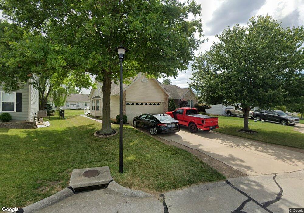
1945 Royal Heir Dr O Fallon, MO 63366
Estimated Value: $356,763 - $386,000
3
Beds
2
Baths
1,624
Sq Ft
$229/Sq Ft
Est. Value
About This Home
This home is located at 1945 Royal Heir Dr, O Fallon, MO 63366 and is currently estimated at $372,441, approximately $229 per square foot. 1945 Royal Heir Dr is a home located in St. Charles County with nearby schools including Westhoff Elementary School, Fort Zumwalt North Middle School, and Fort Zumwalt North High School.
Ownership History
Date
Name
Owned For
Owner Type
Purchase Details
Closed on
Jul 1, 2004
Sold by
Morrissey Timothy J
Bought by
Olender Steven M and Olender Doris M
Current Estimated Value
Home Financials for this Owner
Home Financials are based on the most recent Mortgage that was taken out on this home.
Original Mortgage
$148,000
Outstanding Balance
$74,132
Interest Rate
6.26%
Mortgage Type
Purchase Money Mortgage
Estimated Equity
$298,309
Purchase Details
Closed on
Apr 7, 1997
Sold by
Whittaker Construction Inc
Bought by
Morrissey Timothy J
Home Financials for this Owner
Home Financials are based on the most recent Mortgage that was taken out on this home.
Original Mortgage
$110,200
Interest Rate
7.82%
Create a Home Valuation Report for This Property
The Home Valuation Report is an in-depth analysis detailing your home's value as well as a comparison with similar homes in the area
Home Values in the Area
Average Home Value in this Area
Purchase History
| Date | Buyer | Sale Price | Title Company |
|---|---|---|---|
| Olender Steven M | $185,000 | Ust | |
| Morrissey Timothy J | -- | -- |
Source: Public Records
Mortgage History
| Date | Status | Borrower | Loan Amount |
|---|---|---|---|
| Open | Olender Steven M | $148,000 | |
| Previous Owner | Morrissey Timothy J | $110,200 |
Source: Public Records
Tax History Compared to Growth
Tax History
| Year | Tax Paid | Tax Assessment Tax Assessment Total Assessment is a certain percentage of the fair market value that is determined by local assessors to be the total taxable value of land and additions on the property. | Land | Improvement |
|---|---|---|---|---|
| 2025 | $3,687 | $60,259 | -- | -- |
| 2023 | $3,688 | $55,693 | $0 | $0 |
| 2022 | $3,221 | $45,202 | $0 | $0 |
| 2021 | $3,223 | $45,202 | $0 | $0 |
| 2020 | $3,184 | $43,274 | $0 | $0 |
| 2019 | $3,191 | $43,274 | $0 | $0 |
| 2018 | $3,114 | $40,319 | $0 | $0 |
| 2017 | $3,074 | $40,319 | $0 | $0 |
| 2016 | $2,649 | $34,601 | $0 | $0 |
| 2015 | $2,463 | $34,601 | $0 | $0 |
| 2014 | $2,073 | $28,629 | $0 | $0 |
Source: Public Records
Map
Nearby Homes
- 1113 Renfrew Ln S
- 1401 Noyack Dr
- 306 Estate Dr
- 8 Dugout Ct
- 320 Camilla Dr
- 1384 Deerfield Estates Dr
- 2 England Cir
- 223 England Dr
- 12 Warshire Ct Unit 67A
- 166 Maryland Dr
- 18 Homefield Gardens Dr Unit 21N
- Lot 2 Homefield Blvd
- 18 W Homefield Point Ct
- 1612 Homefield Meadows Dr
- 2024 Homefield Ridge Dr
- 107 Roxbury Dr
- 992 Tilestone Dr
- 103 Roxbury Dr
- 117.76 Acres Missouri 79
- 1129 Danielle Elizabeth Ct
- 1941 Royal Heir Dr
- 1949 Royal Heir Dr
- 1940 Homefield Estates Dr
- 1944 Homefield Estates Dr
- 1937 Royal Heir Dr
- 1936 Homefield Estates Dr
- 1953 Royal Heir Dr
- 1952 Royal Heir Dr
- 1948 Homefield Estates Dr
- 1957 Royal Heir Dr
- 269 Grand Dr
- 1932 Homefield Estates Dr
- 1933 Royal Heir Dr
- 1952 Homefield Estates Dr
- 1966 Royal Heir Dr
- 2627 Montauk Dr
- 1961 Royal Heir Dr
- 273 Grand Dr
- 1939 Homefield Estates Dr
- 1929 Royal Heir Dr