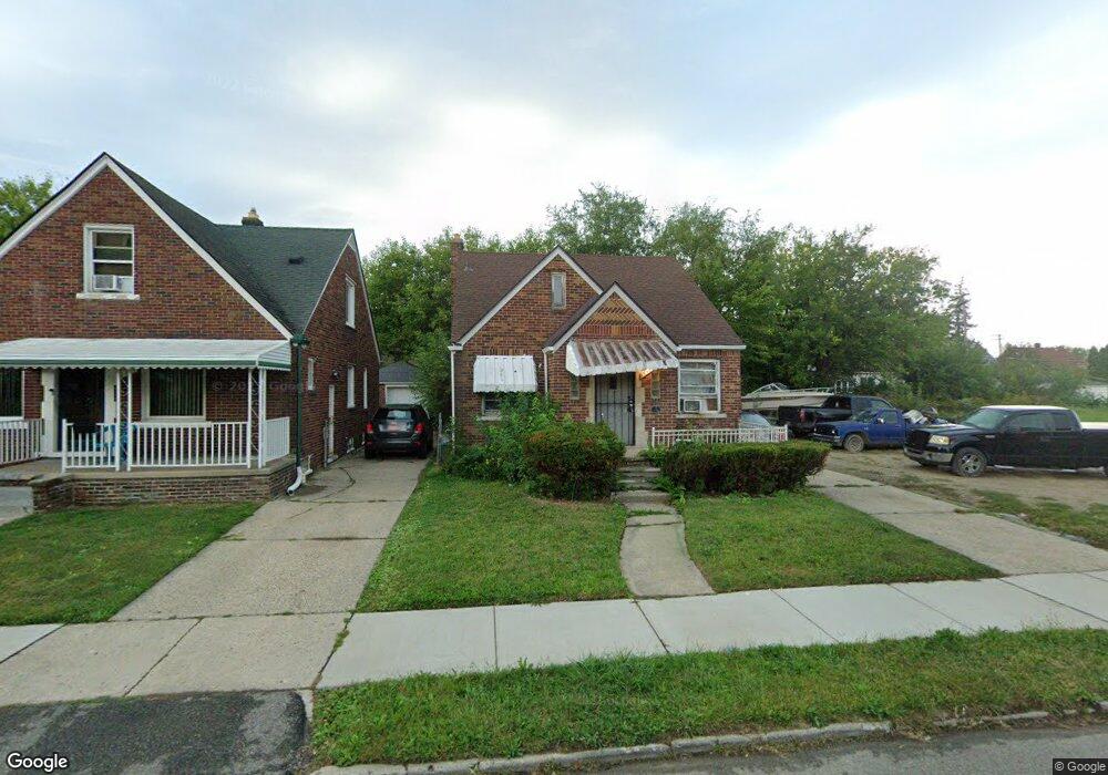
19451 Stotter St Detroit, MI 48234
Nortown NeighborhoodEstimated Value: $64,000 - $67,000
3
Beds
2
Baths
895
Sq Ft
$74/Sq Ft
Est. Value
About This Home
This home is located at 19451 Stotter St, Detroit, MI 48234 and is currently estimated at $65,858, approximately $73 per square foot. 19451 Stotter St is a home located in Wayne County with nearby schools including Marion Law Academy, Edward 'Duke' Ellington Conservatory of Music and Art, and Charles L. Spain Elementary-Middle School.
Ownership History
Date
Name
Owned For
Owner Type
Purchase Details
Closed on
Nov 10, 2014
Sold by
Treasurer Of The Charter County Of Wayne
Bought by
Okoh Isaiah
Current Estimated Value
Purchase Details
Closed on
Nov 16, 2010
Sold by
Donovan Shaun
Bought by
Jackson Jacqueline
Purchase Details
Closed on
Jun 30, 2009
Sold by
Citimortgage Inc
Bought by
The Secretary Of Housing & Urban Develop
Purchase Details
Closed on
Dec 29, 2008
Sold by
Davis Elizabeth P
Bought by
Citimortgage Inc
Create a Home Valuation Report for This Property
The Home Valuation Report is an in-depth analysis detailing your home's value as well as a comparison with similar homes in the area
Home Values in the Area
Average Home Value in this Area
Purchase History
| Date | Buyer | Sale Price | Title Company |
|---|---|---|---|
| Okoh Isaiah | $3,700 | None Available | |
| Jackson Jacqueline | $1,840 | None Available | |
| The Secretary Of Housing & Urban Develop | -- | None Available | |
| Citimortgage Inc | $54,547 | None Available |
Source: Public Records
Tax History Compared to Growth
Tax History
| Year | Tax Paid | Tax Assessment Tax Assessment Total Assessment is a certain percentage of the fair market value that is determined by local assessors to be the total taxable value of land and additions on the property. | Land | Improvement |
|---|---|---|---|---|
| 2025 | $769 | $18,500 | $0 | $0 |
| 2024 | $769 | $15,600 | $0 | $0 |
| 2023 | $745 | $12,700 | $0 | $0 |
| 2022 | $786 | $11,600 | $0 | $0 |
| 2021 | $768 | $9,100 | $0 | $0 |
| 2020 | $768 | $8,100 | $0 | $0 |
| 2019 | $758 | $6,030 | $0 | $0 |
| 2018 | $680 | $5,900 | $0 | $0 |
| 2017 | $106 | $5,600 | $0 | $0 |
| 2016 | $1,308 | $13,700 | $0 | $0 |
| 2015 | $1,410 | $14,100 | $0 | $0 |
| 2013 | $1,760 | $17,601 | $0 | $0 |
| 2010 | -- | $25,806 | $885 | $24,921 |
Source: Public Records
Map
Nearby Homes
- 19423 Spencer St
- 19487 Spencer St
- 19466 Packard St
- 8022 Yolanda St
- 19674 Stotter St
- 19363 Packard St
- 19440 Cliff St
- 8063 Yolanda St
- 19357 Packard St
- 19698 Packard St
- 19721 Spencer St
- 19340 Rogge St
- 19320 Rogge St
- 8103 Sirron St
- 19126 Stotter St
- 19202 Rogge St
- 19190 Rogge St
- 19161 Rogge St
- 19985 Packard St
- 7483 E Brentwood St
- 19459 Stotter St
- 19445 Stotter St
- 19465 Stotter St
- 19437 Stotter St
- 19429 Stotter St
- 19473 Stotter St
- 19450 Spencer St
- 19458 Spencer St
- 19444 Spencer St
- 19466 Spencer St
- 19423 Stotter St
- 19481 Stotter St
- 19454 Stotter St
- 19444 Stotter St
- 19460 Stotter St
- 19434 Spencer St
- 19472 Spencer St
- 19426 Spencer St
- 19436 Stotter St
- 19464 Stotter St