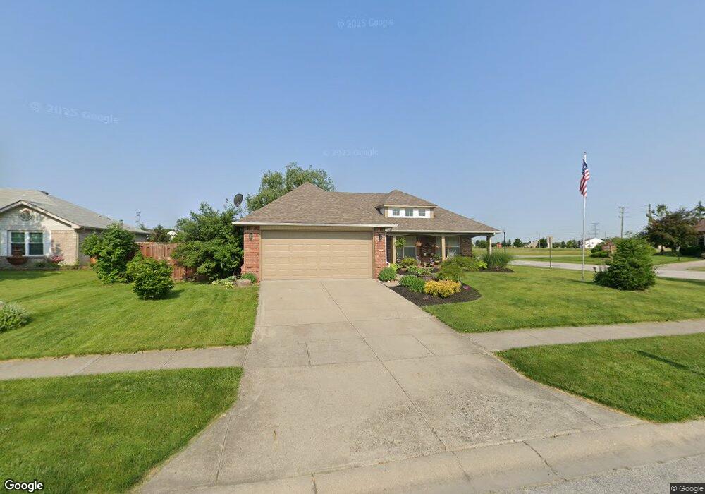
1946 Brocken Ct Indianapolis, IN 46229
East Warren NeighborhoodEstimated Value: $228,554 - $264,000
--
Bed
1
Bath
1,528
Sq Ft
$161/Sq Ft
Est. Value
About This Home
This home is located at 1946 Brocken Ct, Indianapolis, IN 46229 and is currently estimated at $246,139, approximately $161 per square foot. 1946 Brocken Ct is a home located in Marion County with nearby schools including Brookview Elementary School, Stonybrook Intermediate Academy (5-6), and Stonybrook Middle School.
Ownership History
Date
Name
Owned For
Owner Type
Purchase Details
Closed on
Apr 23, 2025
Sold by
Rh Partners Ownerco Llc and Lamco Asset Company 2 Llc
Bought by
Lamco Asset Company 2 Llc
Current Estimated Value
Purchase Details
Closed on
Jun 25, 2017
Purchase Details
Closed on
Aug 23, 2016
Sold by
Dore Steven P O and Wells Fargo Bank Na
Bought by
Mupr 3 Assets Llc
Create a Home Valuation Report for This Property
The Home Valuation Report is an in-depth analysis detailing your home's value as well as a comparison with similar homes in the area
Home Values in the Area
Average Home Value in this Area
Purchase History
| Date | Buyer | Sale Price | Title Company |
|---|---|---|---|
| Lamco Asset Company 2 Llc | -- | None Listed On Document | |
| -- | $178,100 | -- | |
| Safari One Asset Co Llc | $178,061 | Westcor Ltic | |
| Mupr 3 Assets Llc | $90,100 | None Available |
Source: Public Records
Tax History Compared to Growth
Tax History
| Year | Tax Paid | Tax Assessment Tax Assessment Total Assessment is a certain percentage of the fair market value that is determined by local assessors to be the total taxable value of land and additions on the property. | Land | Improvement |
|---|---|---|---|---|
| 2024 | $5,074 | $220,600 | $26,300 | $194,300 |
| 2023 | $5,074 | $216,000 | $26,300 | $189,700 |
| 2022 | $4,008 | $177,400 | $26,300 | $151,100 |
| 2021 | $3,544 | $156,100 | $26,300 | $129,800 |
| 2020 | $3,362 | $147,700 | $26,300 | $121,400 |
| 2019 | $3,197 | $140,300 | $26,300 | $114,000 |
| 2018 | $2,939 | $128,700 | $26,300 | $102,400 |
| 2017 | $2,476 | $119,200 | $26,300 | $92,900 |
| 2016 | $2,354 | $113,200 | $26,300 | $86,900 |
| 2014 | $2,116 | $105,800 | $26,300 | $79,500 |
| 2013 | $1,084 | $106,900 | $26,300 | $80,600 |
Source: Public Records
Map
Nearby Homes
- 2045 N Cumberland Rd
- 11733 E 21st St
- 2202 Rossington Ln
- 11917 Cardis Ct
- 1967 Star Fire Dr
- 1809 Mutz Dr
- 11632 Coastal Way
- 11614 Gosling Dr
- 1029 N Village Greene Dr
- 2021 Bradford Trace Blvd
- 2308 Valley Creek West Ln
- 11541 Coastal Dr
- 11345 Mcdowell Dr
- 11521 Coastal Dr
- 12212 Huntington Cir
- 11320 Mcdowell Dr
- 1528 Wilford Ln
- 1527 Warren Lake Ct
- 12110 Sunrise Ct
- 1639 Moores Ct
- 1946 Brocken Ct
- 1946 Brocken Ct
- 1938 Brocken Ct
- 11723 Brocken Way
- 11702 Brocken Way
- 11708 Brocken Way
- 1930 Brocken Ct
- 1930 Brocken Ct
- 11716 Brocken Way
- 11647 Brookwood Trace Dr
- 1931 Brocken Ct
- 1937 Brocken Ct
- 1937 Brocken Ct
- 11731 Brocken Way
- 11724 Brocken Way
- 11641 Brookwood Trace Dr
- 2045 Cumberland Rd
- 11732 Brocken Way
- 11635 Brookwood Trace Dr
- 11739 Brocken Way