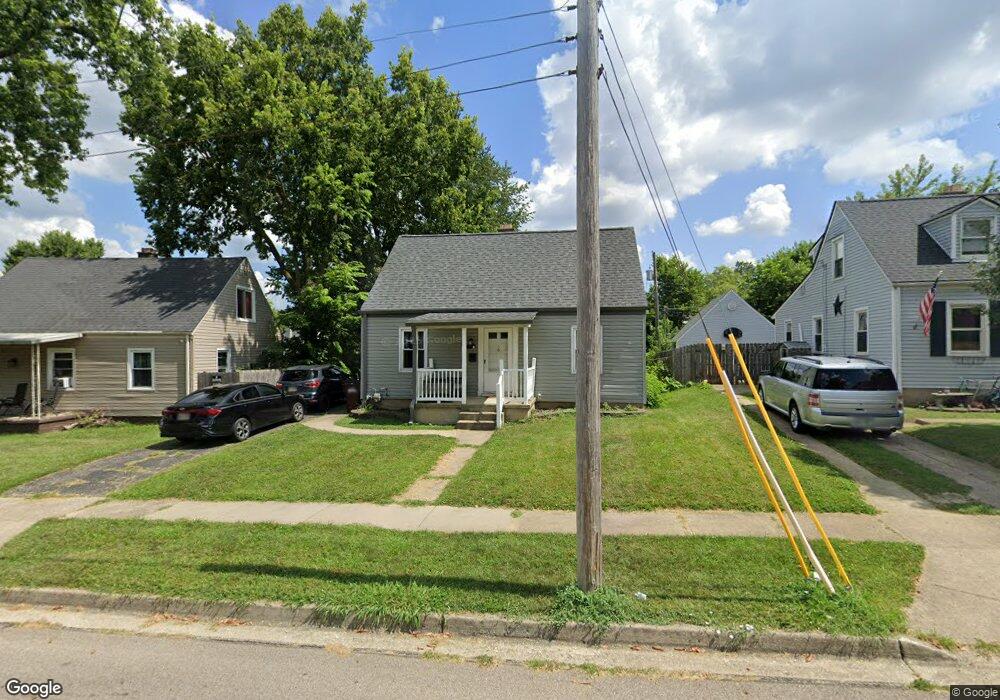
1946 Craig Dr Dayton, OH 45420
Estimated Value: $175,000 - $182,000
4
Beds
1
Bath
1,008
Sq Ft
$177/Sq Ft
Est. Value
About This Home
This home is located at 1946 Craig Dr, Dayton, OH 45420 and is currently estimated at $178,563, approximately $177 per square foot. 1946 Craig Dr is a home located in Montgomery County with nearby schools including Greenmont Elementary School, Kettering Middle School, and Kettering Fairmont High School.
Ownership History
Date
Name
Owned For
Owner Type
Purchase Details
Closed on
Aug 13, 2021
Sold by
Sands Mary K
Bought by
Berger Russell A and Hudson Sarah L
Current Estimated Value
Home Financials for this Owner
Home Financials are based on the most recent Mortgage that was taken out on this home.
Original Mortgage
$125,000
Outstanding Balance
$113,319
Interest Rate
2.7%
Mortgage Type
New Conventional
Estimated Equity
$65,244
Purchase Details
Closed on
Jan 5, 2006
Sold by
Sands Jonathan L
Bought by
Sands Mary K
Purchase Details
Closed on
Oct 16, 2000
Sold by
Hays Gloria J
Bought by
Sands Jonathan L and Sands Mary K
Home Financials for this Owner
Home Financials are based on the most recent Mortgage that was taken out on this home.
Original Mortgage
$73,364
Interest Rate
7.9%
Mortgage Type
FHA
Create a Home Valuation Report for This Property
The Home Valuation Report is an in-depth analysis detailing your home's value as well as a comparison with similar homes in the area
Home Values in the Area
Average Home Value in this Area
Purchase History
| Date | Buyer | Sale Price | Title Company |
|---|---|---|---|
| Berger Russell A | $135,000 | Plum Title | |
| Sands Mary K | -- | None Available | |
| Sands Jonathan L | $74,000 | -- |
Source: Public Records
Mortgage History
| Date | Status | Borrower | Loan Amount |
|---|---|---|---|
| Open | Berger Russell A | $125,000 | |
| Previous Owner | Sands Jonathan L | $73,364 |
Source: Public Records
Tax History Compared to Growth
Tax History
| Year | Tax Paid | Tax Assessment Tax Assessment Total Assessment is a certain percentage of the fair market value that is determined by local assessors to be the total taxable value of land and additions on the property. | Land | Improvement |
|---|---|---|---|---|
| 2024 | $2,682 | $42,710 | $11,010 | $31,700 |
| 2023 | $2,682 | $42,710 | $11,010 | $31,700 |
| 2022 | $2,374 | $29,820 | $7,700 | $22,120 |
| 2021 | $2,198 | $29,820 | $7,700 | $22,120 |
| 2020 | $2,205 | $29,820 | $7,700 | $22,120 |
| 2019 | $2,279 | $27,280 | $7,700 | $19,580 |
| 2018 | $2,291 | $27,280 | $7,700 | $19,580 |
| 2017 | $2,113 | $27,280 | $7,700 | $19,580 |
| 2016 | $1,974 | $23,910 | $7,700 | $16,210 |
| 2015 | $1,925 | $23,910 | $7,700 | $16,210 |
| 2014 | $1,925 | $23,910 | $7,700 | $16,210 |
| 2012 | -- | $27,560 | $8,400 | $19,160 |
Source: Public Records
Map
Nearby Homes
- 1914 W Bataan Dr
- 1910 Roop Place
- 2139 E Bataan Dr
- 1744 Woodman Dr
- 1512 Horlacher Ave
- 1513 Horlacher Ave
- 1840 Culver Ave
- 2830 Kennedy Ave
- 2530 Barryknoll St
- 4802 Amesborough Rd
- 4643 Amesborough Rd
- 2004 Hazel Ave
- 1701 Marilyn Ave
- 5369 Haverfield Rd
- 1829 Hazel Ave
- 2603 Kennedy Ave
- 4549 Amesborough Rd
- 2908 Kingston Ave
- 1300 Watervliet Ave
- 2704 Hazel Ave
- 1950 Craig Dr
- 1942 Craig Dr
- 1938 Craig Dr
- 1945 E Bataan Dr
- 1953 E Bataan Dr
- 1941 E Bataan Dr
- 1945 Craig Dr
- 1957 E Bataan Dr
- 1958 Craig Dr
- 1937 E Bataan Dr
- 1951 Craig Dr
- 1932 Malcom Dr
- 1961 E Bataan Dr
- 1944 Malcom Dr
- 1955 Craig Dr
- 1962 Craig Dr
- 1965 E Bataan Dr
- 1933 E Bataan Dr
- 1948 Malcom Dr
- 1920 Malcom Dr