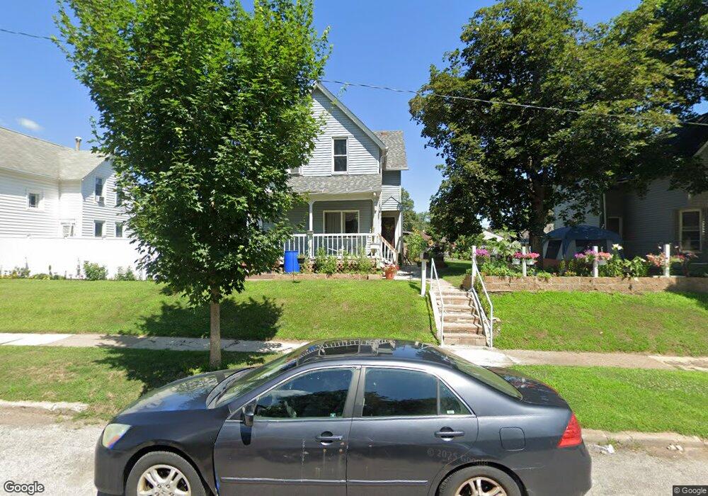
1946 Dixwell St Davenport, IA 52802
West End NeighborhoodEstimated Value: $123,000 - $133,896
4
Beds
2
Baths
1,742
Sq Ft
$72/Sq Ft
Est. Value
About This Home
This home is located at 1946 Dixwell St, Davenport, IA 52802 and is currently estimated at $125,974, approximately $72 per square foot. 1946 Dixwell St is a home located in Scott County with nearby schools including Walnut Hill Elementary School, South Christian Elementary School, and Caverna Middle School.
Ownership History
Date
Name
Owned For
Owner Type
Purchase Details
Closed on
Mar 25, 2013
Sold by
Tellez Rico Ismael and Garcia Abigail
Bought by
Garcia Leopoldo Negrete and A Magdalena Vargas Medrano M
Current Estimated Value
Purchase Details
Closed on
Feb 2, 2006
Sold by
Tellez Alfredo J and Rico Petra
Bought by
Tellez Rico Ismael
Create a Home Valuation Report for This Property
The Home Valuation Report is an in-depth analysis detailing your home's value as well as a comparison with similar homes in the area
Home Values in the Area
Average Home Value in this Area
Purchase History
| Date | Buyer | Sale Price | Title Company |
|---|---|---|---|
| Garcia Leopoldo Negrete | $34,000 | None Available | |
| Tellez Rico Ismael | -- | None Available |
Source: Public Records
Tax History Compared to Growth
Tax History
| Year | Tax Paid | Tax Assessment Tax Assessment Total Assessment is a certain percentage of the fair market value that is determined by local assessors to be the total taxable value of land and additions on the property. | Land | Improvement |
|---|---|---|---|---|
| 2025 | $2,068 | $153,360 | $16,500 | $136,860 |
| 2024 | $2,014 | $125,990 | $16,500 | $109,490 |
| 2023 | $2,492 | $125,990 | $16,500 | $109,490 |
| 2022 | $2,452 | $125,580 | $16,500 | $109,080 |
| 2021 | $2,452 | $123,270 | $16,500 | $106,770 |
| 2020 | $2,266 | $113,100 | $16,500 | $96,600 |
| 2019 | $2,072 | $100,850 | $16,500 | $84,350 |
| 2018 | $796 | $100,850 | $16,500 | $84,350 |
| 2017 | $672 | $45,010 | $16,500 | $28,510 |
| 2016 | $964 | $44,010 | $0 | $0 |
| 2015 | $964 | $44,260 | $0 | $0 |
| 2014 | $982 | $44,660 | $0 | $0 |
| 2013 | $974 | $0 | $0 | $0 |
| 2012 | -- | $49,130 | $13,070 | $36,060 |
Source: Public Records
Map
Nearby Homes
- 1944 Dixwell St
- 1950 Dixwell St
- 1942 Dixwell St
- 2002 Dixwell St
- 1953 Claussen St
- 2004 Dixwell St
- 1930 Dixwell St
- 1926 Dixwell St
- 1942 Claussen St
- 1946 Claussen St
- 1945 Dixwell St
- 2003 Claussen St
- 1941 Dixwell St
- 1947 Dixwell St
- 1950 Claussen St
- 2001 Dixwell St
- 1954 Claussen St
- 1922 Dixwell St
- 1929 Dixwell St
- 2003 Dixwell St