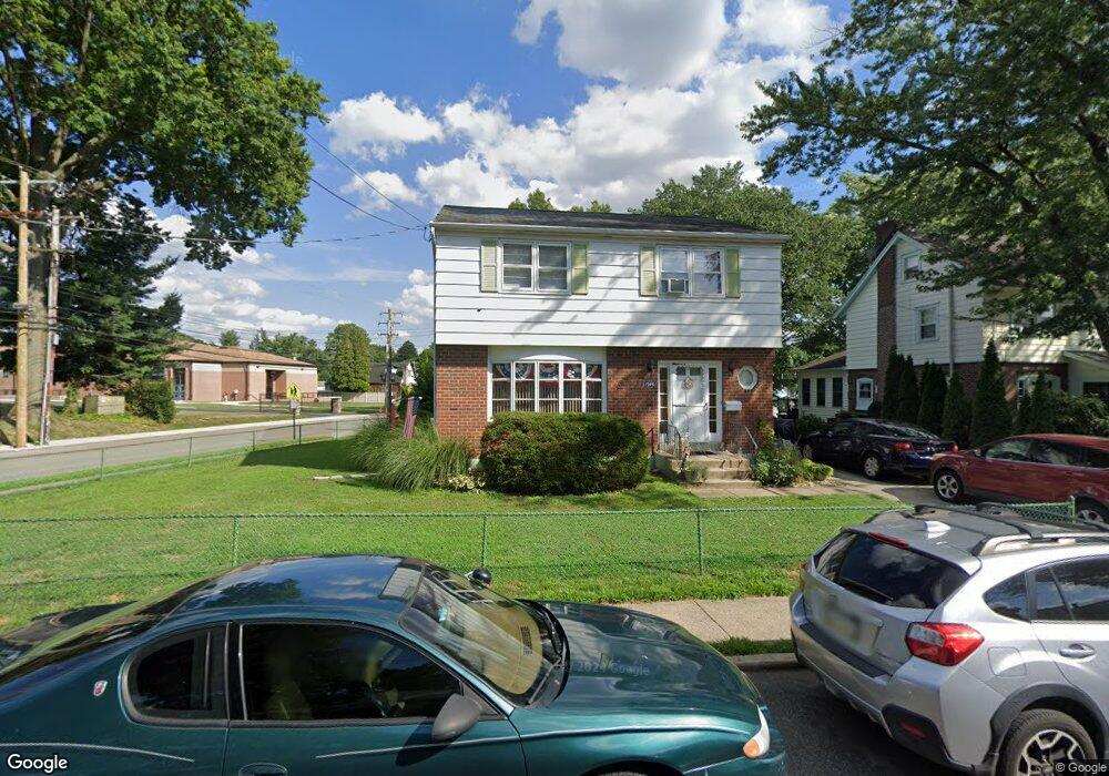
1946 Forrest Ave Morton, PA 19070
Estimated Value: $341,869 - $417,000
4
Beds
2
Baths
1,512
Sq Ft
$259/Sq Ft
Est. Value
About This Home
This home is located at 1946 Forrest Ave, Morton, PA 19070 and is currently estimated at $390,967, approximately $258 per square foot. 1946 Forrest Ave is a home located in Delaware County with nearby schools including Amosland El School, Ridley Middle School, and Ridley High School.
Ownership History
Date
Name
Owned For
Owner Type
Purchase Details
Closed on
Mar 22, 2005
Sold by
Fuscaldo Joseph D and Fuscaldo Anna M
Bought by
Putter Ronald H and Putter Sharon
Current Estimated Value
Home Financials for this Owner
Home Financials are based on the most recent Mortgage that was taken out on this home.
Original Mortgage
$22,500
Outstanding Balance
$11,611
Interest Rate
5.78%
Mortgage Type
Unknown
Estimated Equity
$379,356
Create a Home Valuation Report for This Property
The Home Valuation Report is an in-depth analysis detailing your home's value as well as a comparison with similar homes in the area
Home Values in the Area
Average Home Value in this Area
Purchase History
| Date | Buyer | Sale Price | Title Company |
|---|---|---|---|
| Putter Ronald H | $225,000 | -- |
Source: Public Records
Mortgage History
| Date | Status | Borrower | Loan Amount |
|---|---|---|---|
| Open | Putter Ronald H | $22,500 | |
| Open | Putter Ronald H | $180,000 |
Source: Public Records
Tax History Compared to Growth
Tax History
| Year | Tax Paid | Tax Assessment Tax Assessment Total Assessment is a certain percentage of the fair market value that is determined by local assessors to be the total taxable value of land and additions on the property. | Land | Improvement |
|---|---|---|---|---|
| 2025 | $6,258 | $180,230 | $55,120 | $125,110 |
| 2024 | $6,258 | $180,230 | $55,120 | $125,110 |
| 2023 | $5,986 | $180,230 | $55,120 | $125,110 |
| 2022 | $5,794 | $180,230 | $55,120 | $125,110 |
| 2021 | $8,969 | $180,230 | $55,120 | $125,110 |
| 2020 | $6,512 | $115,280 | $33,080 | $82,200 |
| 2019 | $6,393 | $115,280 | $33,080 | $82,200 |
| 2018 | $6,313 | $115,280 | $0 | $0 |
| 2017 | $6,313 | $115,280 | $0 | $0 |
| 2016 | $633 | $115,280 | $0 | $0 |
| 2015 | $633 | $115,280 | $0 | $0 |
| 2014 | $633 | $115,280 | $0 | $0 |
Source: Public Records
Map
Nearby Homes
- 31 Silver Lake Terrace Unit 32
- 7 & 0 Woodland Ave
- 2 Yale Ave
- 15 Sycamore Ave
- 916 Brooke Ave
- 601 Country Ln
- 111 Broad St
- 120 Bridge St
- 810 Quince Ln
- 742 Agnes Ave
- 136 Linden Ave
- 246 Pennington Ave
- 2330 Poe Rd
- 115 President Ave
- 226 W Sylvan Ave
- 880 Quaint St
- 216-218 President Ave
- 2379 Mole Rd
- 668 Hutchinson Terrace
- 860 Wyndom Terrace
- 1942 Forrest Ave
- 947 Amosland Rd
- 1938 Forrest Ave
- 1949 Forrest Ave
- 1943 Forrest Ave
- 1934 Forrest Ave
- 960 Amosland Rd
- 1939 Forrest Ave
- 964 Amosland Rd
- 1930 Forrest Ave
- 1926 Forrest Ave
- 1933 Forrest Ave
- 1922 Forrest Ave
- 1932 Franklin Ave
- 2108 Franklin Ave
- 930 Amosland Rd
- 2101 Highland Ave
- 2114 Franklin Ave
- 1928 Franklin Ave
- 1923 Forrest Ave