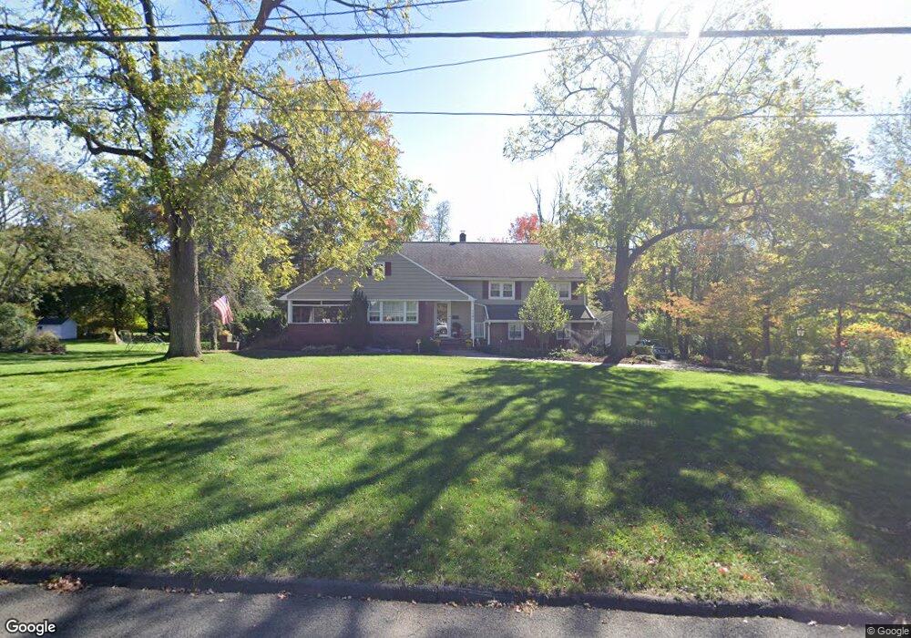
1946 Inverness Dr Scotch Plains, NJ 07076
Estimated Value: $735,428 - $1,460,000
--
Bed
--
Bath
2,063
Sq Ft
$566/Sq Ft
Est. Value
About This Home
This home is located at 1946 Inverness Dr, Scotch Plains, NJ 07076 and is currently estimated at $1,167,607, approximately $565 per square foot. 1946 Inverness Dr is a home located in Union County with nearby schools including William J. McGinn Elementary School, Terrill Middle School, and Scotch Plains-Fanwood High School.
Ownership History
Date
Name
Owned For
Owner Type
Purchase Details
Closed on
Jun 1, 2001
Sold by
Voget Gail and Tunick Robert C
Bought by
Wirth Donald F and Wirth Lori G
Current Estimated Value
Home Financials for this Owner
Home Financials are based on the most recent Mortgage that was taken out on this home.
Original Mortgage
$75,000
Interest Rate
6.59%
Mortgage Type
Stand Alone Second
Create a Home Valuation Report for This Property
The Home Valuation Report is an in-depth analysis detailing your home's value as well as a comparison with similar homes in the area
Home Values in the Area
Average Home Value in this Area
Purchase History
| Date | Buyer | Sale Price | Title Company |
|---|---|---|---|
| Wirth Donald F | $450,000 | -- |
Source: Public Records
Mortgage History
| Date | Status | Borrower | Loan Amount |
|---|---|---|---|
| Closed | Wirth Donald F | $75,000 | |
| Open | Wirth Donald F | $275,000 |
Source: Public Records
Tax History Compared to Growth
Tax History
| Year | Tax Paid | Tax Assessment Tax Assessment Total Assessment is a certain percentage of the fair market value that is determined by local assessors to be the total taxable value of land and additions on the property. | Land | Improvement |
|---|---|---|---|---|
| 2025 | $18,511 | $157,300 | $53,700 | $103,600 |
| 2024 | $17,965 | $157,300 | $53,700 | $103,600 |
| 2023 | $17,965 | $157,300 | $53,700 | $103,600 |
| 2022 | $17,751 | $157,300 | $53,700 | $103,600 |
| 2021 | $17,721 | $157,300 | $53,700 | $103,600 |
| 2020 | $17,636 | $157,300 | $53,700 | $103,600 |
| 2019 | $17,506 | $157,300 | $53,700 | $103,600 |
| 2018 | $17,212 | $157,300 | $53,700 | $103,600 |
| 2017 | $16,830 | $157,300 | $53,700 | $103,600 |
| 2016 | $16,505 | $157,300 | $53,700 | $103,600 |
| 2015 | $16,235 | $157,300 | $53,700 | $103,600 |
| 2014 | $15,700 | $157,300 | $53,700 | $103,600 |
Source: Public Records
Map
Nearby Homes
- 2 Dutch Ln
- 2 Brookside Ct
- 57 Rambling Dr
- 1466 Lamberts Mill Rd
- 1933 W Broad St
- 2 Unami Ln
- 2154 W Broad St
- 314 Highgate Ave
- 1933 Mary Ellen Ln
- 119 Lamberts Mill Rd
- 1840 Raritan Rd
- 1701 Raritan Rd
- 1840 Lake Ave
- 1380 Terrill Rd
- 1621 Terrill Rd
- 2116 Newark Ave
- 187 King St
- 525 Edgar Rd
- 676 Vermont St
- 524 Edgar Rd
- 1940 Inverness Dr
- 1952 Inverness Dr
- 1934 Inverness Dr
- 1949 Inverness Dr
- 1941 Inverness Dr
- 1958 Inverness Dr
- 2013 Dogwood Dr
- 1941 Stony Brook Cir
- 2009 Dogwood Dr
- 1957 Inverness Dr
- 1907 Duncan Dr
- 2003 Dogwood Dr
- 2021 Dogwood Dr
- 1926 Inverness Dr
- 1964 Inverness Dr
- 1937 Stony Brook Cir
- 1942 Duncan Dr
- 1950 Duncan Dr
- 1915 Duncan Dr
- 1942 Stony Brook Cir