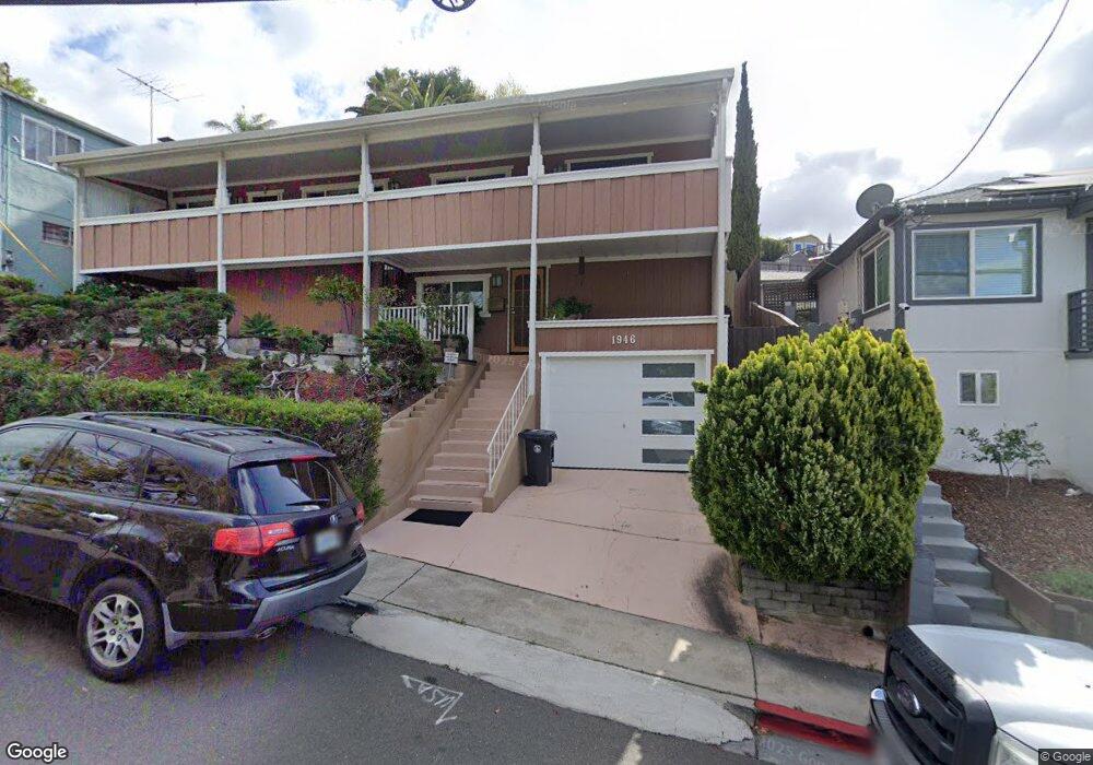
1946 Manchester Rd San Leandro, CA 94578
West Castro Valley NeighborhoodEstimated Value: $924,000 - $1,050,000
5
Beds
3
Baths
2,136
Sq Ft
$458/Sq Ft
Est. Value
About This Home
This home is located at 1946 Manchester Rd, San Leandro, CA 94578 and is currently estimated at $978,362, approximately $458 per square foot. 1946 Manchester Rd is a home located in Alameda County with nearby schools including Corvallis Elementary School, Edendale Middle, and San Lorenzo High School.
Ownership History
Date
Name
Owned For
Owner Type
Purchase Details
Closed on
Aug 22, 2018
Sold by
Taylor Ruby J
Bought by
Taylor Ruby Jean
Current Estimated Value
Purchase Details
Closed on
Aug 3, 2000
Sold by
June Schiada Patrick J and June Trianaschiada
Bought by
Taylor Ruby J
Home Financials for this Owner
Home Financials are based on the most recent Mortgage that was taken out on this home.
Original Mortgage
$280,000
Outstanding Balance
$102,598
Interest Rate
8.37%
Estimated Equity
$875,764
Purchase Details
Closed on
Jul 2, 1996
Sold by
Stuhlmacher Glen and Stuhlmacher Julie Ann
Bought by
Schiada Patrick J and Triana Schiada June
Purchase Details
Closed on
Oct 13, 1994
Sold by
Goodwin Jeremiah
Bought by
Stuhlmacher Glen and Stuhlmacher Julie Ann
Create a Home Valuation Report for This Property
The Home Valuation Report is an in-depth analysis detailing your home's value as well as a comparison with similar homes in the area
Home Values in the Area
Average Home Value in this Area
Purchase History
| Date | Buyer | Sale Price | Title Company |
|---|---|---|---|
| Taylor Ruby Jean | -- | None Available | |
| Taylor Ruby J | $350,000 | Fidelity National Title Co | |
| Schiada Patrick J | -- | -- | |
| Stuhlmacher Glen | -- | North American Title Company |
Source: Public Records
Mortgage History
| Date | Status | Borrower | Loan Amount |
|---|---|---|---|
| Open | Taylor Ruby J | $280,000 |
Source: Public Records
Tax History Compared to Growth
Tax History
| Year | Tax Paid | Tax Assessment Tax Assessment Total Assessment is a certain percentage of the fair market value that is determined by local assessors to be the total taxable value of land and additions on the property. | Land | Improvement |
|---|---|---|---|---|
| 2025 | $6,752 | $520,354 | $158,206 | $369,148 |
| 2024 | $6,752 | $510,015 | $155,104 | $361,911 |
| 2023 | $6,817 | $506,880 | $152,064 | $354,816 |
| 2022 | $6,715 | $489,943 | $149,083 | $347,860 |
| 2021 | $6,530 | $480,200 | $146,160 | $341,040 |
| 2020 | $6,389 | $482,204 | $144,661 | $337,543 |
| 2019 | $6,397 | $472,751 | $141,825 | $330,926 |
| 2018 | $6,043 | $463,483 | $139,045 | $324,438 |
| 2017 | $5,767 | $454,397 | $136,319 | $318,078 |
| 2016 | $5,501 | $445,490 | $133,647 | $311,843 |
| 2015 | $5,381 | $438,801 | $131,640 | $307,161 |
| 2014 | $5,301 | $430,208 | $129,062 | $301,146 |
Source: Public Records
Map
Nearby Homes
- 15976 Carolyn St
- 15806 Maubert Ave
- 16063 Berkshire Dr
- 15925 Maubert Ave Unit 2
- 15683 Liberty St
- 16108 Berkshire Dr
- 16153 Windsor Dr
- 16049 Selborne Dr
- 16068 Gramercy Dr
- 16085 Gramercy Dr
- 2081 Strang Ave
- 1540 Mono Ave
- 0 Lindview Dr
- 2250 Strang Ave
- 1507 Green Ct
- 1525 Thrush Ave
- 1440 Thrush Ave Unit 48
- 16118 Mateo St
- 1550 162nd Ave Unit 69
- 1550 162nd Ave Unit 47
- 1954 Manchester Rd
- 1932 Manchester Rd
- 15933 Wellington Way
- 1926 Manchester Rd
- 15945 Wellington Way
- 15921 Wellington Way
- 1968 Manchester Rd
- 15911 Wellington Way
- 15951 Wellington Way
- 15910 Carolyn St
- 1919 Manchester Rd
- 1972 Manchester Rd
- 15924 Carolyn St
- 1941 Manchester Rd
- 15965 Wellington Way
- 15938 Carolyn St
- 1953 Manchester Rd
- 15922 Wellington Way
- 15922 Wellington Way Unit 1
- 15922 Wellington Way Unit 2