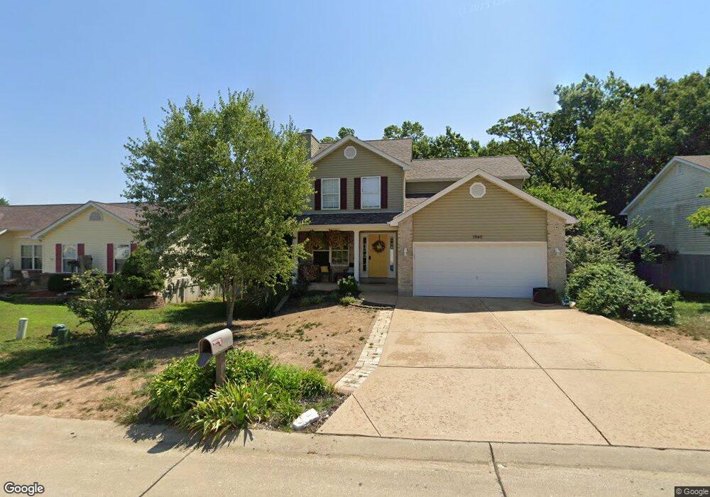
1946 McKinley Range Festus, MO 63028
Festus/Crystal City NeighborhoodEstimated Value: $253,000 - $343,000
--
Bed
1
Bath
768
Sq Ft
$386/Sq Ft
Est. Value
About This Home
This home is located at 1946 McKinley Range, Festus, MO 63028 and is currently estimated at $296,804, approximately $386 per square foot. 1946 McKinley Range is a home located in Jefferson County with nearby schools including Festus Elementary School, Festus Intermediate School, and Festus Middle School.
Ownership History
Date
Name
Owned For
Owner Type
Purchase Details
Closed on
Mar 30, 2005
Sold by
Hite Jeffrey E and Hite Amanda J
Bought by
Nolfo Anthony and Nolfo Carrie
Current Estimated Value
Home Financials for this Owner
Home Financials are based on the most recent Mortgage that was taken out on this home.
Original Mortgage
$127,920
Outstanding Balance
$73,136
Interest Rate
7.59%
Mortgage Type
Purchase Money Mortgage
Estimated Equity
$223,668
Purchase Details
Closed on
Aug 19, 2003
Sold by
K A B Construction Co Llc
Bought by
Hite Jeffrey E and Hite Amanda J
Home Financials for this Owner
Home Financials are based on the most recent Mortgage that was taken out on this home.
Original Mortgage
$110,000
Interest Rate
5.51%
Mortgage Type
Purchase Money Mortgage
Create a Home Valuation Report for This Property
The Home Valuation Report is an in-depth analysis detailing your home's value as well as a comparison with similar homes in the area
Home Values in the Area
Average Home Value in this Area
Purchase History
| Date | Buyer | Sale Price | Title Company |
|---|---|---|---|
| Nolfo Anthony | -- | -- | |
| Hite Jeffrey E | -- | -- |
Source: Public Records
Mortgage History
| Date | Status | Borrower | Loan Amount |
|---|---|---|---|
| Open | Nolfo Anthony | $127,920 | |
| Previous Owner | Hite Jeffrey E | $110,000 |
Source: Public Records
Tax History Compared to Growth
Tax History
| Year | Tax Paid | Tax Assessment Tax Assessment Total Assessment is a certain percentage of the fair market value that is determined by local assessors to be the total taxable value of land and additions on the property. | Land | Improvement |
|---|---|---|---|---|
| 2025 | $1,953 | $37,100 | $8,800 | $28,300 |
| 2024 | $1,953 | $34,500 | $8,800 | $25,700 |
| 2023 | $1,953 | $34,500 | $8,800 | $25,700 |
| 2022 | $1,943 | $34,500 | $8,800 | $25,700 |
| 2021 | $1,945 | $34,500 | $8,800 | $25,700 |
| 2020 | $1,870 | $31,100 | $8,000 | $23,100 |
| 2019 | $1,869 | $31,100 | $8,000 | $23,100 |
| 2018 | $1,685 | $31,100 | $8,000 | $23,100 |
| 2017 | $1,685 | $31,100 | $8,000 | $23,100 |
| 2016 | $1,492 | $27,400 | $6,400 | $21,000 |
| 2015 | $1,424 | $27,400 | $6,400 | $21,000 |
| 2013 | $1,424 | $27,200 | $6,400 | $20,800 |
Source: Public Records
Map
Nearby Homes
- 1316 Kodiak Ct
- 1904 Iditarod Trail
- 1262 Denali Dr
- 1603 Sugar Creek Dr
- 1605 Sugar Creek Dr
- 1607 Sugar Creek Dr
- 24 Adventura Dr
- 6 Cedarbrook
- 30 Adventura Dr
- 50 Adventura Dr
- 33 Ashford Place
- 1836 Championship Ln
- 1839 Championship Ln
- 624 Westwood South Dr Unit A
- 518 Westwood Place
- 1513 Donover Ln
- 813 American Legion Dr
- 0 Tbb Birchwood Overlook-Hickory
- 0 Tbb Birchwood Overlook -Pin Oa Unit MAR24022705
- 1417 Westvale Dr
- 1950 McKinley Range
- 1942 McKinley Range
- 1938 McKinley Range
- 1954 McKinley Range
- 1939 McKinley Range
- 1935 McKinley Range
- 1943 McKinley Range
- 1409 Moose Pass
- 1412 Glacier Pass
- 1401 Moose Pass
- 1931 McKinley Range
- 1958 McKinley Range
- 1947 McKinley Range
- 1927 McKinley Range
- 1951 McKinley Range
- 1417 Moose Pass
- 1936 Anchorage Dr
- 1402 Moose Pass
- 1962 McKinley Range
- 1934 McKinley Range